Enable Location

We need your location to show you interesting places around you

Discover nearby places

Find interesting locations and hidden gems around you

Precise directions

Get accurate directions and distances to places

Your location is never shared with other users. It's only used when you tap the location button.

Paola

Log in to your account

Start exploring — it's free

Trusted by 63,414 travelers worldwide

Continue with Google
Continue with Apple
or

We will send you a code to connect

By continuing, you accept our Terms and Conditions and our Privacy Policy

Check your inbox

We've sent a pincode in your inbox. Please enter the code below.

Discussion Reviews 1 Photos
17.7k Popularity

Paola, city in Kansas, United States

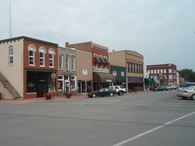
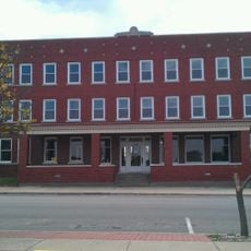
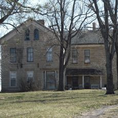
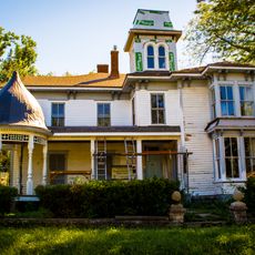
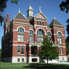
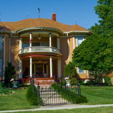
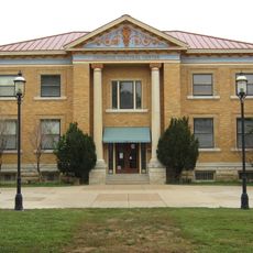
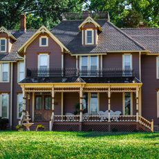
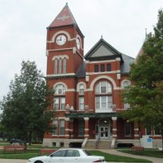
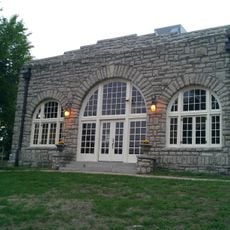
Paola is a small city in Miami County, Kansas, serving as the county seat. Its downtown features a historic square with a Victorian gazebo and brick pathways, lined with older buildings alongside modern shops and local businesses.

The town was founded in 1867, with its central square gifted by founder Baptiste Peoria. The area holds significance in Native American history, particularly through connections to the Potawatomi and the Trail of Death that passed through the region.

The town carries the name of the Miami tribe that originally inhabited the area, and this heritage remains central to how the community sees itself. Visitors notice this connection reflected in local monuments, events, and the way residents speak about their town's roots.

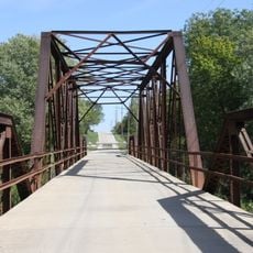
The town is easy to explore on foot or by car since it is small and streets are straightforward. Visitors can find parks for walking, nearby lakes for fishing, small shops and restaurants downtown with convenient parking throughout.

The region is home to one of the few operating drive-in theaters in Kansas, offering movie lovers a nostalgic cinema experience under the open sky. This type of entertainment has vanished from most places, making the area special for those seeking a classic American experience.

The community of curious travelers

AroundUs brings together thousands of curated places, local tips, and hidden gems, enriched daily by 60,000 contributors worldwide.

Start exploring
Location
Inception
1855
Elevation above the sea
279 m
GPS coordinates
38.57360,-94.87330
Latest update
February 17, 2026 00:20
Around this place
Blue Valley West High School
United States of America

Blue Valley West High School

33.1 km
Hillsdale Lake
United States of America

Hillsdale Lake

9.4 km
United States of America

Overland Park Arboretum and Botanical Gardens

29.7 km
Dietrich Cabin
United States of America

Dietrich Cabin

34.5 km
United States of America

Powell Observatory

17.1 km
Cedar Cove Feline Conservatory & Sanctuary
United States of America

Cedar Cove Feline Conservatory & Sanctuary

21.9 km
Liston Stadium
United States of America

Liston Stadium

34.8 km
Peoples Bank Field
United States of America

Peoples Bank Field

34 km
Landers Creek Bridge
United States of America

Landers Creek Bridge

34.2 km
Jackson Hotel
United States of America

Jackson Hotel

564 m
William Thomas Turner Barn
United States of America

William Thomas Turner Barn

22 km
Tauy Jones Hall
United States of America

Tauy Jones Hall

34.1 km
Ottawa High School and Junior High School
United States of America

Ottawa High School and Junior High School

34.6 km
Tauy Jones House
United States of America

Tauy Jones House

31.8 km
I. O. Pickering House
United States of America

I. O. Pickering House

34.8 km
Franklin County Courthouse
United States of America

Franklin County Courthouse

34.6 km
Albert Ott House
United States of America

Albert Ott House

34.3 km
Franklin R. Lanter House
United States of America

Franklin R. Lanter House

34.6 km
Ottawa Library
United States of America

Ottawa Library

34 km
Martin Van Buren Parker House
United States of America

Martin Van Buren Parker House

34.6 km
Miami County Courthouse
United States of America

Miami County Courthouse

517 m
Carey’s Ford Bridge
United States of America

Carey’s Ford Bridge

15.1 km
John Brown Museum State Historic Site
United States of America

John Brown Museum State Historic Site

11.2 km
Black Jack Battlefield
United States of America

Black Jack Battlefield

30.6 km
Creamery Bridge
United States of America

Creamery Bridge

10.6 km
Windsurfer Beach
United States of America

Windsurfer Beach

11 km
Pottawatomie Creek Bridge
United States of America

Pottawatomie Creek Bridge

11.9 km
Asylum Bridge
United States of America

Asylum Bridge

9.7 km
Show the full map
Reviews
Share your experience

No review yet

Discussions
Start a discussion...

No discussion yet

« Paola - city in Kansas, United States » is provided by Around Us (aroundus.com). Images and texts are derived from Wikimedia project under a Creative Commons license. You are allowed to copy, distribute, and modify copies of this page, under the conditions set by the license, as long as this note is clearly visible.

Discover hidden gems everywhere you go!

From secret cafés to breathtaking viewpoints, skip the crowded tourist spots and find places that match your style. Our app makes it easy with voice search, smart filtering, route optimization, and insider tips from travelers worldwide. Download now for the complete mobile experience.

Around Us App Screenshot

A unique approach to discovering new places

Le Figaro

All the places worth exploring

France Info

A tailor-made excursion in just a few clicks

20 Minutes

Around Us
Travel Guide & Maps
Download

Send to your phone

QR Code
1

Open the camera app on your mobile.

2

Point at the QR code with your camera. A notification will appear.

3

Tap the notification to open the link.