Chest opened
+${chestReward.xp} XP
Explorer
NOUVEAU ×${chestReward.collectible.quantity}
tapez pour fermer
Chest locked

Open chests in the app

Around Us is built for your phone — chests unlock when you walk, explore and capture nearby places.

Enable Location

We need your location to show you interesting places around you

Discover nearby places

Find interesting locations and hidden gems around you

Precise directions

Get accurate directions and distances to places

Your location is never shared with other users. It's only used when you tap the location button.

Log in to your account

Start exploring — it's free

Trusted by 72,944 travelers worldwide

Continue with Google
Continue with Apple
or

We will send you a code to connect

By continuing, you accept our Terms and Conditions and our Privacy Policy

Check your inbox

We've sent a pincode in your inbox. Please enter the code below.

Discussion Reviews Photo
41.2k Popularity

Buies Creek, University town in Harnett County, North Carolina.

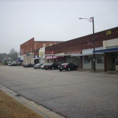
Buies Creek is a small community in Harnett County, North Carolina, built largely around Campbell University's main campus in its center. Residential neighborhoods and university buildings form the basic structure of the place.

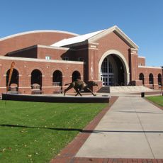
The settlement grew around Campbell University after its founding in 1887, which drove development in the area. The community was formally established in 1914 but later lost its official status when its charter was repealed in 1967.

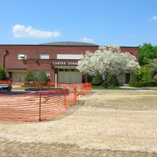
Campbell University shapes how people gather and spend time here, with students and faculty bringing energy to local spots and events. This academic presence colors daily life in visible ways, from how the streets feel to what activities happen around town.

U.S. Route 421 runs through the area and connects it to nearby towns such as Lillington and Erwin. The best time to explore is outside of peak student periods, when the surroundings are quieter and easier to navigate.

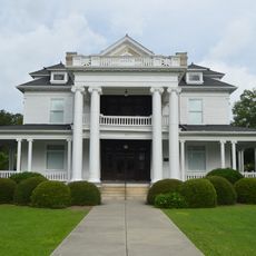
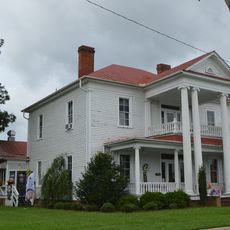
The James Archibald Campbell House, added to the National Register of Historic Places in 1977, shows what local architecture looked like in earlier times. Walking past this home reveals details about how people lived and built their houses generations ago.

The community of curious travelers

AroundUs brings together thousands of curated places, local tips, and hidden gems, enriched daily by 60,000 contributors worldwide.

Start exploring
Location
Elevation above the sea
65 m
GPS coordinates
35.41030,-78.73890
Latest update
December 17, 2025 08:17
Around this place
Raven Rock State Park
United States of America

Raven Rock State Park

16.8 km
John W. Pope, Jr. Convocation Center
United States of America

John W. Pope, Jr. Convocation Center

333 m
Carter Gymnasium
United States of America

Carter Gymnasium

11.2 km
United States of America

Lebanon

17.9 km
United States of America

James Archibald Campbell House

1 km
Kenneth L. Howard House
United States of America

Kenneth L. Howard House

16 km
United States of America

Dr. Wayman C. Melvin House

16 km
Summerville Presbyterian Church and Cemetery
United States of America

Summerville Presbyterian Church and Cemetery

10.6 km
United States of America

Harnett County Training School

16.7 km
John A. McKay House and Manufacturing Company
United States of America

John A. McKay House and Manufacturing Company

16.3 km
United States of America

Gen. William C. Lee House

16.1 km
Williams Grove School
United States of America

Williams Grove School

10.8 km
United States of America

Summer Villa and the McKay-Salmon House

11.5 km
Erwin Commercial Historic District
United States of America

Erwin Commercial Historic District

10.9 km
United States of America

Benson Historic District

17.7 km
United States of America

Gem Theater

17.4 km
United States of America

Bakers Pond

5.6 km
United States of America

Raven Rock

15.8 km
United States of America

Princess Theatre

17.6 km
United States of America

McLambs Pond

18.3 km
United States of America

Lundy Fetterman Museum

400 m
United States of America

Chicora Golf Club

13.9 km
United States of America

Pine Burr Golf Course

8.3 km
United States of America

Black Course

2.5 km
United States of America

Orange Course

2.5 km
United States of America

Boxcar

16.3 km
United States of America

Scenic viewpoint

16.5 km
United States of America

Jumping Fish Falls

17.4 km
Show the full map
Reviews
Share your experience

No review yet

Discussions
Start a discussion...

No discussion yet

« Buies Creek - University town in Harnett County, North Carolina » is provided by Around Us (aroundus.com). Images and texts are derived from Wikimedia project under a Creative Commons license. You are allowed to copy, distribute, and modify copies of this page, under the conditions set by the license, as long as this note is clearly visible.

Discover hidden gems everywhere you go!

From secret cafés to breathtaking viewpoints, skip the crowded tourist spots and find places that match your style. Our app makes it easy with voice search, smart filtering, route optimization, and insider tips from travelers worldwide. Download now for the complete mobile experience.

Around Us App Screenshot

A unique approach to discovering new places

Le Figaro

All the places worth exploring

France Info

A tailor-made excursion in just a few clicks

20 Minutes

Around Us
Travel Guide & Maps
Download

Send to your phone

QR Code
1

Open the camera app on your mobile.

2

Point at the QR code with your camera. A notification will appear.

3

Tap the notification to open the link.