Harnett County

Log in to your account

AroundUs is a community-driven map of interesting places, built by curious explorers like you. It grows with every review, story, and photo you share.
Connect to save your favorite spots, contribute locations, and create personalized routes.
By continuing, you accept our Terms and Conditions and our Privacy Policy
Add to collection
Map
Suggest a change
Share

Harnett County, Administrative county in North Carolina, US

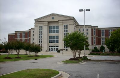
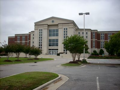
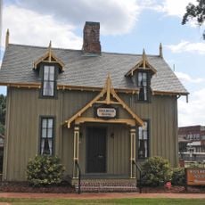
Harnett County is an administrative region in central North Carolina combining urban and rural areas across its territory. The county is governed through central administrative offices located in Lillington.

The North Carolina General Assembly created Harnett County in 1855, naming it after Nicholas Harnett, a Revolutionary War officer. This establishment reflected the state's expansion of administrative divisions during the mid-19th century.

The area hosts programs honoring veterans and maintains a strong military community presence that shapes local values and social gatherings. This focus reflects how residents connect with and support those who served.

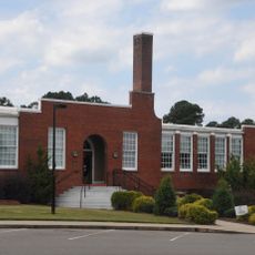
Visitors and residents find county services centered in Lillington, handling everything from tax matters to permit applications and court services. The area benefits from connections to two major interstate highways, making travel to neighboring regions straightforward.

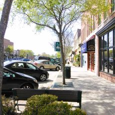
The area participates in a regional alliance developing industrial parks that strategically link to both interstate corridors passing through the state. This positioning has turned the area into a business and industrial hub within the region.

Location: North Carolina

Inception: 1855

Capital city: Lillington

Shares border with: Wake County, Johnston County, Sampson County, Cumberland County, Moore County, Lee County, Chatham County

Website: http://harnett.org

GPS coordinates: 35.37000,-78.86000

Latest update: December 7, 2025 09:20

Photos
Around this place
Show the full map
Raven Rock State Park
United States of America

Raven Rock State Park

12.2 km
Carvers Creek State Park
United States of America

Carvers Creek State Park

20.6 km
John W. Pope, Jr. Convocation Center
United States of America

John W. Pope, Jr. Convocation Center

12 km
Ellerslie
United States of America

Ellerslie

15.6 km
Carter Gymnasium
United States of America

Carter Gymnasium

19.2 km
Bass Lake
United States of America

Bass Lake

30.7 km
Falcon Tabernacle
United States of America

Falcon Tabernacle

27.5 km
Temple Theater
United States of America

Temple Theater

31.5 km
Leslie-Alford-Mims House
United States of America

Leslie-Alford-Mims House

31.5 km
Railroad House
United States of America

Railroad House

31.3 km
Samuel Bartley Holleman House
United States of America

Samuel Bartley Holleman House

28 km
Lee County Courthouse
United States of America

Lee County Courthouse

29.6 km
Fuquay Mineral Spring
United States of America

Fuquay Mineral Spring

24 km
Fuquay Springs Historic District
United States of America

Fuquay Springs Historic District

24.1 km
Buffalo Presbyterian Church and Cemeteries
United States of America

Buffalo Presbyterian Church and Cemeteries

31.9 km
Lee Avenue Historic District
United States of America

Lee Avenue Historic District

28.3 km
Kenneth L. Howard House
United States of America

Kenneth L. Howard House

23.2 km
Summerville Presbyterian Church and Cemetery
United States of America

Summerville Presbyterian Church and Cemetery

3.7 km
Lee County Training School
United States of America

Lee County Training School

31.5 km
J. Beale Johnson House
United States of America

J. Beale Johnson House

28.5 km
Fuquay-Varina Woman's Club Clubhouse
United States of America

Fuquay-Varina Woman's Club Clubhouse

25.5 km
Hawkins Avenue Historic District
United States of America

Hawkins Avenue Historic District

31.8 km
John A. McKay House and Manufacturing Company
United States of America

John A. McKay House and Manufacturing Company

23.6 km
Fuquay Springs Teacherage
United States of America

Fuquay Springs Teacherage

24.8 km
East Sanford Historic District
United States of America

East Sanford Historic District

30.6 km
Rosemount-McIver Park Historic District
United States of America

Rosemount-McIver Park Historic District

32 km
Kemp B. Johnson House
United States of America

Kemp B. Johnson House

27 km
Erwin Commercial Historic District
United States of America

Erwin Commercial Historic District

17.4 km
Show the full map
Reviews

Visited this place? Tap the stars to rate it and share your experience / photos with the community! Try now! You can cancel it anytime.

Administrative divisions
« Harnett County - Administrative county in North Carolina, US » is provided by Around Us (aroundus.com). Images and texts are derived from Wikimedia project under a Creative Commons license. You are allowed to copy, distribute, and modify copies of this page, under the conditions set by the license, as long as this note is clearly visible.

Discover hidden gems everywhere you go!

From secret cafés to breathtaking viewpoints, skip the crowded tourist spots and find places that match your style. Our app makes it easy with voice search, smart filtering, route optimization, and insider tips from travelers worldwide. Download now for the complete mobile experience.

Around Us App Screenshot

A unique approach to discovering new places

Le Figaro

All the places worth exploring

France Info

A tailor-made excursion in just a few clicks

20 Minutes