Mount Horeb, village in Dane County, Wisconsin, United States
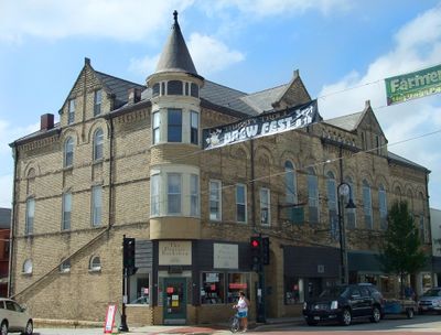
Mount Horeb is a small village in Wisconsin known for its troll sculptures and friendly streets. The town features a historic downtown with classic buildings and numerous troll figures placed mainly along Main Street, which is called the Trollway.
The area was originally home to the Ho-Chunk Nation for centuries before settlement began around 1828. Norwegian immigrants arrived starting in the 1870s and became the primary force in shaping the village's cultural identity.
The village is deeply rooted in Norwegian traditions that have shaped the community since the 1870s. Visitors can see this heritage expressed through troll sculptures and local festivals that keep these customs alive.
The village is easy to explore on foot and has a flat, simple layout centered on Main Street. Parking is available near downtown, and visitors can reach most attractions by walking.
The village declared itself the 'Troll Capital of the World' in the 1980s and decorates its streets with hundreds of handcrafted troll figures. These sculptures are regularly refreshed and expanded by local artists, making the town an ever-changing open-air gallery.
The community of curious travelers
AroundUs brings together thousands of curated places, local tips, and hidden gems, enriched daily by 60,000 contributors worldwide.