Chest opened
+${chestReward.xp} XP
Explorer
NOUVEAU ×${chestReward.collectible.quantity}
tapez pour fermer
Chest locked

Open chests in the app

Around Us is built for your phone — chests unlock when you walk, explore and capture nearby places.

Enable Location

We need your location to show you interesting places around you

Discover nearby places

Find interesting locations and hidden gems around you

Precise directions

Get accurate directions and distances to places

Your location is never shared with other users. It's only used when you tap the location button.

Belcourt

Log in to your account

Start exploring — it's free

Trusted by 72,890 travelers worldwide

Continue with Google
Continue with Apple
or

We will send you a code to connect

By continuing, you accept our Terms and Conditions and our Privacy Policy

Check your inbox

We've sent a pincode in your inbox. Please enter the code below.

Discussion Reviews 1 Photos
10.3k Popularity

Belcourt, Census-designated place in Rolette County, North Dakota, United States.

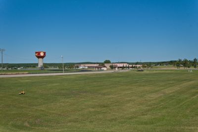
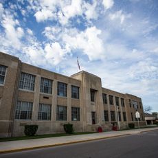
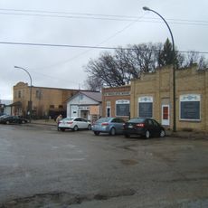
Belcourt is a census-designated place located within the Turtle Mountain Indian Reservation, functioning as a local community hub with schools and communication services. The town provides essential facilities and services that support both residents and visitors passing through.

The settlement was originally known as Siipiising by the Anishinaabe people before its founding in 1884. The town took its name from Georges-Antoine Belcourt, a French-Canadian missionary who worked in the region.

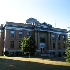
The community serves as the administrative hub for the Turtle Mountain Band of Chippewa Indians, where Native American governance and cultural practices remain central to daily life. Visitors can observe how the town functions as a vital center for the Anishinaabe people.

The town provides access to local schools and radio services that offer information about community activities and news. Using these resources helps visitors understand the daily life and rhythm of the settlement.

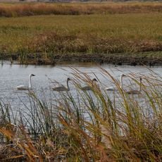
The area experiences dramatic temperature swings from intense summer heat to severe winter cold, shaping the character of this highland community. These harsh conditions have shaped how residents adapt and build their lives in this place.

The community of curious travelers

AroundUs brings together thousands of curated places, local tips, and hidden gems, enriched daily by 60,000 contributors worldwide.

Start exploring
Location
Inception
1884
Elevation above the sea
598 m
GPS coordinates
48.84056,-99.74667
Latest update
December 10, 2025 15:54
Around this place
International Peace Garden
Canada

International Peace Garden

29 km
Nygard Park
Canada

Nygard Park

67.8 km
Coghlan Castle
United States of America

Coghlan Castle

12 km
J. Clark Salyer National Wildlife Refuge
United States of America

J. Clark Salyer National Wildlife Refuge

74.3 km
St. John–Lena Border Crossing
Canada

St. John–Lena Border Crossing

18.8 km
Roxy Theatre
United States of America

Roxy Theatre

101.5 km
Benson County Courthouse
United States of America

Benson County Courthouse

93.4 km
Central High School
United States of America

Central High School

103.9 km
McHenry County Courthouse
United States of America

McHenry County Courthouse

73.5 km
Ramsey County Sheriff's House
United States of America

Ramsey County Sheriff's House

104.1 km
Rugby Post Office
United States of America

Rugby Post Office

55.5 km
Devils Lake Carnegie Library
United States of America

Devils Lake Carnegie Library

104 km
Old Main
United States of America

Old Main

50.8 km
Granville State Bank
United States of America

Granville State Bank

102.4 km
Westminster Presbyterian Church
United States of America

Westminster Presbyterian Church

104 km
Pierce County Courthouse
United States of America

Pierce County Courthouse

55.5 km
Towner County Courthouse
United States of America

Towner County Courthouse

55.5 km
United States of America

Episcopal Church of the Advent and Guild Hall

104.1 km
Assiniboine Corridor Wildlife Management Area
Canada

Assiniboine Corridor Wildlife Management Area

92 km
Bangs-Wineman Block
United States of America

Bangs-Wineman Block

103.5 km
Lake Metigoshe State Park
United States of America

Lake Metigoshe State Park

45.3 km
Prairie Village Museum
United States of America

Prairie Village Museum

57.3 km
Souris Swinging Bridge
Canada

Souris Swinging Bridge

94 km
St. Paul's United Church
Canada

St. Paul's United Church

48.8 km
Derksen-Heide Reservoir
Canada

Derksen-Heide Reservoir

49.2 km
Wawanesa Mutual Insurance Company Building
Canada

Wawanesa Mutual Insurance Company Building

84 km
W'eel the turtle
United States of America

W'eel the turtle

23.4 km
Geographical Center of North America Monument
United States of America

Geographical Center of North America Monument

57.2 km
Show the full map
Reviews
Share your experience

No review yet

Discussions
Start a discussion...

No discussion yet

« Belcourt - Census-designated place in Rolette County, North Dakota, United States » is provided by Around Us (aroundus.com). Images and texts are derived from Wikimedia project under a Creative Commons license. You are allowed to copy, distribute, and modify copies of this page, under the conditions set by the license, as long as this note is clearly visible.

Discover hidden gems everywhere you go!

From secret cafés to breathtaking viewpoints, skip the crowded tourist spots and find places that match your style. Our app makes it easy with voice search, smart filtering, route optimization, and insider tips from travelers worldwide. Download now for the complete mobile experience.

Around Us App Screenshot

A unique approach to discovering new places

Le Figaro

All the places worth exploring

France Info

A tailor-made excursion in just a few clicks

20 Minutes

Around Us
Travel Guide & Maps
Download

Send to your phone

QR Code
1

Open the camera app on your mobile.

2

Point at the QR code with your camera. A notification will appear.

3

Tap the notification to open the link.