·

Enable Location

We need your location to show you interesting places around you

Discover nearby places

Find interesting locations and hidden gems around you

Precise directions

Get accurate directions and distances to places

Your location is never shared with other users. It's only used when you tap the location button.

Alewife Brook Parkway

Log in to your account

Start exploring — it's free

Trusted by 62,655 travelers worldwide

Continue with Google
Continue with Apple
or

We will send you a code to connect

By continuing, you accept our Terms and Conditions and our Privacy Policy

Check your inbox

We've sent a pincode in your inbox. Please enter the code below.

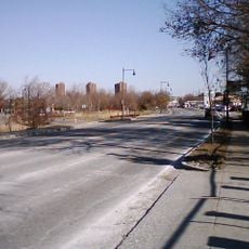
Alewife Brook Parkway, highway in Massachusetts

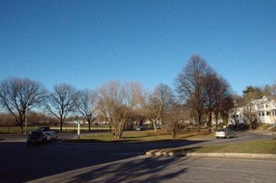
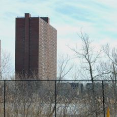
Alewife Brook Parkway is a wide road running through Cambridge and Somerville, Massachusetts, lined with trees and green spaces that define the local neighborhoods. The route accommodates cars, bikes, and pedestrians while connecting different parts of the city through its straightforward layout.

The parkway was built in the early 20th century when city planners focused on creating better transportation routes and landscape architects like the Olmsted Brothers shaped the area. It was part of a larger plan to connect the city with green spaces for outdoor activities.

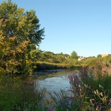
The name comes from a small waterway where alewife fish were once caught by local people centuries ago. Today, the parkway connects different neighborhoods and serves as a pathway where residents walk, bike, and move through their daily lives.

The parkway is designed for multiple forms of transportation with wide sidewalks, bike paths, and car lanes all running comfortably side by side. Visiting during warm months will let you best enjoy the trees and green spaces that line the route.

A drive-in theater operated nearby in the 1950s before being replaced by a shopping center that transformed the area significantly. This shift reveals how the location adapted its purpose over time while the historic road design itself remained a constant feature.

The community of curious travelers

AroundUs brings together thousands of curated places, local tips, and hidden gems, enriched daily by 60,000 contributors worldwide.

Start exploring
Location
Location
Location
Location
Inception
1916
GPS coordinates
42.38870,-71.14330
Latest update
February 7, 2026 11:40
Around this place
Show the full map
« Alewife Brook Parkway - highway in Massachusetts » is provided by Around Us (aroundus.com). Images and texts are derived from Wikimedia project under a Creative Commons license. You are allowed to copy, distribute, and modify copies of this page, under the conditions set by the license, as long as this note is clearly visible.

Discover hidden gems everywhere you go!

From secret cafés to breathtaking viewpoints, skip the crowded tourist spots and find places that match your style. Our app makes it easy with voice search, smart filtering, route optimization, and insider tips from travelers worldwide. Download now for the complete mobile experience.

Around Us App Screenshot

A unique approach to discovering new places

Le Figaro

All the places worth exploring

France Info

A tailor-made excursion in just a few clicks

20 Minutes

Around Us
Travel Guide & Maps
Download

Send to your phone

QR Code
1

Open the camera app on your mobile.

2

Point at the QR code with your camera. A notification will appear.

3

Tap the notification to open the link.