Chest opened
+${chestReward.xp} XP
Explorer
NOUVEAU ×${chestReward.collectible.quantity}
tapez pour fermer
Chest locked

Open chests in the app

Around Us is built for your phone — chests unlock when you walk, explore and capture nearby places.

Enable Location

We need your location to show you interesting places around you

Discover nearby places

Find interesting locations and hidden gems around you

Precise directions

Get accurate directions and distances to places

Your location is never shared with other users. It's only used when you tap the location button.

Pomfret

Log in to your account

Start exploring — it's free

Trusted by 72,887 travelers worldwide

Continue with Google
Continue with Apple
or

We will send you a code to connect

By continuing, you accept our Terms and Conditions and our Privacy Policy

Check your inbox

We've sent a pincode in your inbox. Please enter the code below.

Discussion Reviews 1 Photos
20.8k Popularity

Pomfret, town in Connecticut, United States

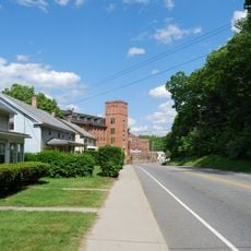
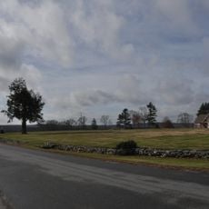
Pomfret is a small town in the northeast corner of Connecticut with a scattered, rural structure. The landscape consists of open fields, old farms, forests, and scattered houses spread along country roads, with two main village centers: Pomfret Center with basic shops and Pomfret Landing by the water.

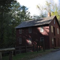
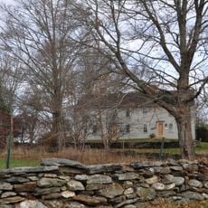
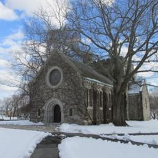
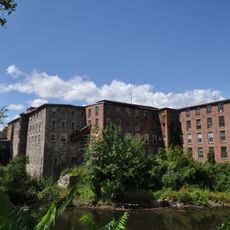
The town was first settled in the late 1600s and formally established in 1713 after the land was purchased from Native Americans. In the 18th and 19th centuries, farming and small water mills shaped daily life, while later the founding of schools like Pomfret School in the late 1800s shifted its character toward education.

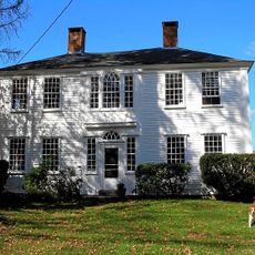
The name Pomfret comes from Pontefract, a town in Yorkshire, England, reflecting its colonial roots. You can see this heritage in the old street layouts and architecture that still carries that British influence.

The town office sits along US Route 44 where you can find local information and assistance. Two ZIP codes, 06259 and 06258, help with location, and small shops and lodging options are scattered nearby.

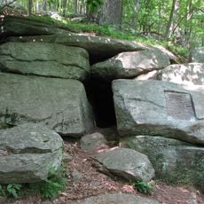
Mashamoquet State Park contains the Wolf's Den, a cave where Revolutionary War hero Israel Putnam reportedly killed Connecticut's last wild wolf. This historical tale draws visitors interested in exploring both nature and local legend.

The community of curious travelers

AroundUs brings together thousands of curated places, local tips, and hidden gems, enriched daily by 60,000 contributors worldwide.

Start exploring
Location
Inception
1713
Elevation above the sea
131 m
Shares border with
Hampton
GPS coordinates
41.86667,-71.98333
Latest update
February 7, 2026 09:31
Around this place
Israel Putnam Wolf Den
United States of America

Israel Putnam Wolf Den

2.6 km
Dayville Historic District
United States of America

Dayville Historic District

8.4 km
United States of America

Israel Putnam Monument

9.4 km
Frog Rock
United States of America

Frog Rock

5.7 km
Mashamoquet Brook State Park
United States of America

Mashamoquet Brook State Park

1.7 km
Putnam Farm
United States of America

Putnam Farm

5.5 km
Abington Congregational Church
United States of America

Abington Congregational Church

2.3 km
Pomfret Street Historic District
United States of America

Pomfret Street Historic District

2.9 km
Brooklyn Green Historic District
United States of America

Brooklyn Green Historic District

9.2 km
Pomfret Town House
United States of America

Pomfret Town House

1.6 km
Israel Putnam School
United States of America

Israel Putnam School

8.4 km
Cargill Falls Mill
United States of America

Cargill Falls Mill

8 km
Putnam High School
United States of America

Putnam High School

8.2 km
Bush Hill Historic District
United States of America

Bush Hill Historic District

6.3 km
Sumner-Carpenter House
United States of America

Sumner-Carpenter House

8 km
Old Westfield Cemetery
United States of America

Old Westfield Cemetery

9.4 km
Killingly Intermediate School
United States of America

Killingly Intermediate School

7.3 km
Mathew Bowen Homestead
United States of America

Mathew Bowen Homestead

8.5 km
United States of America

Nathaniel Lyon Memorial Park

8.5 km
United States of America

Hampton Reservoir

7.8 km
United States of America

Dayville Pond

7.8 km
United States of America

Harrisville Golf Course

7.1 km
United States of America

Vineyard Valley Golf Club

3 km
United States of America

Soldier's grave

1.7 km
United States of America

Frog Rock

5.6 km
United States of America

Bara-Hack Abandoned Village

2.7 km
United States of America

Bradley Playhouse

8.2 km
United States of America

Loos Center for the Arts

7 km
Show the full map
Reviews
Share your experience

No review yet

Discussions
Start a discussion...

No discussion yet

« Pomfret - town in Connecticut, United States » is provided by Around Us (aroundus.com). Images and texts are derived from Wikimedia project under a Creative Commons license. You are allowed to copy, distribute, and modify copies of this page, under the conditions set by the license, as long as this note is clearly visible.

Discover hidden gems everywhere you go!

From secret cafés to breathtaking viewpoints, skip the crowded tourist spots and find places that match your style. Our app makes it easy with voice search, smart filtering, route optimization, and insider tips from travelers worldwide. Download now for the complete mobile experience.

Around Us App Screenshot

A unique approach to discovering new places

Le Figaro

All the places worth exploring

France Info

A tailor-made excursion in just a few clicks

20 Minutes

Around Us
Travel Guide & Maps
Download

Send to your phone

QR Code
1

Open the camera app on your mobile.

2

Point at the QR code with your camera. A notification will appear.

3

Tap the notification to open the link.