Enable Location

We need your location to show you interesting places around you

Discover nearby places

Find interesting locations and hidden gems around you

Precise directions

Get accurate directions and distances to places

Your location is never shared with other users. It's only used when you tap the location button.

Wappingers Falls Historic District

Log in to your account

Start exploring — it's free

Trusted by 62,176 travelers worldwide

Continue with Google
Continue with Apple
or

We will send you a code to connect

By continuing, you accept our Terms and Conditions and our Privacy Policy

Check your inbox

We've sent a pincode in your inbox. Please enter the code below.

Wappingers Falls Historic District, Historic district in Wappingers Falls, United States

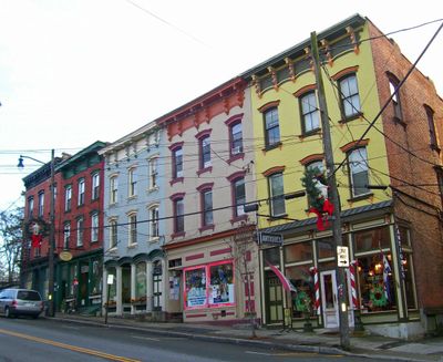
Wappingers Falls Historic District is a neighborhood in central Wappingers Falls encompassing Mesier Park, residential areas, and buildings along South Avenue and West Main Street. The area contains a collection of historical structures from different periods with varied architectural features.

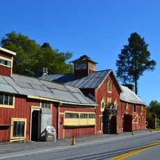
The district developed after a cotton mill was established in 1819, which grew into one of the largest printworks in the country by 1856. This early industry shaped the economic foundation and growth of the entire area.

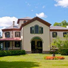
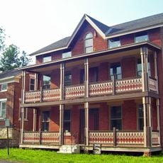
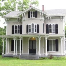
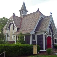
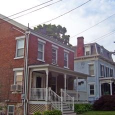
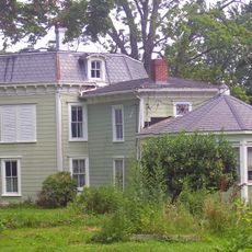
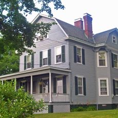
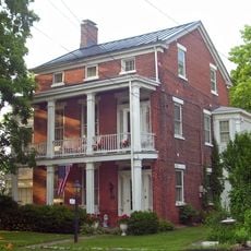
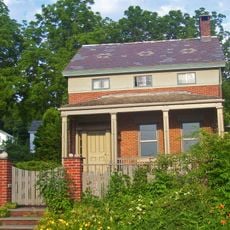
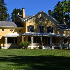
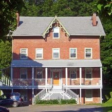
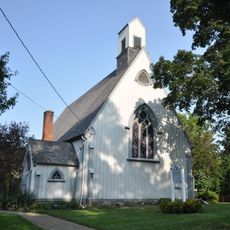
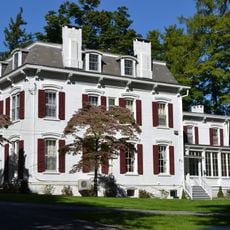
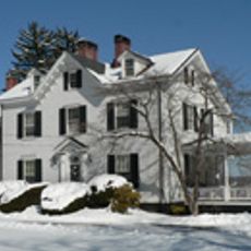
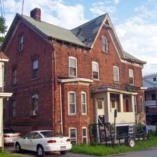
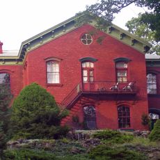
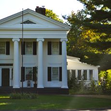
The district displays various 19th-century architectural styles including Italianate row buildings, Greek Revival houses, Gothic Revival structures, and Queen Anne residences. These different styles reflect the various phases of growth and development you notice while walking through the streets.

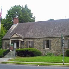
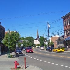
The district is easy to explore and contains the village's main services, including the police station at the intersection of East Main Street and South Avenue near central Mesier Park. The central location and proximity to key facilities make it a practical starting point for your visit.

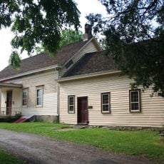
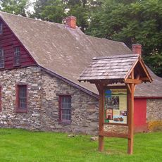
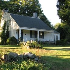
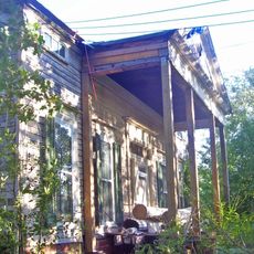
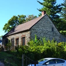
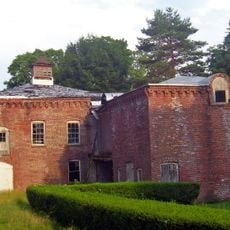
The Mesier-Brewer House, built around 1740, shows the construction method typical of the Hudson Valley region using stone and wood from the pre-Revolutionary era. This building offers a rare glimpse into the earliest settlement of the area.

The community of curious travelers

AroundUs brings together thousands of curated places, local tips, and hidden gems, enriched daily by 60,000 contributors worldwide.

Start exploring
Location
GPS coordinates
41.59806,-73.91861
Latest update
December 14, 2025 14:41
Around this place
The Chapel of Sacred Mirrors
United States of America

The Chapel of Sacred Mirrors

2.5 km
Van Wyck Homestead
United States of America

Van Wyck Homestead

8.7 km
Locust Grove
United States of America

Locust Grove

8.4 km
Main Street Historic District
United States of America

Main Street Historic District

2.8 km
Stony Kill Farm
United States of America

Stony Kill Farm

7.1 km
Rombout House
United States of America

Rombout House

9.3 km
Zion Memorial Chapel
United States of America

Zion Memorial Chapel

2.8 km
Stone Street Historic District
United States of America

Stone Street Historic District

2.7 km
Dubois-Sarles Octagon
United States of America

Dubois-Sarles Octagon

4.6 km
Captain Moses W. Collyer House
United States of America

Captain Moses W. Collyer House

6.8 km
Adolph Brower House
United States of America

Adolph Brower House

2.8 km
Kimlin Cider Mill
United States of America

Kimlin Cider Mill

7.8 km
Abraham Brower House
United States of America

Abraham Brower House

2.8 km
Joseph Horton House
United States of America

Joseph Horton House

4.8 km
Wappingers Falls Village Hall
United States of America

Wappingers Falls Village Hall

132 m
Maple Grove
United States of America

Maple Grove

9.3 km
Fishkill Village District
United States of America

Fishkill Village District

7.1 km
Dutchess Company Superintendent's House
United States of America

Dutchess Company Superintendent's House

706 m
Cornelius Carman House
United States of America

Cornelius Carman House

6.9 km
United States of America

Lattingtown Baptist Church

8.9 km
Saint Mark's Episcopal Church
United States of America

Saint Mark's Episcopal Church

6.6 km
Thompson House
United States of America

Thompson House

9.3 km
Freer House
United States of America

Freer House

9.1 km
Elliot–Buckley House
United States of America

Elliot–Buckley House

4.6 km
William Shay Double House
United States of America

William Shay Double House

2.9 km
Union Free School
United States of America

Union Free School

2.4 km
Shay's Warehouse and Stable
United States of America

Shay's Warehouse and Stable

2.8 km
Elias Titus House
United States of America

Elias Titus House

8.4 km
Show the full map
« Wappingers Falls Historic District - Historic district in Wappingers Falls, United States » is provided by Around Us (aroundus.com). Images and texts are derived from Wikimedia project under a Creative Commons license. You are allowed to copy, distribute, and modify copies of this page, under the conditions set by the license, as long as this note is clearly visible.

Discover hidden gems everywhere you go!

From secret cafés to breathtaking viewpoints, skip the crowded tourist spots and find places that match your style. Our app makes it easy with voice search, smart filtering, route optimization, and insider tips from travelers worldwide. Download now for the complete mobile experience.

Around Us App Screenshot

A unique approach to discovering new places

Le Figaro

All the places worth exploring

France Info

A tailor-made excursion in just a few clicks

20 Minutes

Around Us
Travel Guide & Maps
Download

Send to your phone

QR Code
1

Open the camera app on your mobile.

2

Point at the QR code with your camera. A notification will appear.

3

Tap the notification to open the link.