Enable Location

We need your location to show you interesting places around you

Discover nearby places

Find interesting locations and hidden gems around you

Precise directions

Get accurate directions and distances to places

Your location is never shared with other users. It's only used when you tap the location button.

Elizabeth River

Log in to your account

Start exploring — it's free

Trusted by 64,609 travelers worldwide

Continue with Google
Continue with Apple
or

We will send you a code to connect

By continuing, you accept our Terms and Conditions and our Privacy Policy

Check your inbox

We've sent a pincode in your inbox. Please enter the code below.

Elizabeth River
Discussion Reviews 1 Photos
15.2k Popularity

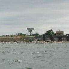
Elizabeth River, Tidal estuary in southeastern Virginia, United States.

The Elizabeth River is a tidal estuary in southeastern Virginia with three main branches. These waterways connect Portsmouth, Norfolk, and Chesapeake to Hampton Roads harbor.

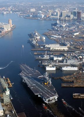
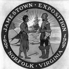
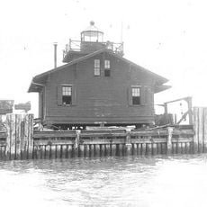
The river was named after Princess Elizabeth Stuart, daughter of King James I, during early colonization. A major shipyard established here in 1767 became one of the oldest continuously operating naval facilities in North America.

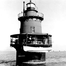
The river has long been central to maritime life and naval operations in the region. Visitors today can observe working shipyards, docks, and boat facilities that show how closely the communities depend on waterborne trade and military activities.

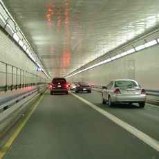
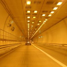
The Downtown and Midtown tunnels cross the river to connect communities throughout Hampton Roads. These passages can become congested during peak hours, so timing your visit accordingly helps.

The river serves as an entry point to the Atlantic Intracoastal Waterway, a protected shipping route along the Atlantic coast. This passage allows vessels to travel south without exposing themselves to open ocean conditions.

The community of curious travelers

AroundUs brings together thousands of curated places, local tips, and hidden gems, enriched daily by 60,000 contributors worldwide.

Start exploring
GPS coordinates
36.92500,-76.34361
Latest update
December 7, 2025 19:31
Around this place
Hampton Roads Bridge–Tunnel
United States of America

Hampton Roads Bridge–Tunnel

7.7 km
Monitor-Merrimac Memorial Bridge-Tunnel
United States of America

Monitor-Merrimac Memorial Bridge-Tunnel

5.5 km
Jamestown Exposition
United States of America

Jamestown Exposition

4.1 km
Chrysler Museum of Art
United States of America

Chrysler Museum of Art

8.9 km
Ted Constant Convocation Center
United States of America

Ted Constant Convocation Center

5.9 km
Fort Wool
United States of America

Fort Wool

7.8 km
S.B. Ballard Stadium
United States of America

S.B. Ballard Stadium

5.3 km
Virginia Zoological Park
United States of America

Virginia Zoological Park

7.8 km
The Chamberlin
United States of America

The Chamberlin

8.9 km
Harrison Opera House
United States of America

Harrison Opera House

8.8 km
Fort Norfolk
United States of America

Fort Norfolk

8.3 km
Newport News Middle Ground Light
United States of America

Newport News Middle Ground Light

4.8 km
Commodore Levy Chapel
United States of America

Commodore Levy Chapel

3.3 km
Elmwood Cemetery
United States of America

Elmwood Cemetery

8.9 km
Christ and St. Luke's Church
United States of America

Christ and St. Luke's Church

8.3 km
James Blair Junior High School
United States of America

James Blair Junior High School

7.6 km
West Point Cemetery
United States of America

West Point Cemetery

8.8 km
Port Norfolk Historic District
United States of America

Port Norfolk Historic District

8.6 km
Talbot Hall
United States of America

Talbot Hall

5.6 km
Boush-Tazewell House
United States of America

Boush-Tazewell House

4 km
Craney Island Light
United States of America

Craney Island Light

3.7 km
Norfolk and Western Railroad Historic District
United States of America

Norfolk and Western Railroad Historic District

7.3 km
Virginia Ice & Freezing Corporation Cold Storage Warehouse
United States of America

Virginia Ice & Freezing Corporation Cold Storage Warehouse

8.3 km
Lambert Point Light
United States of America

Lambert Point Light

5.7 km
Norfolk Auto Row Historic District
United States of America

Norfolk Auto Row Historic District

8.9 km
Saint Mary's Catholic Cemetery
United States of America

Saint Mary's Catholic Cemetery

8 km
Zion Methodist Church
United States of America

Zion Methodist Church

6.3 km
Williamston-Woodland Historic District
United States of America

Williamston-Woodland Historic District

8.4 km
Show the full map
Reviews
Share your experience

No review yet

Discussions
Start a discussion...

No discussion yet

« Elizabeth River - Tidal estuary in southeastern Virginia, United States » is provided by Around Us (aroundus.com). Images and texts are derived from Wikimedia project under a Creative Commons license. You are allowed to copy, distribute, and modify copies of this page, under the conditions set by the license, as long as this note is clearly visible.

Discover hidden gems everywhere you go!

From secret cafés to breathtaking viewpoints, skip the crowded tourist spots and find places that match your style. Our app makes it easy with voice search, smart filtering, route optimization, and insider tips from travelers worldwide. Download now for the complete mobile experience.

Around Us App Screenshot

A unique approach to discovering new places

Le Figaro

All the places worth exploring

France Info

A tailor-made excursion in just a few clicks

20 Minutes

Around Us
Travel Guide & Maps
Download

Send to your phone

QR Code
1

Open the camera app on your mobile.

2

Point at the QR code with your camera. A notification will appear.

3

Tap the notification to open the link.