Mississippi Palisades State Park
Mississippi Palisades State Park, State park and National Natural Landmark in Carroll County, Illinois.
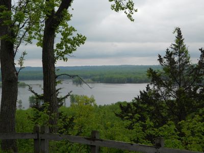
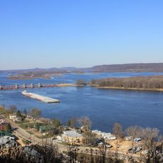
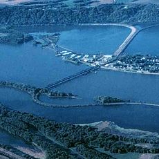
Mississippi Palisades State Park is a natural area featuring limestone bluffs, caves, and sinkholes along the Mississippi River. The landscape includes varied rock formations and forest where numerous trails wind through the terrain.
The park was designated as a National Natural Landmark by the Department of Interior in 1973, recognizing its geological significance. This official recognition helped protect the rock formations from development.
Native American peoples created pathways through the rock formations, and visitors today follow these same routes when exploring the landscape. These trails connect people directly to the geology and history of the place.
Visitors can camp in different sections of the park, with many sites offering basic facilities like showers and restrooms. It is wise to wear comfortable hiking shoes and bring plenty of water, as parts of the terrain are uneven and steep.
The park is a popular destination for rock climbers, with several cliff faces offering numerous different routes. These climbing areas utilize the natural limestone bluffs and regularly attract dedicated athletes.
Location: Carroll County
Inception: 1973
Elevation above the sea: 229 m
Website: https://www2.illinois.gov/dnr/Parks/Pages/MississippiPalisades.aspx
GPS coordinates: 42.13835,-90.15902
Latest update: December 6, 2025 17:41
Illinois holds a rich collection of historical sites and natural landscapes. Visitors can explore prehistoric ruins like the Cahokia Mounds, where earthen structures reflect the achievements of ancient peoples. The region also features striking rock formations such as Garden of the Gods and natural stone bridges that reveal the area's geological history. The collection includes buildings that span different periods and styles, from the minimalist Farnsworth House to the ornate Villa Kathrine. Historic settlements like Nauvoo and Lincoln's New Salem show how communities developed and thrived in earlier times. Lighthouses, churches, and monuments dot the landscape, marking important chapters in the region's past. Natural areas provide space for walking and exploring. Waterfalls and canyons frame parks like Starved Rock, while rare wetlands like Volo Bog offer chances to see native plants and wildlife. Japanese gardens, tree collections, and state forests round out the options for visitors seeking both history and nature.
Lock and Dam No. 13
26.7 km
Apple River Fort
20.5 km
Lock and Dam No. 12
25.5 km
Bellevue State Park
24.9 km
Dale Gardner Veterans Memorial Bridge
3.8 km
Sabula Rail Bridge
8.3 km
Mount Carroll Historic District
15.6 km
Caroline Mark Home
15.8 km
Potter's Mill
25.4 km
Townsend Home
27.7 km
W.E. White Building
26.7 km
Carroll County Courthouse
15.5 km
Dyas Hexagonal Barn
22.9 km
Building at 306 South Second Street
25.4 km
Spring Side
27 km
Bellevue Herald Building
25.5 km
Lafayette Lamb House
13.5 km
George Dyas House
24.6 km
Jeremiah Wood House
7.9 km
Great River Road Bridge
24.8 km
Peter Dierks House
28.2 km
House at 505 Court Street
25.8 km
John S. Dominy House
7.7 km
Building at 101 North Riverview Street
25.6 km
Nathaniel Halderman House
16.1 km
William Dyas Barn
24.5 km
Kellogg's Grove
28.8 km
Jackson County Courthouse
25.7 kmVisited this place? Tap the stars to rate it and share your experience / photos with the community! Try now! You can cancel it anytime.
Discover hidden gems everywhere you go!
From secret cafés to breathtaking viewpoints, skip the crowded tourist spots and find places that match your style. Our app makes it easy with voice search, smart filtering, route optimization, and insider tips from travelers worldwide. Download now for the complete mobile experience.
A unique approach to discovering new places❞
— Le Figaro
All the places worth exploring❞
— France Info
A tailor-made excursion in just a few clicks❞
— 20 Minutes