Enable Location

We need your location to show you interesting places around you

Discover nearby places

Find interesting locations and hidden gems around you

Precise directions

Get accurate directions and distances to places

Your location is never shared with other users. It's only used when you tap the location button.

Rockport

Log in to your account

Start exploring — it's free

Trusted by 62,166 travelers worldwide

Continue with Google
Continue with Apple
or

We will send you a code to connect

By continuing, you accept our Terms and Conditions and our Privacy Policy

Check your inbox

We've sent a pincode in your inbox. Please enter the code below.

Rockport, Administrative division in Indiana, United States

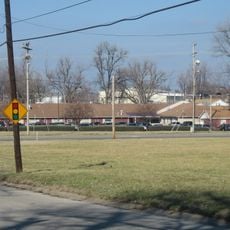
Rockport is a town in Spencer County, Indiana, situated on the banks of the Ohio River. The community provides municipal services and handles local governance for residents throughout the area.

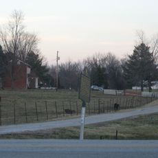
The town took shape in the early 1800s when settlers established formal administrative structures. Its location on the Ohio River made it a logical spot for commerce and community growth.

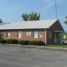
The Municipal Building hosts regular town meetings where citizens participate in discussions about community development and local governance initiatives.

The town offers residents access to municipal services through local offices and facilities. Visitors can find basic services and information readily available throughout the area.

The geographic coordinates of 37.8831055, -87.0494408 position Rockport at a strategic point for administrative oversight of surrounding communities.

The community of curious travelers

AroundUs brings together thousands of curated places, local tips, and hidden gems, enriched daily by 60,000 contributors worldwide.

Start exploring
GPS coordinates
37.88311,-87.04944
Latest update
December 8, 2025 13:43
Around this place
Lincoln Boyhood National Memorial
United States of America

Lincoln Boyhood National Memorial

26.6 km
Lincoln State Park
United States of America

Lincoln State Park

25 km
William H. Natcher Bridge
United States of America

William H. Natcher Bridge

2.4 km
Glover Cary Bridge
United States of America

Glover Cary Bridge

12.7 km
St. Stephen's Cathedral
United States of America

St. Stephen's Cathedral

13.9 km
Temple Adath Israel
United States of America

Temple Adath Israel

13.5 km
Yankeetown Site
United States of America

Yankeetown Site

22.6 km
Col. William Jones House
United States of America

Col. William Jones House

25.7 km
Western Kentucky Botanical Garden
United States of America

Western Kentucky Botanical Garden

14.5 km
Christ of the Ohio
United States of America

Christ of the Ohio

25.3 km
Haphazard
United States of America

Haphazard

11.4 km
Confederate Monument in Owensboro
United States of America

Confederate Monument in Owensboro

13.4 km
St. Joseph's Catholic Church
United States of America

St. Joseph's Catholic Church

13.3 km
Mathias Sharp House
United States of America

Mathias Sharp House

559 m
Boonville Public Square Historic District
United States of America

Boonville Public Square Historic District

27.1 km
Odd Fellows Building
United States of America

Odd Fellows Building

13.4 km
Trinity Episcopal Church
United States of America

Trinity Episcopal Church

13.6 km
Spencer County Courthouse
United States of America

Spencer County Courthouse

276 m
Joe Pell Building
United States of America

Joe Pell Building

14.2 km
Old Warrick County Jail
United States of America

Old Warrick County Jail

27 km
Tell City Oddfellows' Hall
United States of America

Tell City Oddfellows' Hall

25.7 km
Felix Grimes House
United States of America

Felix Grimes House

13.6 km
Le Vega Clements House
United States of America

Le Vega Clements House

12.7 km
Yewell House
United States of America

Yewell House

13.6 km
United States of America

Lewisport Masonic Lodge

14.2 km
Hancock County Courthouse
United States of America

Hancock County Courthouse

26.4 km
Robert C. Beauchamp House
United States of America

Robert C. Beauchamp House

21.9 km
Immaculate Conception Church
United States of America

Immaculate Conception Church

26.1 km
Show the full map
« Rockport - Administrative division in Indiana, United States » is provided by Around Us (aroundus.com). Images and texts are derived from Wikimedia project under a Creative Commons license. You are allowed to copy, distribute, and modify copies of this page, under the conditions set by the license, as long as this note is clearly visible.

Discover hidden gems everywhere you go!

From secret cafés to breathtaking viewpoints, skip the crowded tourist spots and find places that match your style. Our app makes it easy with voice search, smart filtering, route optimization, and insider tips from travelers worldwide. Download now for the complete mobile experience.

Around Us App Screenshot

A unique approach to discovering new places

Le Figaro

All the places worth exploring

France Info

A tailor-made excursion in just a few clicks

20 Minutes

Around Us
Travel Guide & Maps
Download

Send to your phone

QR Code
1

Open the camera app on your mobile.

2

Point at the QR code with your camera. A notification will appear.

3

Tap the notification to open the link.