Enable Location

We need your location to show you interesting places around you

Discover nearby places

Find interesting locations and hidden gems around you

Precise directions

Get accurate directions and distances to places

Your location is never shared with other users. It's only used when you tap the location button.

Pere Marquette River

Log in to your account

Start exploring — it's free

Trusted by 65,268 travelers worldwide

Continue with Google
Continue with Apple
or

We will send you a code to connect

By continuing, you accept our Terms and Conditions and our Privacy Policy

Check your inbox

We've sent a pincode in your inbox. Please enter the code below.

Pere Marquette River
Discussion Reviews 1 Photos
9.4k Popularity

Pere Marquette River, River system in Lake County, Michigan, US

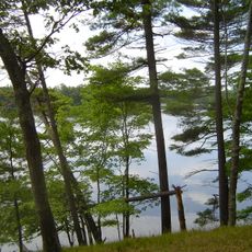
The Pere Marquette River is a river in Michigan's Lower Peninsula that flows westward through Lake County before emptying into Lake Michigan near Ludington. The river alternates between calm, clear stretches and faster-moving sections, with wooded banks and sandy bottom throughout most of its course.

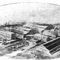
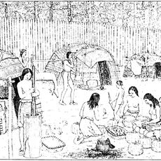
The land around the river was home to Odawa and Ojibwe peoples long before European contact. In the 19th century, the river was heavily used for logging, which stripped the surrounding forests before conservation efforts gradually took hold in the decades that followed.

The river takes its name from Jacques Marquette, a French Jesuit missionary who traveled through this region in the 17th century. Today, the river is closely tied to fly fishing culture, drawing anglers from across the country who follow long-standing traditions along its banks.

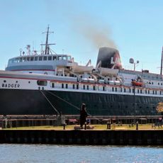
The river can be accessed from several public launch points, and many visitors use marked boat ramps or trails along the banks to reach the water. Arriving early in the day during summer helps avoid crowded conditions at the most popular stretches.

The Pere Marquette River is one of the few rivers in Michigan to hold a federal Wild and Scenic River designation, a status it has carried since 1978. This classification legally protects the river's natural flow and limits the construction of dams or other structures along its course.

The community of curious travelers

AroundUs brings together thousands of curated places, local tips, and hidden gems, enriched daily by 60,000 contributors worldwide.

Start exploring
Location
GPS coordinates
43.93309,-86.11528
Latest update
March 3, 2026 08:19
Around this place
SS Badger
United States of America

SS Badger

27 km
Big Sable Point Light
United States of America

Big Sable Point Light

34.8 km
Mears State Park
United States of America

Mears State Park

30.8 km
Ramsdell Theatre
United States of America

Ramsdell Theatre

38.6 km
Marlborough Historic District
United States of America

Marlborough Historic District

23.6 km
Udell Lookout Tower
United States of America

Udell Lookout Tower

30.6 km
Mason County Courthouse
United States of America

Mason County Courthouse

26.5 km
Our Saviour's Evangelical Lutheran Church
United States of America

Our Saviour's Evangelical Lutheran Church

38.3 km
Guardian Angels Church
United States of America

Guardian Angels Church

38.2 km
Ludington State Park Beach House
United States of America

Ludington State Park Beach House

33.3 km
Warren A. and Catherine Cartier House
United States of America

Warren A. and Catherine Cartier House

26.3 km
Dumaw Creek Site
United States of America

Dumaw Creek Site

25 km
Scottville School
United States of America

Scottville School

13.5 km
Hart Downtown Historic District
United States of America

Hart Downtown Historic District

32.6 km
Jared H. Gay House
United States of America

Jared H. Gay House

20.1 km
First Congregational Church
United States of America

First Congregational Church

38.4 km
Ludington United States Coast Guard Station
United States of America

Ludington United States Coast Guard Station

27.7 km
Navigation Structures at Pentwater Harbor
United States of America

Navigation Structures at Pentwater Harbor

31.1 km
East Ludington Avenue Historic District
United States of America

East Ludington Avenue Historic District

26.1 km
Simeon Babcock House
United States of America

Simeon Babcock House

38.5 km
Ludington Light
United States of America

Ludington Light

28.5 km
Ludington State Park
United States of America

Ludington State Park

33.4 km
Pentwater South Pierhead Light
United States of America

Pentwater South Pierhead Light

31.3 km
Pentwater North Pierhead Light
United States of America

Pentwater North Pierhead Light

31.3 km
Ludington Public Library
United States of America

Ludington Public Library

26.6 km
Pentwater Light
United States of America

Pentwater Light

31.3 km
Luther Area Public Library
United States of America

Luther Area Public Library

36.5 km
Udell Rollways Day Use Area
United States of America

Udell Rollways Day Use Area

36.2 km
Show the full map
Reviews
Share your experience

No review yet

Discussions
Start a discussion...

No discussion yet

« Pere Marquette River - River system in Lake County, Michigan, US » is provided by Around Us (aroundus.com). Images and texts are derived from Wikimedia project under a Creative Commons license. You are allowed to copy, distribute, and modify copies of this page, under the conditions set by the license, as long as this note is clearly visible.

Discover hidden gems everywhere you go!

From secret cafés to breathtaking viewpoints, skip the crowded tourist spots and find places that match your style. Our app makes it easy with voice search, smart filtering, route optimization, and insider tips from travelers worldwide. Download now for the complete mobile experience.

Around Us App Screenshot

A unique approach to discovering new places

Le Figaro

All the places worth exploring

France Info

A tailor-made excursion in just a few clicks

20 Minutes

Around Us
Travel Guide & Maps
Download

Send to your phone

QR Code
1

Open the camera app on your mobile.

2

Point at the QR code with your camera. A notification will appear.

3

Tap the notification to open the link.