Alligator River National Wildlife Refuge

Log in to your account

AroundUs is a community-driven map of interesting places, built by curious explorers like you. It grows with every review, story, and photo you share.
Connect to save your favorite spots, contribute locations, and create personalized routes.
By continuing, you accept our Terms and Conditions and our Privacy Policy

Alligator River National Wildlife Refuge

Add to collection
Map
Suggest a change
Share

Alligator River National Wildlife Refuge, National Wildlife Refuge in North Carolina, United States.

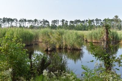
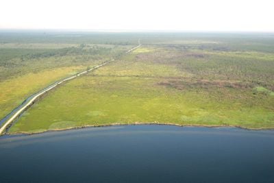
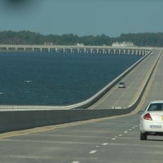
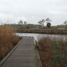
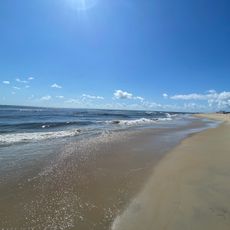
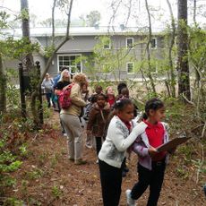
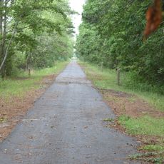
Alligator River National Wildlife Refuge is a protected area covering about 150,000 acres of wetlands, forests, and mixed woodlands along North Carolina's Atlantic coastal plain. The refuge features hiking trails, observation platforms, and water access points spread throughout that visitors can explore from sunrise to sunset each day.

Established in 1984, the refuge converted former agricultural and timber lands into a sanctuary for endangered species and their natural habitats. This transformation redirected the land's future from resource extraction toward protection and restoration of the coastal ecosystem.

Local communities have long understood the tidal marshes and waterways as sources of food and survival shaped by generations of observation. This deep knowledge of how to live with the land remains visible in how people move through and relate to the landscape today.

The refuge is open from sunrise to sunset daily, with most trails and platforms accessible without special permits. Visitors should wear sturdy footwear and prepare for changing weather and insects, which can be heavy during warmer months.

The refuge runs a red wolf breeding program, one of the few places where this critically endangered predator roams freely in the wild. This population plays a vital role in global efforts to prevent the species from disappearing entirely.

Location: North Carolina

Inception: 1984

Website: https://fws.gov/refuge/alligator_river

GPS coordinates: 35.78330,-75.85000

Latest update: December 7, 2025 20:21

Photos
Around this place
Show the full map
Bodie Island Light
United States of America

Bodie Island Light

26.2 km
Jockey's Ridge State Park
United States of America

Jockey's Ridge State Park

27.8 km
Virginia Dare Memorial Bridge
United States of America

Virginia Dare Memorial Bridge

15.7 km
North Carolina Aquariums
United States of America

North Carolina Aquariums

19.9 km
Coquina Beach
United States of America

Coquina Beach

26.9 km
Roanoke Island Festival Park
United States of America

Roanoke Island Festival Park

21.9 km
Roanoke Marshes Light
United States of America

Roanoke Marshes Light

13.8 km
William B. Umstead Bridge
United States of America

William B. Umstead Bridge

17.6 km
Sea Foam Motel
United States of America

Sea Foam Motel

26.9 km
Bodie Island Lifesaving and Coast Guard Station
United States of America

Bodie Island Lifesaving and Coast Guard Station

26.8 km
George Washington Creef House
United States of America

George Washington Creef House

21.3 km
Mattie Midgett Store and House
United States of America

Mattie Midgett Store and House

28 km
University of North Carolina - Coastal Studies Institute
United States of America

University of North Carolina - Coastal Studies Institute

19.8 km
John T. Daniels House
United States of America

John T. Daniels House

20.4 km
Queen Elizabeth I of England statue
United States of America

Queen Elizabeth I of England statue

21.3 km
Theodore S. Meekins House
United States of America

Theodore S. Meekins House

21.2 km
Lindsay C. Warren Bridge
United States of America

Lindsay C. Warren Bridge

19.4 km
Virginia Dare Monument
United States of America

Virginia Dare Monument

21.4 km
Washington Baum Bridge
United States of America

Washington Baum Bridge

23.5 km
Bodie Island Light Station
United States of America

Bodie Island Light Station

26.1 km
Bodie Island Visitor Center
United States of America

Bodie Island Visitor Center

26.1 km
Fort Raleigh
United States of America

Fort Raleigh

21.4 km
Waterside Theatre
United States of America

Waterside Theatre

21.5 km
Coquina Beach
United States of America

Coquina Beach

27 km
Coastal North Carolina National Wildlife Refuges Gateway Visitor Center
United States of America

Coastal North Carolina National Wildlife Refuges Gateway Visitor Center

20.6 km
First Light of Freedom Memorial
United States of America

First Light of Freedom Memorial

21.3 km
Creef Cut Trail
United States of America

Creef Cut Trail

8.7 km
Elizabethan Gardens
United States of America

Elizabethan Gardens

21.3 km
Show the full map
Reviews

Visited this place? Tap the stars to rate it and share your experience / photos with the community! Try now! You can cancel it anytime.

« Alligator River National Wildlife Refuge - National Wildlife Refuge in North Carolina, United States » is provided by Around Us (aroundus.com). Images and texts are derived from Wikimedia project under a Creative Commons license. You are allowed to copy, distribute, and modify copies of this page, under the conditions set by the license, as long as this note is clearly visible.

Discover hidden gems everywhere you go!

From secret cafés to breathtaking viewpoints, skip the crowded tourist spots and find places that match your style. Our app makes it easy with voice search, smart filtering, route optimization, and insider tips from travelers worldwide. Download now for the complete mobile experience.

Around Us App Screenshot

A unique approach to discovering new places

Le Figaro

All the places worth exploring

France Info

A tailor-made excursion in just a few clicks

20 Minutes