Rosebud Indian Reservation

Log in to your account

AroundUs is a community-driven map of interesting places, built by curious explorers like you. It grows with every review, story, and photo you share.
Connect to save your favorite spots, contribute locations, and create personalized routes.
By continuing, you accept our Terms and Conditions and our Privacy Policy
Add to collection
Map
Suggest a change
Share

Rosebud Indian Reservation, Native American reservation in South Dakota, United States.

The Rosebud Indian Reservation is a territory spanning five counties in South Dakota, home to the Sicangu Oyate people. The town of Rosebud serves as the administrative hub, with the broader area containing residential communities, businesses, schools, and open land.

The reservation was established in 1889 following the division of the Great Sioux Reservation, which itself stemmed from the Treaty of Fort Laramie in 1868. This founding moment reshaped the Sicangu Oyate's relationship with federal authority and their management of ancestral lands.

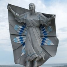
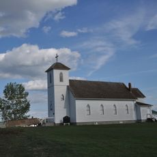
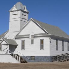
The Sicangu Oyate, also known as the Rosebud Sioux Tribe, practice Lakota traditions through ceremonies and gatherings that are woven into the rhythm of community life. These living customs shape how residents connect with each other and their land.

Visiting the reservation requires respect for private property and boundary markers, as much of the land is residential or protected. Travelers should plan ahead and check locally about which areas are open to visitors and what guidelines apply.

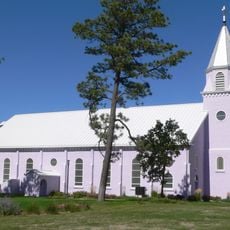
In 2020, the Jesuit religious order returned 525 acres to the people, land that had been held for religious purposes. This return represented a significant step in the ongoing process of land restitution and territorial restoration.

Location: Todd County

Location: Mellette County

Location: Tripp County

Location: Gregory County

Location: Lyman County

Inception: 1889

Capital city: Rosebud

Shares border with: Pine Ridge Indian Reservation

Website: http://rosebudsiouxtribe-nsn.gov

GPS coordinates: 43.29444,-100.65611

Latest update: December 14, 2025 18:29

Photos
Around this place
Dignity
United States of America

Dignity

119.6 km
Chamberlain Bridge
United States of America

Chamberlain Bridge

121 km
St. Francis Mission
United States of America

St. Francis Mission

21.8 km
South Dakota Hall of Fame
United States of America

South Dakota Hall of Fame

119.9 km
Snake Creek Recreation Area
United States of America

Snake Creek Recreation Area

124.9 km
Akta Lakota Museum and Cultural Center
United States of America

Akta Lakota Museum and Cultural Center

122.6 km
Platte Creek Recreation Area
United States of America

Platte Creek Recreation Area

134.4 km
Lewis and Clark Memorial Bridge
United States of America

Lewis and Clark Memorial Bridge

119.4 km
Bijou Hills
United States of America

Bijou Hills

125 km
Stamford Bridge
United States of America

Stamford Bridge

69.2 km
St. Augustine Church
United States of America

St. Augustine Church

92.6 km
Lewis Bridge
United States of America

Lewis Bridge

89.2 km
St. John's Catholic Church
United States of America

St. John's Catholic Church

93.2 km
Chamberlain Rail Bridge
United States of America

Chamberlain Rail Bridge

118.8 km
Holy Trinity Church
United States of America

Holy Trinity Church

145.7 km
Tripp County Veteran's Memorial
United States of America

Tripp County Veteran's Memorial

65.5 km
Herrick Elevator
United States of America

Herrick Elevator

121 km
South Dakota Dept. of Transportation Bridge No. 48-244-204
United States of America

South Dakota Dept. of Transportation Bridge No. 48-244-204

32.3 km
Church of Christ in LaRoche Township
United States of America

Church of Christ in LaRoche Township

128.6 km
Academy Lake
United States of America

Academy Lake

126.5 km
Spotted Tail Gravesite
United States of America

Spotted Tail Gravesite

17 km
Dallas Carnegie Library
United States of America

Dallas Carnegie Library

92.6 km
Edward Morrison House
United States of America

Edward Morrison House

130.6 km
Manthey Barn
United States of America

Manthey Barn

71.5 km
South Dakota Hall of Fame
United States of America

South Dakota Hall of Fame

119.9 km
South Dakota Tractor Museum
United States of America

South Dakota Tractor Museum

145.5 km
Black Bluffs
United States of America

Black Bluffs

111.7 km
Grandpie Head
United States of America

Grandpie Head

109.5 km
Show the full map
Reviews

Visited this place? Tap the stars to rate it and share your experience / photos with the community! Try now! You can cancel it anytime.

« Rosebud Indian Reservation - Native American reservation in South Dakota, United States » is provided by Around Us (aroundus.com). Images and texts are derived from Wikimedia project under a Creative Commons license. You are allowed to copy, distribute, and modify copies of this page, under the conditions set by the license, as long as this note is clearly visible.

Discover hidden gems everywhere you go!

From secret cafés to breathtaking viewpoints, skip the crowded tourist spots and find places that match your style. Our app makes it easy with voice search, smart filtering, route optimization, and insider tips from travelers worldwide. Download now for the complete mobile experience.

Around Us App Screenshot

A unique approach to discovering new places

Le Figaro

All the places worth exploring

France Info

A tailor-made excursion in just a few clicks

20 Minutes