Ashuelot River

Log in to your account

AroundUs is a community-driven map of interesting places, built by curious explorers like you. It grows with every review, story, and photo you share.
Connect to save your favorite spots, contribute locations, and create personalized routes.
Continue with Google
Continue with Apple
Continue with X
Continue with Facebook
Continue with email
By continuing, you accept our Terms and Conditions and our Privacy Policy
Create an account
Add to collection
Map
Suggest a change
Share

Ashuelot River, Brook in Sullivan County, New Hampshire, United States.

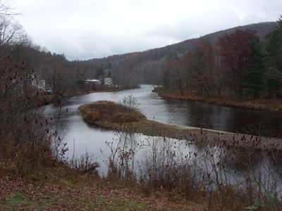
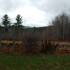
Ashuelot River is a waterway in southwestern New Hampshire that flows through rolling terrain for approximately 64 miles. It originates at Butterfield Pond and continues until it merges with the Connecticut River at Hinsdale.

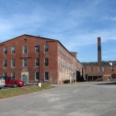
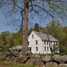
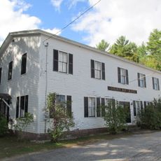
In the early 1800s, the river powered numerous mills that drove the industrial growth of surrounding communities. This manufacturing period shaped the character of settlements along the waterway.

The name comes from the Abenaki language and means 'collection of many waters' or 'place where the water flows'. This heritage reflects the indigenous history woven into the landscape.

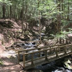
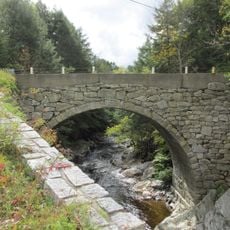
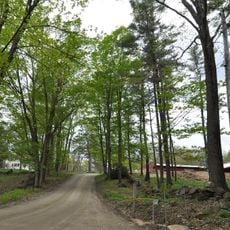
Several access points along the waterway make it easy to start fishing, kayaking, or canoeing trips. The best visiting season runs from spring through summer when water conditions are most favorable.

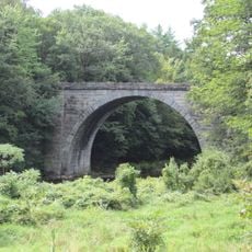
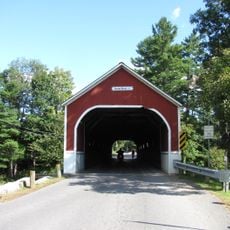
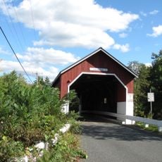
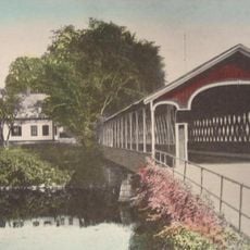
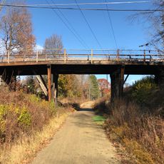
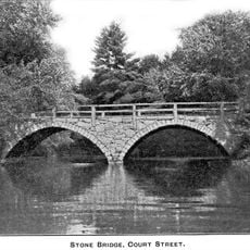
The waterway is home to several covered bridges listed on the National Register of Historic Places. Carleton Bridge and Sawyers Crossing Bridge stand out as functional examples that still carry traffic today.

Location: Sullivan County

GPS coordinates: 42.96950,-72.30293

Latest update: December 10, 2025 20:10

Photos
Around this place
United States of America

Monadnock Region

5.7 km
Stone Arch Bridge
United States of America

Stone Arch Bridge

7.4 km
Chesterfield Gorge Natural Area
United States of America

Chesterfield Gorge Natural Area

10.3 km
Sawyers Crossing Covered Bridge
United States of America

Sawyers Crossing Covered Bridge

9.4 km
Carleton Bridge
United States of America

Carleton Bridge

13 km
Apple Hill Center for Chamber Music
United States of America

Apple Hill Center for Chamber Music

10.4 km
West Swanzey Covered Bridge
United States of America

West Swanzey Covered Bridge

11.1 km
Gilsum Stone Arch Bridge
United States of America

Gilsum Stone Arch Bridge

8.2 km
Park Hill Meetinghouse
United States of America

Park Hill Meetinghouse

12.5 km
Sawyer Tavern
United States of America

Sawyer Tavern

3.6 km
Wyman Tavern
United States of America

Wyman Tavern

5.3 km
Beaver Mills
United States of America

Beaver Mills

4.8 km
Colony House
United States of America

Colony House

4.2 km
Elliot Mansion
United States of America

Elliot Mansion

5.3 km
Buckminster-Kingsbury Farm
United States of America

Buckminster-Kingsbury Farm

7.6 km
Cheshire County Courthouse
United States of America

Cheshire County Courthouse

4.4 km
Dr. Daniel Adams House
United States of America

Dr. Daniel Adams House

5.4 km
Noah Cooke House
United States of America

Noah Cooke House

5.8 km
John Adams Homestead-Wellscroft
United States of America

John Adams Homestead-Wellscroft

12.7 km
Smith-Mason Farm
United States of America

Smith-Mason Farm

12.6 km
Golden Rod Grange No. 114
United States of America

Golden Rod Grange No. 114

11 km
Willard Homestead
United States of America

Willard Homestead

12.4 km
Dinsmoor-Hale House
United States of America

Dinsmoor-Hale House

5.1 km
Mason-Watkins House
United States of America

Mason-Watkins House

3.5 km
Colonial Theatre
United States of America

Colonial Theatre

4.7 km
Christian Hill Road Bridge
United States of America

Christian Hill Road Bridge

11.2 km
Old Stone Arch Bridge
United States of America

Old Stone Arch Bridge

930 m
Otter Brook Lake
United States of America

Otter Brook Lake

6 km
Show the full map
Reviews

Visited this place? Tap the stars to rate it and share your experience / photos with the community! Try now! You can cancel it anytime.

« Ashuelot River - Brook in Sullivan County, New Hampshire, United States » is provided by Around Us (aroundus.com). Images and texts are derived from Wikimedia project under a Creative Commons license. You are allowed to copy, distribute, and modify copies of this page, under the conditions set by the license, as long as this note is clearly visible.

Discover hidden gems everywhere you go!

From secret cafés to breathtaking viewpoints, skip the crowded tourist spots and find places that match your style. Our app makes it easy with voice search, smart filtering, route optimization, and insider tips from travelers worldwide. Download now for the complete mobile experience.

Around Us App Screenshot

A unique approach to discovering new places

Le Figaro

All the places worth exploring

France Info

A tailor-made excursion in just a few clicks

20 Minutes