Chest opened
+${chestReward.xp} XP
Explorer
NOUVEAU ×${chestReward.collectible.quantity}
tapez pour fermer
Chest locked

Open chests in the app

Around Us is built for your phone — chests unlock when you walk, explore and capture nearby places.

Enable Location

We need your location to show you interesting places around you

Discover nearby places

Find interesting locations and hidden gems around you

Precise directions

Get accurate directions and distances to places

Your location is never shared with other users. It's only used when you tap the location button.

Barren Island

Log in to your account

Start exploring — it's free

Trusted by 72,982 travelers worldwide

Continue with Google
Continue with Apple
or

We will send you a code to connect

By continuing, you accept our Terms and Conditions and our Privacy Policy

Check your inbox

We've sent a pincode in your inbox. Please enter the code below.

Barren Island
Discussion Reviews 1 Photos
21.1k Popularity

Barren Island, Former island on Jamaica Bay, Brooklyn, United States

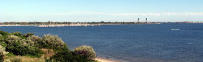
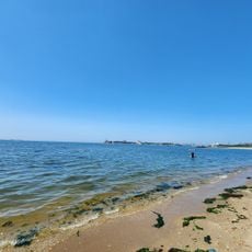
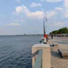
Barren Island is a peninsula extending into Jamaica Bay in Brooklyn, featuring salt meadows and tidal wetlands along its edges. The land connects to Floyd Bennett Field on Brooklyn's southeastern shore and now serves as part of a national recreation area with camping facilities.

Dutch settlers called the area Beeren Eylandt in the 1600s, and by the mid-1800s it became a major industrial center processing animal remains from New York City. This transformation turned it into a critical part of the city's waste management system.

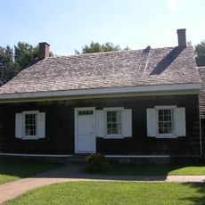
The island's workers included African Americans and European immigrants from Italy, Ireland, and Poland who built a small community while laboring in processing facilities despite the harsh industrial environment.

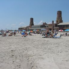
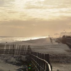
The site offers about fifty camping spots near old runway areas, including sections designed for recreational vehicles within the national recreation area. Check tide schedules if you plan to explore the shoreline and beach features.

Glass Bottle Beach reveals artifacts from the 1950s, including household items from a demolished Brooklyn neighborhood that became visible during low tide along the eroding shore. These finds offer a rare window into the daily life of a vanished community.

The community of curious travelers

AroundUs brings together thousands of curated places, local tips, and hidden gems, enriched daily by 60,000 contributors worldwide.

Start exploring
Location
Location
GPS coordinates
40.59288,-73.89319
Latest update
December 7, 2025 10:05
Around this place
Jacob Riis Park
United States of America

Jacob Riis Park

3.3 km
Wyckoff House
United States of America

Wyckoff House

6.2 km
Fort Tilden
United States of America

Fort Tilden

3.5 km
Marine Parkway-Gil Hodges Memorial Bridge
United States of America

Marine Parkway-Gil Hodges Memorial Bridge

2.3 km
Shirley Chisholm State Park
United States of America

Shirley Chisholm State Park

5.8 km
Cross Bay Veterans Memorial Bridge
United States of America

Cross Bay Veterans Memorial Bridge

6.2 km
Marine Park
United States of America

Marine Park

2.4 km
Hendrick I. Lott House
United States of America

Hendrick I. Lott House

3.9 km
Jacob Riis Park Beach 7
United States of America

Jacob Riis Park Beach 7

3.5 km
Wyckoff-Bennett Homestead
United States of America

Wyckoff-Bennett Homestead

5.3 km
Mill Basin Bridge
United States of America

Mill Basin Bridge

1.4 km
Kingsway Jewish Center
United States of America

Kingsway Jewish Center

5.1 km
Millennium Theater
United States of America

Millennium Theater

5.8 km
United States of America

Brighton Ballet Theater

3.9 km
Manhattan Beach Jewish Center
United States of America

Manhattan Beach Jewish Center

5.5 km
Flatlands Dutch Reformed Church
United States of America

Flatlands Dutch Reformed Church

5.1 km
Jewish Center of Kings Highway
United States of America

Jewish Center of Kings Highway

6 km
Joost Van Nuyse House
United States of America

Joost Van Nuyse House

5.8 km
Sheepshead Bay Houses
United States of America

Sheepshead Bay Houses

3.8 km
Stoothoff-Baxter-Kouwenhaven House
United States of America

Stoothoff-Baxter-Kouwenhaven House

4.3 km
Beth El Jewish Center of Flatbush
United States of America

Beth El Jewish Center of Flatbush

5.7 km
Sgt. Joyce Kilmer Triangle
United States of America

Sgt. Joyce Kilmer Triangle

5.9 km
Plumb Beach
United States of America

Plumb Beach

2.6 km
Rockaway Beach
United States of America

Rockaway Beach

4.3 km
Shorefront YM/YWHA
United States of America

Shorefront YM/YWHA

6 km
Fort Tilden Beach
United States of America

Fort Tilden Beach

3.7 km
Jamaica Bay Wildlife Refuge
United States of America

Jamaica Bay Wildlife Refuge

5.8 km
Canarsie Beach
United States of America

Canarsie Beach

4 km
Show the full map
Reviews
Share your experience

No review yet

Discussions
Start a discussion...

No discussion yet

« Barren Island - Former island on Jamaica Bay, Brooklyn, United States » is provided by Around Us (aroundus.com). Images and texts are derived from Wikimedia project under a Creative Commons license. You are allowed to copy, distribute, and modify copies of this page, under the conditions set by the license, as long as this note is clearly visible.

Discover hidden gems everywhere you go!

From secret cafés to breathtaking viewpoints, skip the crowded tourist spots and find places that match your style. Our app makes it easy with voice search, smart filtering, route optimization, and insider tips from travelers worldwide. Download now for the complete mobile experience.

Around Us App Screenshot

A unique approach to discovering new places

Le Figaro

All the places worth exploring

France Info

A tailor-made excursion in just a few clicks

20 Minutes

Around Us
Travel Guide & Maps
Download

Send to your phone

QR Code
1

Open the camera app on your mobile.

2

Point at the QR code with your camera. A notification will appear.

3

Tap the notification to open the link.