Enable Location

We need your location to show you interesting places around you

Discover nearby places

Find interesting locations and hidden gems around you

Precise directions

Get accurate directions and distances to places

Your location is never shared with other users. It's only used when you tap the location button.

Beaver Brook State Park

Log in to your account

Start exploring — it's free

Trusted by 61,553 travelers worldwide

Continue with Google
Continue with Apple
or

We will send you a code to connect

By continuing, you accept our Terms and Conditions and our Privacy Policy

Check your inbox

We've sent a pincode in your inbox. Please enter the code below.

Beaver Brook State Park

Beaver Brook State Park, State park in Windham County, United States.

Description

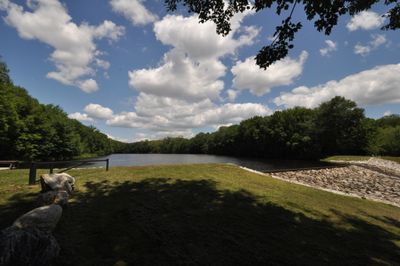
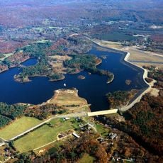
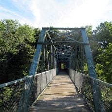
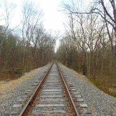
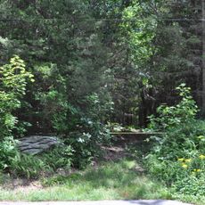
Beaver Brook State Park is a 401-acre natural area in Connecticut centered on Bibbins Pond, a 20-acre water body held back by a man-made dam. The land connects to the Air Line State Park Trail and provides wooded paths along with water access for recreational use.

History

The park was established in 1955 by Connecticut's Department of Energy and Environmental Protection as a public recreation space, funded by a bequest from George Dudley Seymour. This founding reflected the region's commitment to preserving natural areas for public use.

Culture

The undeveloped setting allows people to pursue outdoor activities like fishing and non-motorized boating on the pond in a natural environment. This connection to water-based recreation shapes how visitors experience and use the land.

Practical

The main parking area on Back Road provides ADA-accessible facilities and a seasonal boat launch for non-motorized watercraft. Visitors should check ahead about the boat launch schedule since it operates only during certain months of the year.

Did you know?

Between 1994 and 1998, Bibbins Pond held Connecticut's state record for brook trout populations. This notable fishing period left a lasting reputation that still draws people interested in trout fishing to the location.

Location
Inception
1955
GPS coordinates
41.73222,-72.12611
Latest update
December 14, 2025 09:40

AroundUs brings together thousands of curated places, local tips, and hidden gems, enriched daily by 60,000 contributors worldwide. Discover all places nearby (Windham County).

Around this place
Frog Bridge
United States of America

Frog Bridge

7.3 km
Connecticut Eastern Railroad Museum
United States of America

Connecticut Eastern Railroad Museum

9.3 km
Mansfield Hollow State Park
United States of America

Mansfield Hollow State Park

5.7 km
Willimantic Footbridge
United States of America

Willimantic Footbridge

7.6 km
Windham Textile and History Museum
United States of America

Windham Textile and History Museum

7 km
Windham Town Hall
United States of America

Windham Town Hall

7.9 km
Salt Rock State Campground
United States of America

Salt Rock State Campground

10.9 km
Mohegan State Forest
United States of America

Mohegan State Forest

11.3 km
Samuel Huntington Birthplace
United States of America

Samuel Huntington Birthplace

5 km
Windham Center Historic District
United States of America

Windham Center Historic District

4.4 km
Edward Waldo House
United States of America

Edward Waldo House

8.4 km
Mansfield Hollow Historic District
United States of America

Mansfield Hollow Historic District

5.7 km
Main Street Historic District
United States of America

Main Street Historic District

7.7 km
Spring Hill Historic District
United States of America

Spring Hill Historic District

10.6 km
Dr. Chester Hunt Office
United States of America

Dr. Chester Hunt Office

4.5 km
William Jillson Stone House
United States of America

William Jillson Stone House

7.4 km
William Park House
United States of America

William Park House

10.9 km
Witter House
United States of America

Witter House

7.1 km
Willimantic Freight House and Office
United States of America

Willimantic Freight House and Office

8.2 km
Eleazer Williams House
United States of America

Eleazer Williams House

7.2 km
Chaplin Historic District
United States of America

Chaplin Historic District

6.9 km
Hampton Hill Historic District
United States of America

Hampton Hill Historic District

8.1 km
Old Willimantic Post Office
United States of America

Old Willimantic Post Office

7.9 km
Mansfield Center Cemetery
United States of America

Mansfield Center Cemetery

6.7 km
Windham Textile & History Museum (the Mill Museum)
United States of America

Windham Textile & History Museum (the Mill Museum)

7 km
Mansfield Center Historic District
United States of America

Mansfield Center Historic District

7.8 km
Willimantic Movieplex
United States of America

Willimantic Movieplex

7.2 km
Willimantic River Railroad Bridge
United States of America

Willimantic River Railroad Bridge

9.5 km
Show the full map
« Beaver Brook State Park - State park in Windham County, United States » is provided by Around Us (aroundus.com). Images and texts are derived from Wikimedia project under a Creative Commons license. You are allowed to copy, distribute, and modify copies of this page, under the conditions set by the license, as long as this note is clearly visible.

Discover hidden gems everywhere you go!

From secret cafés to breathtaking viewpoints, skip the crowded tourist spots and find places that match your style. Our app makes it easy with voice search, smart filtering, route optimization, and insider tips from travelers worldwide. Download now for the complete mobile experience.

Around Us App Screenshot

A unique approach to discovering new places

Le Figaro

All the places worth exploring

France Info

A tailor-made excursion in just a few clicks

20 Minutes

Around Us
Travel Guide & Maps
Download

Send to your phone

QR Code
1

Open the camera app on your mobile.

2

Point at the QR code with your camera. A notification will appear.

3

Tap the notification to open the link.