Chest opened
+${chestReward.xp} XP
Explorer
NOUVEAU ×${chestReward.collectible.quantity}
tapez pour fermer
Chest locked

Open chests in the app

Around Us is built for your phone — chests unlock when you walk, explore and capture nearby places.

Enable Location

We need your location to show you interesting places around you

Discover nearby places

Find interesting locations and hidden gems around you

Precise directions

Get accurate directions and distances to places

Your location is never shared with other users. It's only used when you tap the location button.

Log in to your account

Start exploring — it's free

Trusted by 72,890 travelers worldwide

Continue with Google
Continue with Apple
or

We will send you a code to connect

By continuing, you accept our Terms and Conditions and our Privacy Policy

Check your inbox

We've sent a pincode in your inbox. Please enter the code below.

Blue Mountain
Discussion Reviews Photo
28k Popularity

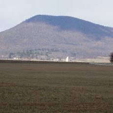
Blue Mountain, Mountain ridge in Pennsylvania, United States.

Blue Mountain is a ridge extending across Pennsylvania as part of the Appalachian system. The formation runs roughly northeast to southwest with steep slopes on one side and gentler terrain on the other, shaped by streams that have carved valleys through the rock.

The mountain served as a major crossing point between indigenous nations and later became integral to colonial expansion westward. The ridge's natural passes made it essential for early exploration and settlement of the region beyond.

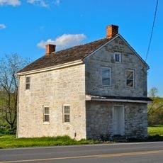
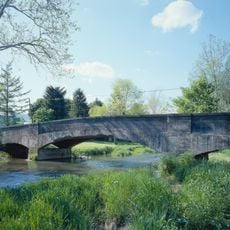
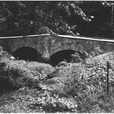
The ridgeline has long served as a travel corridor connecting communities on either side of Pennsylvania. Local residents and visitors alike follow paths that have guided people through this terrain for generations.

The ridge can be accessed from multiple points along its length, with trails ranging from easy valley walks to more demanding ridge-top hikes. Weather conditions can change quickly at elevation, so visitors should come prepared with appropriate layers and footwear.

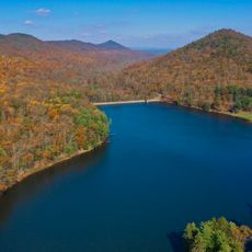
The ridge displays visible geological layering that reveals how ancient rocks were pushed upward and folded over millions of years. This makes it a natural classroom for understanding the forces that shaped North America's interior.

The community of curious travelers

AroundUs brings together thousands of curated places, local tips, and hidden gems, enriched daily by 60,000 contributors worldwide.

Start exploring
Location
GPS coordinates
40.05000,-77.74780
Latest update
December 20, 2025 13:06
Around this place
Wilson College
United States of America

Wilson College

13.9 km
Cowans Gap State Park
United States of America

Cowans Gap State Park

15.9 km
Franklin County Courthouse
United States of America

Franklin County Courthouse

14.5 km
Franklin County Jail
United States of America

Franklin County Jail

14.5 km
John Brown House
United States of America

John Brown House

14.5 km
Middle Spring Presbyterian Church
United States of America

Middle Spring Presbyterian Church

18 km
Rocky Spring Presbyterian Church
United States of America

Rocky Spring Presbyterian Church

9.2 km
Zion Reformed Church
United States of America

Zion Reformed Church

14.9 km
Capitol Theatre
United States of America

Capitol Theatre

14.8 km
Masonic Temple
United States of America

Masonic Temple

14.8 km
Chambersburg Historic District
United States of America

Chambersburg Historic District

15.4 km
Gass House
United States of America

Gass House

16.8 km
Parnell Knob
United States of America

Parnell Knob

17.7 km
Shade Gap Feed and Flour Mill
United States of America

Shade Gap Feed and Flour Mill

18.4 km
Coldbrook Farm
United States of America

Coldbrook Farm

15.6 km
James Finley House
United States of America

James Finley House

10.9 km
Carrick Furnace
United States of America

Carrick Furnace

11.5 km
Horse Valley Bridge
United States of America

Horse Valley Bridge

2 km
Mt. Pleasant Iron Works House
United States of America

Mt. Pleasant Iron Works House

16 km
Townhouse Row
United States of America

Townhouse Row

14.4 km
Burnt Cabins Gristmill Property
United States of America

Burnt Cabins Gristmill Property

12.2 km
Chambersburg and Bedford Turnpike Road Company Toll House
United States of America

Chambersburg and Bedford Turnpike Road Company Toll House

16.2 km
Bridge in Metal Township
United States of America

Bridge in Metal Township

8.3 km
Franklin Furnace Historic District
United States of America

Franklin Furnace Historic District

12 km
McClay's Twin Bridge (East)
United States of America

McClay's Twin Bridge (East)

16 km
Corker Hill
United States of America

Corker Hill

16.6 km
Culbertson-Harbison Farm
United States of America

Culbertson-Harbison Farm

10.8 km
McClay's Twin Bridge
United States of America

McClay's Twin Bridge

16 km
Show the full map
Reviews
Share your experience

No review yet

Discussions
Start a discussion...

No discussion yet

« Blue Mountain - Mountain ridge in Pennsylvania, United States » is provided by Around Us (aroundus.com). Images and texts are derived from Wikimedia project under a Creative Commons license. You are allowed to copy, distribute, and modify copies of this page, under the conditions set by the license, as long as this note is clearly visible.

Discover hidden gems everywhere you go!

From secret cafés to breathtaking viewpoints, skip the crowded tourist spots and find places that match your style. Our app makes it easy with voice search, smart filtering, route optimization, and insider tips from travelers worldwide. Download now for the complete mobile experience.

Around Us App Screenshot

A unique approach to discovering new places

Le Figaro

All the places worth exploring

France Info

A tailor-made excursion in just a few clicks

20 Minutes

Around Us
Travel Guide & Maps
Download

Send to your phone

QR Code
1

Open the camera app on your mobile.

2

Point at the QR code with your camera. A notification will appear.

3

Tap the notification to open the link.