Chest opened
+${chestReward.xp} XP
Explorer
NOUVEAU ×${chestReward.collectible.quantity}
tapez pour fermer
Chest locked

Open chests in the app

Around Us is built for your phone — chests unlock when you walk, explore and capture nearby places.

Enable Location

We need your location to show you interesting places around you

Discover nearby places

Find interesting locations and hidden gems around you

Precise directions

Get accurate directions and distances to places

Your location is never shared with other users. It's only used when you tap the location button.

Log in to your account

Start exploring — it's free

Trusted by 72,990 travelers worldwide

Continue with Google
Continue with Apple
or

We will send you a code to connect

By continuing, you accept our Terms and Conditions and our Privacy Policy

Check your inbox

We've sent a pincode in your inbox. Please enter the code below.

Bloodsworth Island
Discussion Reviews Photo
13.4k Popularity

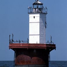
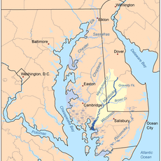
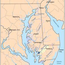
Bloodsworth Island, Military island in Chesapeake Bay, Maryland, US

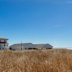
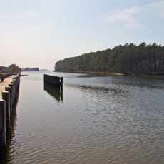
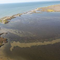
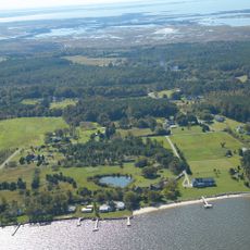
Bloodsworth Island is a barrier island in southern Dorchester County, Maryland, characterized by coastal wetlands and salt marshes that extend across its landscape. These habitats support diverse populations of waterfowl and other bird species within the wider Chesapeake Bay ecosystem.

The U.S. Navy transformed this location into a bombing and artillery range starting in 1942, maintaining military operations there for over five decades. The practice range was deactivated in the mid-1990s after serving its strategic purpose.

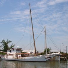
Archaeological investigations on the northern section reveal settlements connected to nineteenth-century families involved in the Chesapeake Bay oystering industry.

The island is closed to public visitation because unexploded ordnance from former military use remains a safety concern. Bird watchers and researchers observe the location from boats or the mainland at safe distances.

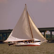
The location now serves as a key waypoint for migratory birds traveling along the Atlantic Flyway, making it one of the most important rest stops for waterfowl on the eastern coast. This ecological importance was not fully understood until decades after military operations ended.

The community of curious travelers

AroundUs brings together thousands of curated places, local tips, and hidden gems, enriched daily by 60,000 contributors worldwide.

Start exploring
Location
GPS coordinates
38.17670,-76.05220
Latest update
December 7, 2025 20:40
Around this place
Point Lookout State Park
United States of America

Point Lookout State Park

27.7 km
Blackwater National Wildlife Refuge
United States of America

Blackwater National Wildlife Refuge

26.7 km
Janes Island State Park
United States of America

Janes Island State Park

24.7 km
Holland Island Bar Light
United States of America

Holland Island Bar Light

12.6 km
Point No Point Light
United States of America

Point No Point Light

21.5 km
Glenn Martin National Wildlife Refuge
United States of America

Glenn Martin National Wildlife Refuge

17.8 km
Hooper Island Light
United States of America

Hooper Island Light

19.4 km
Hooper Strait Light
United States of America

Hooper Strait Light

5.9 km
Solomons Lump Light
United States of America

Solomons Lump Light

14.7 km
Deal Island Wildlife Management Area
United States of America

Deal Island Wildlife Management Area

16.1 km
Yellow Brick House
United States of America

Yellow Brick House

23.2 km
Ida May
United States of America

Ida May

9.2 km
Fannie L. Daugherty
United States of America

Fannie L. Daugherty

10.6 km
Waterloo
United States of America

Waterloo

26.8 km
Somers Cove Light
United States of America

Somers Cove Light

28 km
Manokin Historic District
United States of America

Manokin Historic District

23.1 km
Long Hill
United States of America

Long Hill

25.2 km
All Saints Church at Monie
United States of America

All Saints Church at Monie

25.2 km
Thomas W. Clyde
United States of America

Thomas W. Clyde

10.6 km
Sharkfin Shoal Light
United States of America

Sharkfin Shoal Light

6.4 km
Whitehaven Historic District
United States of America

Whitehaven Historic District

25 km
St. Peter's Methodist Episcopal Church
United States of America

St. Peter's Methodist Episcopal Church

27 km
Great Shoals Light
United States of America

Great Shoals Light

15.7 km
Sudler's Conclusion
United States of America

Sudler's Conclusion

24.9 km
Beaudley
United States of America

Beaudley

21.3 km
Upper Fairmount Historic District
United States of America

Upper Fairmount Historic District

23.4 km
Cullen Homestead Historic District
United States of America

Cullen Homestead Historic District

27.8 km
Hughes A.M.E. Chapel
United States of America

Hughes A.M.E. Chapel

18.2 km
Show the full map
Reviews
Share your experience

No review yet

Discussions
Start a discussion...

No discussion yet

« Bloodsworth Island - Military island in Chesapeake Bay, Maryland, US » is provided by Around Us (aroundus.com). Images and texts are derived from Wikimedia project under a Creative Commons license. You are allowed to copy, distribute, and modify copies of this page, under the conditions set by the license, as long as this note is clearly visible.

Discover hidden gems everywhere you go!

From secret cafés to breathtaking viewpoints, skip the crowded tourist spots and find places that match your style. Our app makes it easy with voice search, smart filtering, route optimization, and insider tips from travelers worldwide. Download now for the complete mobile experience.

Around Us App Screenshot

A unique approach to discovering new places

Le Figaro

All the places worth exploring

France Info

A tailor-made excursion in just a few clicks

20 Minutes

Around Us
Travel Guide & Maps
Download

Send to your phone

QR Code
1

Open the camera app on your mobile.

2

Point at the QR code with your camera. A notification will appear.

3

Tap the notification to open the link.