Chest opened
+${chestReward.xp} XP
Explorer
NOUVEAU ×${chestReward.collectible.quantity}
tapez pour fermer
Chest locked

Open chests in the app

Around Us is built for your phone — chests unlock when you walk, explore and capture nearby places.

Enable Location

We need your location to show you interesting places around you

Discover nearby places

Find interesting locations and hidden gems around you

Precise directions

Get accurate directions and distances to places

Your location is never shared with other users. It's only used when you tap the location button.

Log in to your account

Start exploring — it's free

Trusted by 72,885 travelers worldwide

Continue with Google
Continue with Apple
or

We will send you a code to connect

By continuing, you accept our Terms and Conditions and our Privacy Policy

Check your inbox

We've sent a pincode in your inbox. Please enter the code below.

Bronx River Road
Discussion Reviews Photo
1.5k Popularity

Bronx River Road, Residential thoroughfare in Yonkers, United States.

Bronx River Road is a street in Yonkers that runs alongside the Bronx River and Metro-North railroad tracks. It connects McLean Avenue to Midland Avenue at Cross County Parkway.

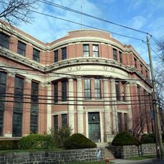
The street was substantially modified in the early 1900s to accommodate increased car traffic and improve connections between neighboring communities. These improvements made it a major passage route for the region.

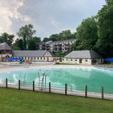
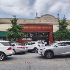
The street runs through a neighborhood filled with apartment buildings and small shops serving the diverse residents of the area. People use these local businesses for daily needs and gather along its commercial sections.

The street offers good access to public transportation with multiple Metro-North stations and bus lines connecting to New York City. Pedestrians should expect some uneven sidewalks and be aware of the proximity to railroad tracks.

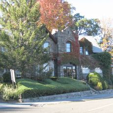
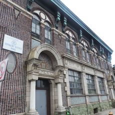
Wakefield Towers building suffered a major fire in 2003, which led to extensive renovation work that restored historic architectural features like turrets and minarets by 2007. This restoration stands as one of the area's most significant rebuilding projects.

The community of curious travelers

AroundUs brings together thousands of curated places, local tips, and hidden gems, enriched daily by 60,000 contributors worldwide.

Start exploring
Location
GPS coordinates
40.91460,-73.85030
Latest update
December 14, 2025 15:01
Around this place
Woodlawn Cemetery
United States of America

Woodlawn Cemetery

3.4 km
Van Cortlandt Park
United States of America

Van Cortlandt Park

3.4 km
Tibbetts Brook Park
United States of America

Tibbetts Brook Park

2.6 km
United States of America

Croton Water Filtration Plant

4 km
Pelhamdale
United States of America

Pelhamdale

3.3 km
Admiral David Glasgow Farragut Gravesite
United States of America

Admiral David Glasgow Farragut Gravesite

3.4 km
United States Post Office
United States of America

United States Post Office

3.1 km
Plashbourne Estate
United States of America

Plashbourne Estate

3 km
John Stevens House
United States of America

John Stevens House

1.7 km
Public Bath House No. 3
United States of America

Public Bath House No. 3

4 km
Marble Schoolhouse
United States of America

Marble Schoolhouse

3.8 km
Trinity Episcopal Church Complex
United States of America

Trinity Episcopal Church Complex

1.9 km
Public School No. 13
United States of America

Public School No. 13

3.4 km
Lincoln Park Jewish Center
United States of America

Lincoln Park Jewish Center

1.9 km
Pelham Picture House
United States of America

Pelham Picture House

3.3 km
Lisanti Chapel
United States of America

Lisanti Chapel

4 km
Edgewood House
United States of America

Edgewood House

3.4 km
Metropolitan Life Insurance Company Hall of Records
United States of America

Metropolitan Life Insurance Company Hall of Records

3.1 km
Public Bath House No. 4
United States of America

Public Bath House No. 4

4 km
Public School 15
United States of America

Public School 15

3.1 km
Eleazer Hart House
United States of America

Eleazer Hart House

3.1 km
Willson's Waves
United States of America

Willson's Waves

2.9 km
Gould family mausoleum
United States of America

Gould family mausoleum

3.1 km
Cerkiew Trójcy Świętej w Yonkers
United States of America

Cerkiew Trójcy Świętej w Yonkers

3.7 km
St. Paul's Church National Historic Site
United States of America

St. Paul's Church National Historic Site

3.2 km
Masterton-Dusenberry House
United States of America

Masterton-Dusenberry House

3.7 km
Bow-Tie Bronxville Cinemas
United States of America

Bow-Tie Bronxville Cinemas

3.2 km
Edenwald Library
United States of America

Edenwald Library

3 km
Show the full map
Reviews
Share your experience

No review yet

Discussions
Start a discussion...

No discussion yet

« Bronx River Road - Residential thoroughfare in Yonkers, United States » is provided by Around Us (aroundus.com). Images and texts are derived from Wikimedia project under a Creative Commons license. You are allowed to copy, distribute, and modify copies of this page, under the conditions set by the license, as long as this note is clearly visible.

Discover hidden gems everywhere you go!

From secret cafés to breathtaking viewpoints, skip the crowded tourist spots and find places that match your style. Our app makes it easy with voice search, smart filtering, route optimization, and insider tips from travelers worldwide. Download now for the complete mobile experience.

Around Us App Screenshot

A unique approach to discovering new places

Le Figaro

All the places worth exploring

France Info

A tailor-made excursion in just a few clicks

20 Minutes

Around Us
Travel Guide & Maps
Download

Send to your phone

QR Code
1

Open the camera app on your mobile.

2

Point at the QR code with your camera. A notification will appear.

3

Tap the notification to open the link.