Enable Location

We need your location to show you interesting places around you

Discover nearby places

Find interesting locations and hidden gems around you

Precise directions

Get accurate directions and distances to places

Your location is never shared with other users. It's only used when you tap the location button.

Cherryfield Historic District

Log in to your account

Start exploring — it's free

Trusted by 62,378 travelers worldwide

Continue with Google
Continue with Apple
or

We will send you a code to connect

By continuing, you accept our Terms and Conditions and our Privacy Policy

Check your inbox

We've sent a pincode in your inbox. Please enter the code below.

Cherryfield Historic District, historic district in Cherryfield, Maine

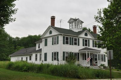
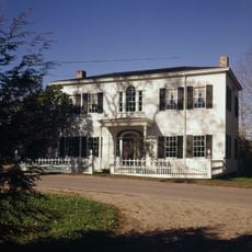
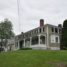
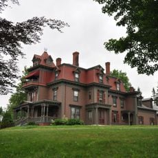
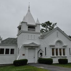
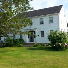
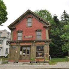
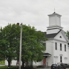
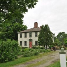
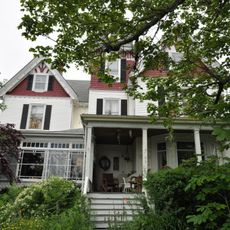
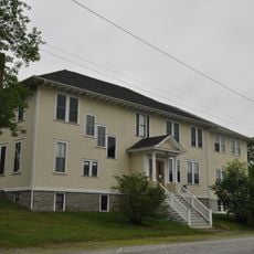
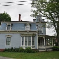
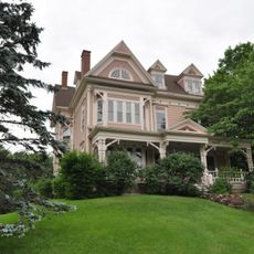
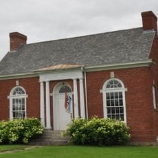
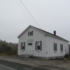
Cherryfield Historic District is a neighborhood in Cherryfield, United States, covering about 75 acres along the Narraguagus River and containing over 50 buildings dating from around 1790 to 1947. The architecture ranges from early Federal styles through Greek Revival to Second Empire and Queen Anne, reflecting the town's development across different historical periods.

The district began its development around 1790 with the General Alexander Campbell House and became a center for lumber trade and shipping during the 1800s. Its listing on the National Register of Historic Places in 1990 helped protect the buildings and preserve the town's history for future generations.

The district reflects how Cherryfield has maintained its identity through preserved buildings that residents still inhabit and use today. Walking through, you notice how locals have kept the structures intact, creating a living community rather than a frozen museum.

The district is easy to walk through, with flat terrain and wide streets that are continuously accessible. Informational plaques on key buildings provide short stories and guide you to notable sites, making exploration straightforward.

The district holds a notably high concentration of Second Empire homes, an architectural style rarely found in small American towns. These houses with their characteristic tall windows and decorative features show how prosperous residents brought European influences into their local surroundings.

The community of curious travelers

AroundUs brings together thousands of curated places, local tips, and hidden gems, enriched daily by 60,000 contributors worldwide.

Start exploring
Location
GPS coordinates
44.59833,-67.92556
Latest update
February 9, 2026 07:40
Around this place
Naval Group Support Activity, Winter Harbor
United States of America

Naval Group Support Activity, Winter Harbor

30.9 km
Petit Manan Light
United States of America

Petit Manan Light

26.1 km
Petit Manan National Wildlife Refuge
United States of America

Petit Manan National Wildlife Refuge

18.2 km
Prospect Harbor Point Light
United States of America

Prospect Harbor Point Light

22.8 km
Ruggles House
United States of America

Ruggles House

16.6 km
Crabtree Ledge Light
United States of America

Crabtree Ledge Light

27.3 km
Narraguagus Light
United States of America

Narraguagus Light

17.5 km
Nash Island Light
United States of America

Nash Island Light

20.6 km
Gen. Alexander Campbell House
United States of America

Gen. Alexander Campbell House

310 m
William M. Nash House
United States of America

William M. Nash House

331 m
Great Wass Island Preserve
United States of America

Great Wass Island Preserve

30.8 km
Robertson Quarry Galamander
United States of America

Robertson Quarry Galamander

26.9 km
Windswept
United States of America

Windswept

20.1 km
Jonesboro Union Church
United States of America

Jonesboro Union Church

28.6 km
United States of America

Union Church

16.7 km
Columbia House
United States of America

Columbia House

16.8 km
David W. Campbell House
United States of America

David W. Campbell House

384 m
Patten Building
United States of America

Patten Building

44 m
Cherryfield Academy
United States of America

Cherryfield Academy

377 m
Archibald-Adams House
United States of America

Archibald-Adams House

841 m
Everett Wallace House
United States of America

Everett Wallace House

8.1 km
Henry D. Moore Parish House and Library
United States of America

Henry D. Moore Parish House and Library

10.2 km
Frank Campbell House
United States of America

Frank Campbell House

208 m
Col. Samuel Campbell House
United States of America

Col. Samuel Campbell House

308 m
West Gouldsboro Village Library
United States of America

West Gouldsboro Village Library

20 km
Gallison Memorial Library
United States of America

Gallison Memorial Library

9.3 km
Jonesboro Grange No. 357
United States of America

Jonesboro Grange No. 357

28.9 km
National Wreaths Across America Headquarters
United States of America

National Wreaths Across America Headquarters

16.6 km
Show the full map
« Cherryfield Historic District - historic district in Cherryfield, Maine » is provided by Around Us (aroundus.com). Images and texts are derived from Wikimedia project under a Creative Commons license. You are allowed to copy, distribute, and modify copies of this page, under the conditions set by the license, as long as this note is clearly visible.

Discover hidden gems everywhere you go!

From secret cafés to breathtaking viewpoints, skip the crowded tourist spots and find places that match your style. Our app makes it easy with voice search, smart filtering, route optimization, and insider tips from travelers worldwide. Download now for the complete mobile experience.

Around Us App Screenshot

A unique approach to discovering new places

Le Figaro

All the places worth exploring

France Info

A tailor-made excursion in just a few clicks

20 Minutes

Around Us
Travel Guide & Maps
Download

Send to your phone

QR Code
1

Open the camera app on your mobile.

2

Point at the QR code with your camera. A notification will appear.

3

Tap the notification to open the link.