Chest opened
+${chestReward.xp} XP
Explorer
NOUVEAU ×${chestReward.collectible.quantity}
tapez pour fermer

See the monuments around you in AR Open chests in the app

Around Us is built for your phone — point your camera at the streets and discover the monuments and places around you in augmented reality. Around Us is built for your phone — chests unlock when you walk, explore and capture nearby places.

Enable Location

We need your location to show you interesting places around you

Discover nearby places

Find interesting locations and hidden gems around you

Precise directions

Get accurate directions and distances to places

Your location is never shared with other users. It's only used when you tap the location button.

Narraguagus Light

Log in to your account

Start exploring — it's free

Trusted by 85,129 travelers worldwide

Continue with Google
Continue with Apple
or

We will send you a code to connect

By continuing, you accept our Terms and Conditions and our Privacy Policy

Check your inbox

We've sent a pincode in your inbox. Please enter the code below.

Discussion Reviews 1 Photos
1.2k Popularity

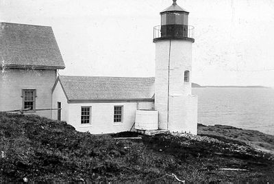
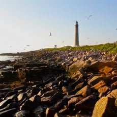
Narraguagus Light, Maritime lighthouse on Pond Island, Maine, United States.

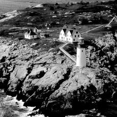
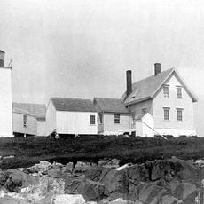
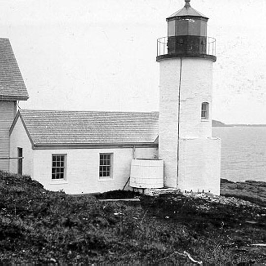
Narraguagus Light is a circular brick tower standing 9.5 meters high on an island off the Maine coast. The tower connects to an L-shaped workroom and the keeper's residence, forming a complete working station on the isolated site.

The tower was built in 1853 to guide ships toward Milbridge's deep-water shipbuilding port. It operated until 1934 when it was deactivated, ending over 80 years of service to maritime traffic.

The lighthouse keeper and his family lived isolated on the island, managing daily life far from town with supplies brought by boat. The station buildings show how lighthouse families adapted to their remote setting.

The site sits on an island accessible only by boat, so check access conditions and weather before planning a visit. The best time to go is during calm weather when boat transportation to the island is reliable.

The station used a wooden cistern system built in 1881 that collected rainwater from the station roofs to supply the island. This water storage method was essential for survival on the isolated site surrounded by seawater.

The community of curious travelers

AroundUs brings together thousands of curated places, local tips, and hidden gems, enriched daily by 60,000 contributors worldwide.
Start exploring
Inception
1853
Height
9.5 m
GPS coordinates
44.45597,-67.83121
Latest update
August 30, 2026 23:27
Around this place
Naval Group Support Activity, Winter Harbor
United States of America

Naval Group Support Activity, Winter Harbor

14 mi
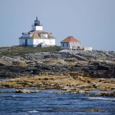
Egg Rock Light
United States of America

Egg Rock Light

16.7 mi
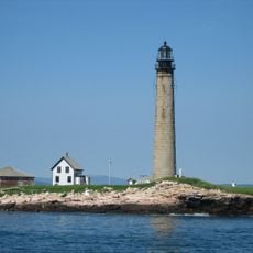
Petit Manan Light
United States of America

Petit Manan Light

6.3 mi
Highseas
United States of America

Highseas

18.7 mi
Petit Manan National Wildlife Refuge
United States of America

Petit Manan National Wildlife Refuge

3.6 mi
Moose Peak Light Shalen’s New Home
United States of America

Moose Peak Light Shalen’s New Home

14.8 mi
Prospect Harbor Point Light
United States of America

Prospect Harbor Point Light

9.7 mi
Ruggles House
United States of America

Ruggles House

14.5 mi
Nash Island Light
United States of America

Nash Island Light

4.2 mi
Cherryfield Historic District
United States of America

Cherryfield Historic District

10.9 mi
Gen. Alexander Campbell House
United States of America

Gen. Alexander Campbell House

10.8 mi
William M. Nash House
United States of America

William M. Nash House

11.1 mi
Great Wass Island Preserve
United States of America

Great Wass Island Preserve

12.5 mi
Windswept
United States of America

Windswept

4.8 mi
United States of America

Union Church

14.5 mi
Columbia House
United States of America

Columbia House

14.6 mi
David W. Campbell House
United States of America

David W. Campbell House

11 mi
Patten Building
United States of America

Patten Building

10.9 mi
Cherryfield Academy
United States of America

Cherryfield Academy

11.1 mi
Archibald-Adams House
United States of America

Archibald-Adams House

11.4 mi
Everett Wallace House
United States of America

Everett Wallace House

5.9 mi
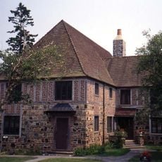
Henry D. Moore Parish House and Library
United States of America

Henry D. Moore Parish House and Library

7.5 mi
Frank Campbell House
United States of America

Frank Campbell House

10.8 mi
Col. Samuel Campbell House
United States of America

Col. Samuel Campbell House

10.8 mi
West Gouldsboro Village Library
United States of America

West Gouldsboro Village Library

13 mi
Gallison Memorial Library
United States of America

Gallison Memorial Library

11.3 mi
Rockefeller Hall
United States of America

Rockefeller Hall

14 mi
National Wreaths Across America Headquarters
United States of America

National Wreaths Across America Headquarters

14.4 mi
Show the full map
Reviews
Share your experience

No review yet

Discussions
Start a discussion...

No discussion yet

« Narraguagus Light - Maritime lighthouse on Pond Island, Maine, United States » is provided by Around Us (aroundus.com). Images and texts are derived from Wikimedia project under a Creative Commons license. You are allowed to copy, distribute, and modify copies of this page, under the conditions set by the license, as long as this note is clearly visible.

Discover hidden gems everywhere you go!

From secret cafés to breathtaking viewpoints, skip the crowded tourist spots and find places that match your style. Our app makes it easy with voice search, smart filtering, route optimization, and insider tips from travelers worldwide. Download now for the complete mobile experience.
Around Us App Screenshot

A unique approach to discovering new places

Le Figaro

All the places worth exploring

France Info

A tailor-made excursion in just a few clicks

20 Minutes

Around Us
Travel Guide & Maps
Download

Send to your phone

QR Code
1

Open the camera app on your mobile.

2

Point at the QR code with your camera. A notification will appear.

3

Tap the notification to open the link.