Enable Location

We need your location to show you interesting places around you

Discover nearby places

Find interesting locations and hidden gems around you

Precise directions

Get accurate directions and distances to places

Your location is never shared with other users. It's only used when you tap the location button.

Clarks Point Light

Log in to your account

Start exploring — it's free

Trusted by 62,554 travelers worldwide

Continue with Google
Continue with Apple
or

We will send you a code to connect

By continuing, you accept our Terms and Conditions and our Privacy Policy

Check your inbox

We've sent a pincode in your inbox. Please enter the code below.

Clarks Point Light

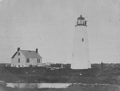
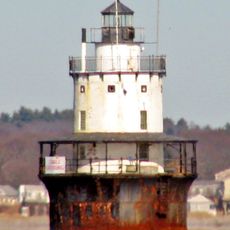
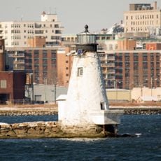
Clarks Point Light, Historic lighthouse at New Bedford Harbor, Massachusetts, US.

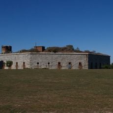
Clarks Point Light is a historic lighthouse structure located on the northern wall of Fort Taber in New Bedford Harbor. The rectangular wooden tower rises 68 feet (21 meters) above sea level and has been rebuilt multiple times throughout its existence.

The original lighthouse was built in 1797 with funding from local merchants, but it burned down within a year and required multiple replacements. The federal government later took over responsibility for maintaining subsequent lighthouse structures at this location.

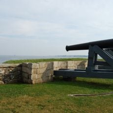
The lighthouse served as a vital guiding light for whalers departing from New Bedford on their lengthy voyages across the oceans. The harbor was one of the wealthiest ports in early America, and the beacon helped protect the ships returning from distant waters.

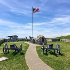
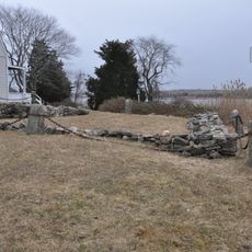
The grounds surrounding the lighthouse are open to visitors, though the tower structure itself is closed to the public for safety reasons. The best time to visit is during daylight hours when the fort and surrounding harbor area are clearly visible.

The Baker family served as lighthouse keepers here across three generations, accumulating 70 years of combined service at this maritime location. This multi-generational continuity was uncommon for lighthouse posts and made this family's dedication particularly notable in the region's maritime history.

The community of curious travelers

AroundUs brings together thousands of curated places, local tips, and hidden gems, enriched daily by 60,000 contributors worldwide.

Start exploring
GPS coordinates
41.59320,-70.90129
Latest update
December 14, 2025 18:45
Around this place
New Bedford Whaling Museum
United States of America

New Bedford Whaling Museum

5 km
Effie M. Morrissey
United States of America

Effie M. Morrissey

4.8 km
New Bedford Whaling National Historical Park
United States of America

New Bedford Whaling National Historical Park

5.1 km
Fort Rodman
United States of America

Fort Rodman

18 m
Nathan and Mary Johnson properties
United States of America

Nathan and Mary Johnson properties

5 km
Fort Phoenix
United States of America

Fort Phoenix

3.4 km
New Bedford Historic District
United States of America

New Bedford Historic District

5.1 km
Fort Phoenix State Reservation
United States of America

Fort Phoenix State Reservation

3.5 km
Butler Flats Light
United States of America

Butler Flats Light

1.3 km
Millicent Library
United States of America

Millicent Library

4.7 km
Rotch-Jones-Duff House and Garden Museum
United States of America

Rotch-Jones-Duff House and Garden Museum

4.7 km
Palmer Island Light
United States of America

Palmer Island Light

3.8 km
William J. Rotch Gothic Cottage
United States of America

William J. Rotch Gothic Cottage

4.9 km
Moreland Terrace Historic District
United States of America

Moreland Terrace Historic District

4.8 km
Hazelwood Park
United States of America

Hazelwood Park

1.8 km
Fairhaven Town Hall
United States of America

Fairhaven Town Hall

4.8 km
Howland Mill Village Historic District
United States of America

Howland Mill Village Historic District

3.7 km
County Street Historic District
United States of America

County Street Historic District

5 km
New Bedford Gas and Edison Light Complex
United States of America

New Bedford Gas and Edison Light Complex

4.4 km
Merrill's Wharf Historic District
United States of America

Merrill's Wharf Historic District

4.7 km
New Bedford Marine Commerce Terminal
United States of America

New Bedford Marine Commerce Terminal

3.6 km
Russell Garrison
United States of America

Russell Garrison

4.7 km
Robert C. Ingraham School
United States of America

Robert C. Ingraham School

3.5 km
Thomas Donaghy School
United States of America

Thomas Donaghy School

4.1 km
Thompson Street School
United States of America

Thompson Street School

3.8 km
Ezekiel Sawin House
United States of America

Ezekiel Sawin House

4.9 km
South End Beach Compass
United States of America

South End Beach Compass

1.2 km
Zeiterion Theatre
United States of America

Zeiterion Theatre

4.9 km
Show the full map
« Clarks Point Light - Historic lighthouse at New Bedford Harbor, Massachusetts, US » is provided by Around Us (aroundus.com). Images and texts are derived from Wikimedia project under a Creative Commons license. You are allowed to copy, distribute, and modify copies of this page, under the conditions set by the license, as long as this note is clearly visible.

Discover hidden gems everywhere you go!

From secret cafés to breathtaking viewpoints, skip the crowded tourist spots and find places that match your style. Our app makes it easy with voice search, smart filtering, route optimization, and insider tips from travelers worldwide. Download now for the complete mobile experience.

Around Us App Screenshot

A unique approach to discovering new places

Le Figaro

All the places worth exploring

France Info

A tailor-made excursion in just a few clicks

20 Minutes

Around Us
Travel Guide & Maps
Download

Send to your phone

QR Code
1

Open the camera app on your mobile.

2

Point at the QR code with your camera. A notification will appear.

3

Tap the notification to open the link.