Enable Location

We need your location to show you interesting places around you

Discover nearby places

Find interesting locations and hidden gems around you

Precise directions

Get accurate directions and distances to places

Your location is never shared with other users. It's only used when you tap the location button.

Codorus State Park

Log in to your account

Start exploring — it's free

Trusted by 62,376 travelers worldwide

Continue with Google
Continue with Apple
or

We will send you a code to connect

By continuing, you accept our Terms and Conditions and our Privacy Policy

Check your inbox

We've sent a pincode in your inbox. Please enter the code below.

Codorus State Park, State park in York County, Pennsylvania, US.

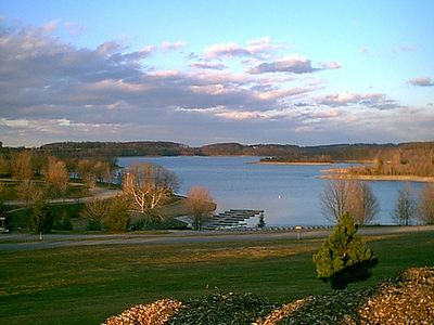
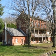
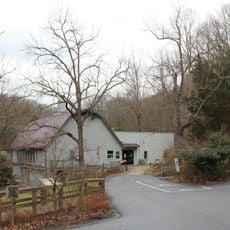
Codorus State Park is a protected area in York County, Pennsylvania, built around a large lake that connects wooded hills with open shoreline zones. The grounds divide into several use areas with marked trails, grassy clearings, and docking points for boats.

The area took shape in the late sixties when the state government acquired land and created the reservoir. The official opening followed shortly after, making the grounds permanently available for recreation.

The name comes from Codorus Creek, which flows through the area and shaped the landscape long before the park opened. Visitors often see anglers along the shore and families gathering at designated swimming areas.

The paths are mostly paved or well maintained, though some shoreline sections remain uneven and require sturdy footwear. Arriving early helps secure parking near swimming areas and boat launches.

Parts of the shoreline lie far enough from main access points that quiet spots for picnicking remain even on summer weekends. The shallow coves warm earlier in the year than deeper waters elsewhere in the region.

The community of curious travelers

AroundUs brings together thousands of curated places, local tips, and hidden gems, enriched daily by 60,000 contributors worldwide.

Start exploring
Location
Inception
1970
Operator
Pennsylvania Bureau of State Parks
GPS coordinates
39.77000,-76.93670
Latest update
December 5, 2025 22:31
Around this place
Whittaker Chambers Farm
United States of America

Whittaker Chambers Farm

12.7 km
Bear Branch Nature Center
United States of America

Bear Branch Nature Center

14.7 km
George Nace House
United States of America

George Nace House

5.4 km
John Abbott House
United States of America

John Abbott House

13.6 km
Hanover Historic District
United States of America

Hanover Historic District

5.7 km
East Berlin Historic District
United States of America

East Berlin Historic District

19.1 km
Charlotte's Quest Nature Center
United States of America

Charlotte's Quest Nature Center

12.6 km
Hampstead School
United States of America

Hampstead School

19.5 km
Eichelberger High School
United States of America

Eichelberger High School

5.8 km
South Road Bridge, Northern Central Railway
United States of America

South Road Bridge, Northern Central Railway

16.1 km
Bridge 634, Northern Central Railway
United States of America

Bridge 634, Northern Central Railway

18.5 km
Christopher Erb House
United States of America

Christopher Erb House

17.3 km
United States Post Office
United States of America

United States Post Office

5.3 km
Bridge 5+92, Northern Central Railway
United States of America

Bridge 5+92, Northern Central Railway

16.9 km
John's Burnt Mill Bridge
United States of America

John's Burnt Mill Bridge

14.1 km
Stone Arch Road Bridge, Stewartstown Railroad
United States of America

Stone Arch Road Bridge, Stewartstown Railroad

21.5 km
Slagle-Byers House
United States of America

Slagle-Byers House

17.3 km
Philip and Uriah Arter Farm
United States of America

Philip and Uriah Arter Farm

13 km
United States of America

Solomon Arter House

10.4 km
Spring Grove Borough Historic District
United States of America

Spring Grove Borough Historic District

13.1 km
S. B. Brodbeck Housing
United States of America

S. B. Brodbeck Housing

9.3 km
Jacob F. Shaffer Farm
United States of America

Jacob F. Shaffer Farm

12 km
Fissel's School
United States of America

Fissel's School

17.4 km
Samuel Stoner Homestead
United States of America

Samuel Stoner Homestead

22.6 km
John Orendorff Farm
United States of America

John Orendorff Farm

17.5 km
Swigart's Mill
United States of America

Swigart's Mill

18.6 km
Railroad Borough Historic District
United States of America

Railroad Borough Historic District

20.4 km
Nixon County Park
United States of America

Nixon County Park

21.5 km
Show the full map
« Codorus State Park - State park in York County, Pennsylvania, US » is provided by Around Us (aroundus.com). Images and texts are derived from Wikimedia project under a Creative Commons license. You are allowed to copy, distribute, and modify copies of this page, under the conditions set by the license, as long as this note is clearly visible.

Discover hidden gems everywhere you go!

From secret cafés to breathtaking viewpoints, skip the crowded tourist spots and find places that match your style. Our app makes it easy with voice search, smart filtering, route optimization, and insider tips from travelers worldwide. Download now for the complete mobile experience.

Around Us App Screenshot

A unique approach to discovering new places

Le Figaro

All the places worth exploring

France Info

A tailor-made excursion in just a few clicks

20 Minutes

Around Us
Travel Guide & Maps
Download

Send to your phone

QR Code
1

Open the camera app on your mobile.

2

Point at the QR code with your camera. A notification will appear.

3

Tap the notification to open the link.