Enable Location

We need your location to show you interesting places around you

Discover nearby places

Find interesting locations and hidden gems around you

Precise directions

Get accurate directions and distances to places

Your location is never shared with other users. It's only used when you tap the location button.

Community Field

Log in to your account

Start exploring — it's free

Trusted by 62,169 travelers worldwide

Continue with Google
Continue with Apple
or

We will send you a code to connect

By continuing, you accept our Terms and Conditions and our Privacy Policy

Check your inbox

We've sent a pincode in your inbox. Please enter the code below.

Community Field

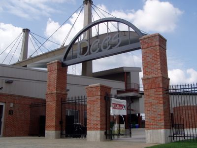
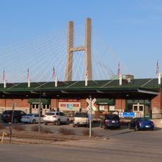
Community Field, Baseball stadium in Burlington, Iowa, United States.

Community Field is a baseball stadium in Burlington with a playing field designed for professional games. The facility includes covered spectator areas, a press box, and modern lighting that illuminates the field for evening events.

The stadium opened in 1947 as home to the Burlington Indians, a minor league team affiliated with Cleveland. A major fire destroyed the grandstand in 1971, but temporary seating allowed games to resume immediately.

The Friends of Community Field organization raises funds through local initiatives and events to maintain and enhance the stadium facilities for the community.

The venue is easy to reach with nearby parking for visitors attending games. It helps to arrive early during game season to find good seating or check ahead for any special arrangements.

After a fire destroyed the grandstand in 1971, managers quickly erected temporary bleachers so the season could continue without cancellations. Local fans still remember this swift decision as a sign of the community's determination to keep baseball alive.

The community of curious travelers

AroundUs brings together thousands of curated places, local tips, and hidden gems, enriched daily by 60,000 contributors worldwide.

Start exploring
Location
Inception
May 11, 1947
Official opening
May 11, 1947
Capacity
3200
GPS coordinates
40.82760,-91.13690
Latest update
December 12, 2025 07:56
Around this place
Great River Bridge
United States of America

Great River Bridge

3.9 km
Burlington Rail Bridge
United States of America

Burlington Rail Bridge

5 km
Lock and Dam No. 18
United States of America

Lock and Dam No. 18

11.2 km
Crapo Park
United States of America

Crapo Park

6.5 km
St. Paul's Catholic Church
United States of America

St. Paul's Catholic Church

3.4 km
First Congregational Church
United States of America

First Congregational Church

3.4 km
Capitol Theater
United States of America

Capitol Theater

3.5 km
German Methodist Episcopal Church
United States of America

German Methodist Episcopal Church

3.1 km
Cascade Bridge
United States of America

Cascade Bridge

6.1 km
Des Moines County Court House
United States of America

Des Moines County Court House

3.5 km
Burlington Public Library
United States of America

Burlington Public Library

3.3 km
Oquawka Wagon Bridge
United States of America

Oquawka Wagon Bridge

17.5 km
South Henderson Church
United States of America

South Henderson Church

19.5 km
Heritage Hill Historic District
United States of America

Heritage Hill Historic District

3.2 km
Christ Episcopal Church
United States of America

Christ Episcopal Church

3.1 km
Snake Alley Historic District
United States of America

Snake Alley Historic District

3.1 km
Downtown Commercial Historic District
United States of America

Downtown Commercial Historic District

3.5 km
Augustus Caesar Dodge House
United States of America

Augustus Caesar Dodge House

3.1 km
Baptist Church
United States of America

Baptist Church

15.5 km
Henderson County Courthouse
United States of America

Henderson County Courthouse

19.6 km
Mary Darwin House
United States of America

Mary Darwin House

3.5 km
West Jefferson Street Historic District
United States of America

West Jefferson Street Historic District

3.2 km
Jagger-Churchill House
United States of America

Jagger-Churchill House

3.4 km
James M. Forney House
United States of America

James M. Forney House

4.1 km
Starker–Leopold Historic District
United States of America

Starker–Leopold Historic District

5 km
Abiathar and Nancy White House
United States of America

Abiathar and Nancy White House

3.4 km
Burlington Rail Bridge (1893)
United States of America

Burlington Rail Bridge (1893)

5 km
Burlington Rail Bridge (1867)
United States of America

Burlington Rail Bridge (1867)

5 km
Show the full map
« Community Field - Baseball stadium in Burlington, Iowa, United States » is provided by Around Us (aroundus.com). Images and texts are derived from Wikimedia project under a Creative Commons license. You are allowed to copy, distribute, and modify copies of this page, under the conditions set by the license, as long as this note is clearly visible.

Discover hidden gems everywhere you go!

From secret cafés to breathtaking viewpoints, skip the crowded tourist spots and find places that match your style. Our app makes it easy with voice search, smart filtering, route optimization, and insider tips from travelers worldwide. Download now for the complete mobile experience.

Around Us App Screenshot

A unique approach to discovering new places

Le Figaro

All the places worth exploring

France Info

A tailor-made excursion in just a few clicks

20 Minutes

Around Us
Travel Guide & Maps
Download

Send to your phone

QR Code
1

Open the camera app on your mobile.

2

Point at the QR code with your camera. A notification will appear.

3

Tap the notification to open the link.