Enable Location

We need your location to show you interesting places around you

Discover nearby places

Find interesting locations and hidden gems around you

Precise directions

Get accurate directions and distances to places

Your location is never shared with other users. It's only used when you tap the location button.

Crapo Park

Log in to your account

Start exploring — it's free

Trusted by 61,996 travelers worldwide

Continue with Google
Continue with Apple
or

We will send you a code to connect

By continuing, you accept our Terms and Conditions and our Privacy Policy

Check your inbox

We've sent a pincode in your inbox. Please enter the code below.

Crapo Park, Historic park and arboretum in Burlington, United States

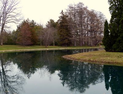
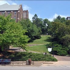
Crapo Park is an 85-acre green space along the Mississippi River featuring over 200 tree varieties, botanical gardens, and multiple walking trails. Lake Starker sits within the grounds, offering additional recreational opportunities for visitors.

In 1805, Lieutenant Zebulon Pike raised the first American flag on Iowa soil at this location during his exploration of the Louisiana Purchase territory. This moment marked an early phase of American expansion westward into newly acquired lands.

The Band Shell brings community life to the park with free Municipal Band performances running from June through August, creating outdoor social gatherings with river views. These shows have become a local tradition for residents seeking evening entertainment.

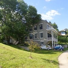
The grounds feature four shelter houses available for picnics and gatherings, with pathways suitable for walking throughout the year. Spring through fall offers the most comfortable conditions for exploring the trees and gardens.

Black Hawk Spring features a rock tube passage extending over 100 feet (30 m) beneath the grounds, named after the Native American leader. Few visitors realize this underground tunnel exists on the property.

The community of curious travelers

AroundUs brings together thousands of curated places, local tips, and hidden gems, enriched daily by 60,000 contributors worldwide.

Start exploring
Location
Elevation above the sea
210 m
GPS coordinates
40.77583,-91.10194
Latest update
December 12, 2025 16:42
Around this place
Great River Bridge
United States of America

Great River Bridge

4.1 km
Community Field
United States of America

Community Field

6.5 km
Burlington Rail Bridge
United States of America

Burlington Rail Bridge

2.7 km
Lock and Dam No. 18
United States of America

Lock and Dam No. 18

13.5 km
St. Paul's Catholic Church
United States of America

St. Paul's Catholic Church

4 km
First Congregational Church
United States of America

First Congregational Church

3.9 km
Capitol Theater
United States of America

Capitol Theater

3.7 km
German Methodist Episcopal Church
United States of America

German Methodist Episcopal Church

4 km
Cascade Bridge
United States of America

Cascade Bridge

662 m
Des Moines County Court House
United States of America

Des Moines County Court House

4 km
Burlington Public Library
United States of America

Burlington Public Library

4.1 km
Oquawka Wagon Bridge
United States of America

Oquawka Wagon Bridge

18.4 km
South Henderson Church
United States of America

South Henderson Church

19.2 km
Heritage Hill Historic District
United States of America

Heritage Hill Historic District

4.1 km
Christ Episcopal Church
United States of America

Christ Episcopal Church

4.2 km
Snake Alley Historic District
United States of America

Snake Alley Historic District

4 km
Daniel McConn Barn
United States of America

Daniel McConn Barn

20.1 km
Downtown Commercial Historic District
United States of America

Downtown Commercial Historic District

3.8 km
Augustus Caesar Dodge House
United States of America

Augustus Caesar Dodge House

4.5 km
Henderson County Courthouse
United States of America

Henderson County Courthouse

21.7 km
Mary Darwin House
United States of America

Mary Darwin House

3.1 km
West Jefferson Street Historic District
United States of America

West Jefferson Street Historic District

3.9 km
Jagger-Churchill House
United States of America

Jagger-Churchill House

4.4 km
James M. Forney House
United States of America

James M. Forney House

2.8 km
Starker–Leopold Historic District
United States of America

Starker–Leopold Historic District

2.2 km
Abiathar and Nancy White House
United States of America

Abiathar and Nancy White House

4.2 km
Burlington Rail Bridge (1893)
United States of America

Burlington Rail Bridge (1893)

2.7 km
Burlington Rail Bridge (1867)
United States of America

Burlington Rail Bridge (1867)

2.7 km
Show the full map
« Crapo Park - Historic park and arboretum in Burlington, United States » is provided by Around Us (aroundus.com). Images and texts are derived from Wikimedia project under a Creative Commons license. You are allowed to copy, distribute, and modify copies of this page, under the conditions set by the license, as long as this note is clearly visible.

Discover hidden gems everywhere you go!

From secret cafés to breathtaking viewpoints, skip the crowded tourist spots and find places that match your style. Our app makes it easy with voice search, smart filtering, route optimization, and insider tips from travelers worldwide. Download now for the complete mobile experience.

Around Us App Screenshot

A unique approach to discovering new places

Le Figaro

All the places worth exploring

France Info

A tailor-made excursion in just a few clicks

20 Minutes

Around Us
Travel Guide & Maps
Download

Send to your phone

QR Code
1

Open the camera app on your mobile.

2

Point at the QR code with your camera. A notification will appear.

3

Tap the notification to open the link.