Chest opened
+${chestReward.xp} XP
Explorer
NOUVEAU ×${chestReward.collectible.quantity}
tapez pour fermer
Chest locked

Open chests in the app

Around Us is built for your phone — chests unlock when you walk, explore and capture nearby places.

Enable Location

We need your location to show you interesting places around you

Discover nearby places

Find interesting locations and hidden gems around you

Precise directions

Get accurate directions and distances to places

Your location is never shared with other users. It's only used when you tap the location button.

Log in to your account

Start exploring — it's free

Trusted by 72,890 travelers worldwide

Continue with Google
Continue with Apple
or

We will send you a code to connect

By continuing, you accept our Terms and Conditions and our Privacy Policy

Check your inbox

We've sent a pincode in your inbox. Please enter the code below.

Diamond Island
Discussion Reviews Photo
2.9k Popularity

Diamond Island, River island in Henderson County, Kentucky, United States.

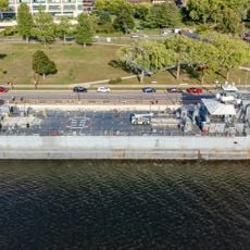
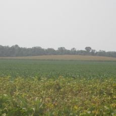
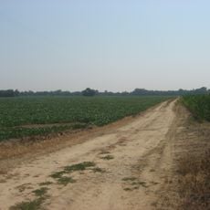
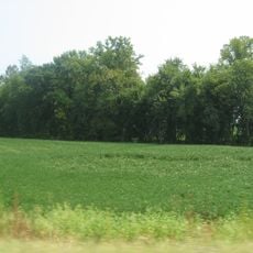
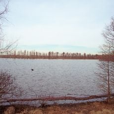
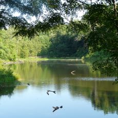
Diamond Island is a river island in the Ohio that spans roughly two square miles, featuring forested edges and open agricultural land. The island contains farm buildings, grain storage structures, and a dock for water access.

In the late 1700s, the island served as a base for Samuel Mason and his pirate crew who worked the Ohio River. A violent clash in 1803 between Native Americans and settlers resulted in deaths and disappearances.

The Diamond Island Massacre of 1803 marked a tragic encounter between Native Americans and the Barnard family, resulting in multiple casualties and disappearances.

The island remains undeveloped with no permanent residents, and visitors typically access it by water via the dock. Expect to find open fields and wooded areas as you move across the landscape.

The island reaches an elevation of 360 feet above sea level, making it a notable landform along the Ohio River between Kentucky and Indiana.

The community of curious travelers

AroundUs brings together thousands of curated places, local tips, and hidden gems, enriched daily by 60,000 contributors worldwide.

Start exploring
Location
GPS coordinates
37.88330,-87.75220
Latest update
December 21, 2025 16:05
Around this place
USS LST-325
United States of America

USS LST-325

18.1 km
Casino Aztar Evansville
United States of America

Casino Aztar Evansville

18.1 km
Mesker Park Zoo and Botanic Garden
United States of America

Mesker Park Zoo and Botanic Garden

18.3 km
Evansville Museum of Arts, History and Science
United States of America

Evansville Museum of Arts, History and Science

18.2 km
Bi-State Vietnam Gold Star Bridges
United States of America

Bi-State Vietnam Gold Star Bridges

17.9 km
Mann Site
United States of America

Mann Site

8.3 km
Hovey Lake Archaeological District
United States of America

Hovey Lake Archaeological District

15.9 km
Ashworth Archaeological Site
United States of America

Ashworth Archaeological Site

16.6 km
Willard Carpenter House
United States of America

Willard Carpenter House

16.2 km
Hovey Lake Fish and Wildlife Area
United States of America

Hovey Lake Fish and Wildlife Area

17.6 km
Posey County Courthouse Square
United States of America

Posey County Courthouse Square

13.6 km
Michael D. Helfrich House
United States of America

Michael D. Helfrich House

17.1 km
Ohio Street Bridge
United States of America

Ohio Street Bridge

17.8 km
I.O.O.F. and Barker Buildings
United States of America

I.O.O.F. and Barker Buildings

13.7 km
Mead Johnson River-Rail-Truck Terminal and Warehouse
United States of America

Mead Johnson River-Rail-Truck Terminal and Warehouse

17.5 km
Mount Vernon Downtown Historic District
United States of America

Mount Vernon Downtown Historic District

13.7 km
South Main and South Elm Streets Historic District
United States of America

South Main and South Elm Streets Historic District

14.8 km
Sunset Park Pavilion
United States of America

Sunset Park Pavilion

18.2 km
Welborn Historic District
United States of America

Welborn Historic District

13.7 km
William Gonnerman House
United States of America

William Gonnerman House

14 km
J. Hawkins Hart House
United States of America

J. Hawkins Hart House

15.5 km
Barret House
United States of America

Barret House

14.9 km
Geibel House
United States of America

Geibel House

14.9 km
Alves Historic District
United States of America

Alves Historic District

15.6 km
Henderson Commercial District
United States of America

Henderson Commercial District

15 km
John James Audubon State Park
United States of America

John James Audubon State Park

17.9 km
Evansville Museum
United States of America

Evansville Museum

18.2 km
Lincolnshire Historic District
United States of America

Lincolnshire Historic District

18.3 km
Show the full map
Reviews
Share your experience

No review yet

Discussions
Start a discussion...

No discussion yet

« Diamond Island - River island in Henderson County, Kentucky, United States » is provided by Around Us (aroundus.com). Images and texts are derived from Wikimedia project under a Creative Commons license. You are allowed to copy, distribute, and modify copies of this page, under the conditions set by the license, as long as this note is clearly visible.

Discover hidden gems everywhere you go!

From secret cafés to breathtaking viewpoints, skip the crowded tourist spots and find places that match your style. Our app makes it easy with voice search, smart filtering, route optimization, and insider tips from travelers worldwide. Download now for the complete mobile experience.

Around Us App Screenshot

A unique approach to discovering new places

Le Figaro

All the places worth exploring

France Info

A tailor-made excursion in just a few clicks

20 Minutes

Around Us
Travel Guide & Maps
Download

Send to your phone

QR Code
1

Open the camera app on your mobile.

2

Point at the QR code with your camera. A notification will appear.

3

Tap the notification to open the link.