Enable Location

We need your location to show you interesting places around you

Discover nearby places

Find interesting locations and hidden gems around you

Precise directions

Get accurate directions and distances to places

Your location is never shared with other users. It's only used when you tap the location button.

Hovey Lake Archaeological District

Log in to your account

Start exploring — it's free

Trusted by 61,702 travelers worldwide

Continue with Google
Continue with Apple
or

We will send you a code to connect

By continuing, you accept our Terms and Conditions and our Privacy Policy

Check your inbox

We've sent a pincode in your inbox. Please enter the code below.

Hovey Lake Archaeological District, Archaeological site at Hovey Lake, Indiana, US

Description

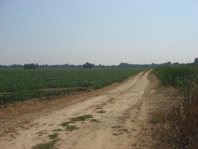
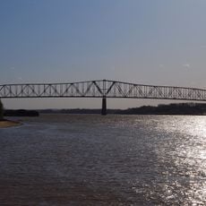
Hovey Lake Archaeological District spans about 343 acres near the Ohio River and contains several settlement sites from the Mississippian period. The excavations reveal rectangular houses, storage pits, and defensive structures that document daily life in these early communities.

History

The area was occupied between 1400 and 1650 by Native American groups who built permanent villages with organized structures. This settlement ended before European explorers arrived and represents a key period in the region's history.

Culture

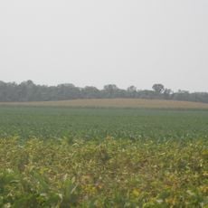
The site shows evidence of trade connections between the local community and distant groups along the Mississippi River. Visitors can trace how the Caborn-Welborn people maintained contact with other peoples and exchanged goods.

Practical

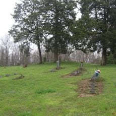
The site is managed by the Indiana Department of Natural Resources and offers research opportunities through partnerships with universities and museums. Visitors should wear appropriate protective gear and stay on marked paths to protect archaeological remains.

Did you know?

Excavations revealed special storage pits near houses that could hold enough grain to feed seven to twelve people for a full year. This storage capacity suggests intensive farming practices and the ability to secure food surpluses for extended periods.

Location
GPS coordinates
37.83000,-87.92000
Latest update
December 14, 2025 11:25

AroundUs brings together thousands of curated places, local tips, and hidden gems, enriched daily by 60,000 contributors worldwide. Discover all places nearby (Indiana).

Around this place
Shawneetown Bank State Historic Site
United States of America

Shawneetown Bank State Historic Site

24.1 km
John T. Myers Locks and Dam
United States of America

John T. Myers Locks and Dam

7.4 km
Mann Site
United States of America

Mann Site

11.6 km
Wabash Memorial Bridge
United States of America

Wabash Memorial Bridge

16.3 km
Shawneetown Bridge
United States of America

Shawneetown Bridge

24.2 km
United States of America

Welborn Village Archeological Site

7.2 km
Hubele Mounds and Village Site
United States of America

Hubele Mounds and Village Site

23 km
Ashworth Archaeological Site
United States of America

Ashworth Archaeological Site

2.6 km
United States of America

Gallatin County Courthouse

26.6 km
Hovey Lake Fish and Wildlife Area
United States of America

Hovey Lake Fish and Wildlife Area

1.9 km
Wilson Mounds and Village Site
United States of America

Wilson Mounds and Village Site

21.2 km
John Marshall House Museum
United States of America

John Marshall House Museum

24.3 km
Confederate Monument of Morganfield
United States of America

Confederate Monument of Morganfield

15.2 km
Posey County Courthouse Square
United States of America

Posey County Courthouse Square

11.6 km
Union County Courthouse
United States of America

Union County Courthouse

16.3 km
Camp Breckinridge Non-Commissioned Officers' Club
United States of America

Camp Breckinridge Non-Commissioned Officers' Club

17.2 km
Bieker-Wilson Village Site
United States of America

Bieker-Wilson Village Site

16.8 km
Duffy Site
United States of America

Duffy Site

15.8 km
I.O.O.F. and Barker Buildings
United States of America

I.O.O.F. and Barker Buildings

11.6 km
Mount Vernon Downtown Historic District
United States of America

Mount Vernon Downtown Historic District

11.4 km
South Main and South Elm Streets Historic District
United States of America

South Main and South Elm Streets Historic District

28.5 km
Daniel H. Hughes House
United States of America

Daniel H. Hughes House

16.3 km
George N. Proctor House
United States of America

George N. Proctor House

14.1 km
Welborn Historic District
United States of America

Welborn Historic District

11.8 km
William Gonnerman House
United States of America

William Gonnerman House

11.1 km
Robert and John McKee Peeples Houses
United States of America

Robert and John McKee Peeples Houses

23.9 km
Barret House
United States of America

Barret House

28.7 km
Morganfield Commercial District
United States of America

Morganfield Commercial District

16.2 km
Show the full map
« Hovey Lake Archaeological District - Archaeological site at Hovey Lake, Indiana, US » is provided by Around Us (aroundus.com). Images and texts are derived from Wikimedia project under a Creative Commons license. You are allowed to copy, distribute, and modify copies of this page, under the conditions set by the license, as long as this note is clearly visible.

Discover hidden gems everywhere you go!

From secret cafés to breathtaking viewpoints, skip the crowded tourist spots and find places that match your style. Our app makes it easy with voice search, smart filtering, route optimization, and insider tips from travelers worldwide. Download now for the complete mobile experience.

Around Us App Screenshot

A unique approach to discovering new places

Le Figaro

All the places worth exploring

France Info

A tailor-made excursion in just a few clicks

20 Minutes

Around Us
Travel Guide & Maps
Download

Send to your phone

QR Code
1

Open the camera app on your mobile.

2

Point at the QR code with your camera. A notification will appear.

3

Tap the notification to open the link.