Enable Location

We need your location to show you interesting places around you

Discover nearby places

Find interesting locations and hidden gems around you

Precise directions

Get accurate directions and distances to places

Your location is never shared with other users. It's only used when you tap the location button.

Wilson Mounds and Village Site

Log in to your account

Start exploring — it's free

Trusted by 62,173 travelers worldwide

Continue with Google
Continue with Apple
or

We will send you a code to connect

By continuing, you accept our Terms and Conditions and our Privacy Policy

Check your inbox

We've sent a pincode in your inbox. Please enter the code below.

Wilson Mounds and Village Site, Archaeological site in White County, Illinois.

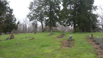
Wilson Mounds and Village Site is an archaeological complex covering a large area with twelve mounds used as burial structures and remains of a prehistoric village underneath. The landscape shows evidence of occupation across different time periods, with structures and artifacts scattered across the terrain.

Settlement at this location began around 400 BC during the Hopewell period and continued through later ages. Systematic excavations in the mid-twentieth century uncovered multiple layers showing how different peoples used this place over centuries.

Different burial methods across the site suggest that multiple groups lived here and maintained connections with distant places. Objects from faraway regions show how trade and exchange shaped the community.

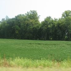
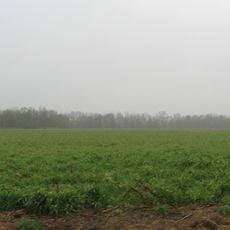
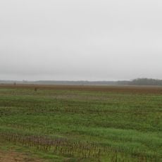
The site is located in a rural area and can be reached by local roads. Access is generally open, though visitors should expect unmarked terrain and minimal infrastructure at the location.

Skeletal remains from different regions within the same mounds reveal unexpected connections between distant communities. These findings suggest that people across the continent maintained contact through exchange and movement.

The community of curious travelers

AroundUs brings together thousands of curated places, local tips, and hidden gems, enriched daily by 60,000 contributors worldwide.

Start exploring
Location
Address
841 County Road 1920 East, Carmi, IL 62821
GPS coordinates
37.99920,-88.03190
Latest update
December 14, 2025 18:09
Around this place
New Harmony's Atheneum
United States of America

New Harmony's Atheneum

16.9 km
Roofless Church
United States of America

Roofless Church

17 km
John T. Myers Locks and Dam
United States of America

John T. Myers Locks and Dam

23.2 km
Mann Site
United States of America

Mann Site

19.5 km
Wabash Memorial Bridge
United States of America

Wabash Memorial Bridge

6.2 km
United States of America

Welborn Village Archeological Site

23.1 km
Hovey Lake Archaeological District
United States of America

Hovey Lake Archaeological District

21.2 km
Hubele Mounds and Village Site
United States of America

Hubele Mounds and Village Site

1.9 km
Ashworth Archaeological Site
United States of America

Ashworth Archaeological Site

18.6 km
Hovey Lake Fish and Wildlife Area
United States of America

Hovey Lake Fish and Wildlife Area

22.1 km
Amon Clarence Thomas House
United States of America

Amon Clarence Thomas House

16.7 km
Posey County Courthouse Square
United States of America

Posey County Courthouse Square

14.2 km
Bieker-Wilson Village Site
United States of America

Bieker-Wilson Village Site

9.9 km
Mattias Scholle House
United States of America

Mattias Scholle House

16.9 km
James Robert Williams House
United States of America

James Robert Williams House

15 km
George Bentel House
United States of America

George Bentel House

17.1 km
Duffy Site
United States of America

Duffy Site

16.6 km
Robinson-Stewart House
United States of America

Robinson-Stewart House

15 km
Ludwig Epple House
United States of America

Ludwig Epple House

17 km
I.O.O.F. and Barker Buildings
United States of America

I.O.O.F. and Barker Buildings

14.1 km
Mount Vernon Downtown Historic District
United States of America

Mount Vernon Downtown Historic District

14.1 km
Carmi Chapter House
United States of America

Carmi Chapter House

15.3 km
Welborn Historic District
United States of America

Welborn Historic District

14.1 km
William Gonnerman House
United States of America

William Gonnerman House

13.9 km
Historic New Harmony Atheneum
United States of America

Historic New Harmony Atheneum

16.9 km
New Harmony Toll Bridge
United States of America

New Harmony Toll Bridge

16.7 km
New Harmony Historic District
United States of America

New Harmony Historic District

16.8 km
James Elliott Farm
United States of America

James Elliott Farm

17.3 km
Show the full map
« Wilson Mounds and Village Site - Archaeological site in White County, Illinois » is provided by Around Us (aroundus.com). Images and texts are derived from Wikimedia project under a Creative Commons license. You are allowed to copy, distribute, and modify copies of this page, under the conditions set by the license, as long as this note is clearly visible.

Discover hidden gems everywhere you go!

From secret cafés to breathtaking viewpoints, skip the crowded tourist spots and find places that match your style. Our app makes it easy with voice search, smart filtering, route optimization, and insider tips from travelers worldwide. Download now for the complete mobile experience.

Around Us App Screenshot

A unique approach to discovering new places

Le Figaro

All the places worth exploring

France Info

A tailor-made excursion in just a few clicks

20 Minutes

Around Us
Travel Guide & Maps
Download

Send to your phone

QR Code
1

Open the camera app on your mobile.

2

Point at the QR code with your camera. A notification will appear.

3

Tap the notification to open the link.