Chest opened
+${chestReward.xp} XP
Explorer
NOUVEAU ×${chestReward.collectible.quantity}
tapez pour fermer
Chest locked

Open chests in the app

Around Us is built for your phone — chests unlock when you walk, explore and capture nearby places.

Enable Location

We need your location to show you interesting places around you

Discover nearby places

Find interesting locations and hidden gems around you

Precise directions

Get accurate directions and distances to places

Your location is never shared with other users. It's only used when you tap the location button.

Douglassville

Log in to your account

Start exploring — it's free

Trusted by 72,986 travelers worldwide

Continue with Google
Continue with Apple
or

We will send you a code to connect

By continuing, you accept our Terms and Conditions and our Privacy Policy

Check your inbox

We've sent a pincode in your inbox. Please enter the code below.

Discussion Reviews 1 Photos
10.7k Popularity

Douglassville, Census-designated place in Amity Township, Pennsylvania, United States.

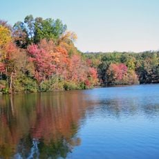
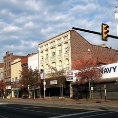
Douglassville is a community located along U.S. Route 422 and Pennsylvania Route 724, with several neighborhoods including Amity Gardens, West Ridge, Briarwood, and High Meadow. The area mixes older buildings with newer residential sections spread across gently rolling terrain.

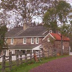
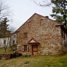
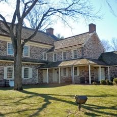
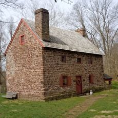
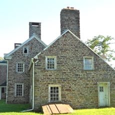
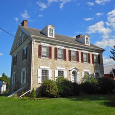
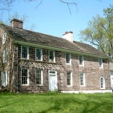
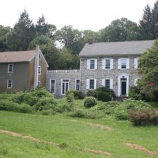
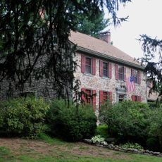
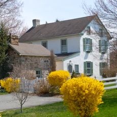
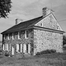
The first settlement appeared along the Schuylkill River in the 1600s when Swedish settlers built the Mouns Jones House in 1716. This early core shaped how the entire region grew and developed.

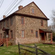
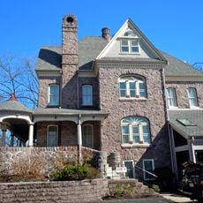
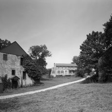
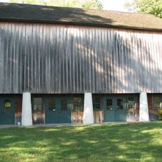
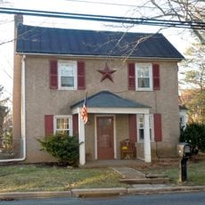
The place reflects early community bonds through its street names and preserved buildings from colonial times. Walking through it, you notice how different settler groups shaped the neighborhoods that still exist today.

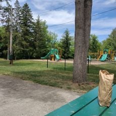
Lake Drive Park and Recreation Area offers basketball and tennis courts plus a skateboard park for outdoor activities. The location sits along major routes 422 and 724, making it easy to reach and navigate.

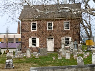
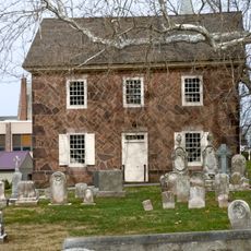
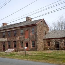
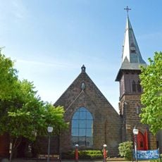
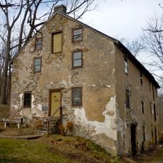
Old St. Gabriel's Episcopal Church, established in 1720, stands as the oldest church building in Berks County. The structure draws visitors interested in early colonial religious architecture and its quiet presence in the landscape.

The community of curious travelers

AroundUs brings together thousands of curated places, local tips, and hidden gems, enriched daily by 60,000 contributors worldwide.

Start exploring
Location
GPS coordinates
40.25722,-75.72639
Latest update
December 10, 2025 15:52
Around this place
French Creek State Park
United States of America

French Creek State Park

7.5 km
Daniel Boone Homestead
United States of America

Daniel Boone Homestead

7.6 km
Mordecai Lincoln House
United States of America

Mordecai Lincoln House

9.5 km
Pottsgrove Mansion
United States of America

Pottsgrove Mansion

5.8 km
Hopewell Big Woods
United States of America

Hopewell Big Woods

7.5 km
Old Swede's House
United States of America

Old Swede's House

463 m
St. Michael's Episcopal Church
United States of America

St. Michael's Episcopal Church

6.9 km
White Horse Tavern
United States of America

White Horse Tavern

343 m
Old St. Gabriel's Episcopal Church
United States of America

Old St. Gabriel's Episcopal Church

236 m
Old Pottstown Historic District
United States of America

Old Pottstown Historic District

6.9 km
Pine Forge Mansion and Industrial Site
United States of America

Pine Forge Mansion and Industrial Site

3.5 km
Grubb Mansion
United States of America

Grubb Mansion

9.1 km
High Street Historic District
United States of America

High Street Historic District

8.4 km
Henry Fisher House
United States of America

Henry Fisher House

9.8 km
Mill Tract Farm
United States of America

Mill Tract Farm

9.3 km
George Douglass House
United States of America

George Douglass House

95 m
Sunnybrook
United States of America

Sunnybrook

9.9 km
North Warwick Historic and Archeological District
United States of America

North Warwick Historic and Archeological District

8.5 km
Pottstown Landing Historic District
United States of America

Pottstown Landing Historic District

5.7 km
Coventry Hall
United States of America

Coventry Hall

9.7 km
Rhoads-Lorah House and Barn
United States of America

Rhoads-Lorah House and Barn

7.1 km
Nathan Michener House
United States of America

Nathan Michener House

10.3 km
Philip Rogers House
United States of America

Philip Rogers House

9.2 km
Ironstone Bridge
United States of America

Ironstone Bridge

9.4 km
Christ Episcopal Church, Pottstown
United States of America

Christ Episcopal Church, Pottstown

6.9 km
Warrenpoint
United States of America

Warrenpoint

10.4 km
Splash Park
United States of America

Splash Park

6 km
John Knauer House and Mill
United States of America

John Knauer House and Mill

9.7 km
Show the full map
Reviews
Share your experience

No review yet

Discussions
Start a discussion...

No discussion yet

« Douglassville - Census-designated place in Amity Township, Pennsylvania, United States » is provided by Around Us (aroundus.com). Images and texts are derived from Wikimedia project under a Creative Commons license. You are allowed to copy, distribute, and modify copies of this page, under the conditions set by the license, as long as this note is clearly visible.

Discover hidden gems everywhere you go!

From secret cafés to breathtaking viewpoints, skip the crowded tourist spots and find places that match your style. Our app makes it easy with voice search, smart filtering, route optimization, and insider tips from travelers worldwide. Download now for the complete mobile experience.

Around Us App Screenshot

A unique approach to discovering new places

Le Figaro

All the places worth exploring

France Info

A tailor-made excursion in just a few clicks

20 Minutes

Around Us
Travel Guide & Maps
Download

Send to your phone

QR Code
1

Open the camera app on your mobile.

2

Point at the QR code with your camera. A notification will appear.

3

Tap the notification to open the link.