Enable Location

We need your location to show you interesting places around you

Discover nearby places

Find interesting locations and hidden gems around you

Precise directions

Get accurate directions and distances to places

Your location is never shared with other users. It's only used when you tap the location button.

Dorset Mountain

Log in to your account

Start exploring — it's free

Trusted by 63,117 travelers worldwide

Continue with Google
Continue with Apple
or

We will send you a code to connect

By continuing, you accept our Terms and Conditions and our Privacy Policy

Check your inbox

We've sent a pincode in your inbox. Please enter the code below.

Dorset Mountain
Discussion Reviews 1 Photos
3.1k Popularity

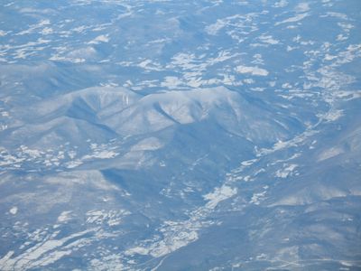
Dorset Mountain, Mountain summit in Rutland County, United States

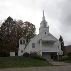
Dorset Mountain is a summit in the Taconic Range located in Rutland County, Vermont, with its peak rising prominently above the surrounding landscape. The mountain forms part of a larger ridge system that characterizes this section of southwestern Vermont.

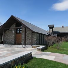
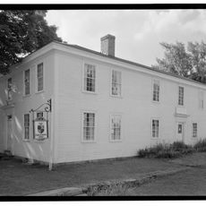
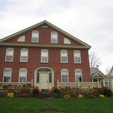
The Dorset Mountain area has been known for its geological resources since the early days of European settlement in Vermont. Significant economic development came in the late 1800s when large-scale extraction operations began in the region.

The mountain's drainage system connects to multiple waterways, including Otter Creek and the Mettawee River, contributing to Lake Champlain's water network.

The summit is accessible via unmaintained trails that depart mainly from the southwest side of the mountain. Visits are best planned from late spring through early fall when conditions are most suitable for hiking.

Beneath the mountain lies one of the world's largest underground marble quarries, with extensive excavations running deep into the rock. This hidden network demonstrates the substantial geological resources that have defined much of the area's economic activity.

The community of curious travelers

AroundUs brings together thousands of curated places, local tips, and hidden gems, enriched daily by 60,000 contributors worldwide.

Start exploring
Location
GPS coordinates
43.30931,-73.02812
Latest update
December 12, 2025 09:06
Around this place
Hildene
United States of America

Hildene

19.3 km
Equinox Mountain
United States of America

Equinox Mountain

17.5 km
Bill Wilson House
United States of America

Bill Wilson House

7.9 km
Weston Priory
United States of America

Weston Priory

19.4 km
United States of America

Mount Aeolus

7.7 km
The American Museum of Fly Fishing
United States of America

The American Museum of Fly Fishing

16 km
Manley-Lefevre House
United States of America

Manley-Lefevre House

10 km
Equinox House Historic District
United States of America

Equinox House Historic District

16.8 km
Lemuel Haynes House
United States of America

Lemuel Haynes House

21.8 km
Farrar-Mansur House
United States of America

Farrar-Mansur House

19 km
Wallingford Main Street Historic District
United States of America

Wallingford Main Street Historic District

18.5 km
Dorset Village Historic District
United States of America

Dorset Village Historic District

8.4 km
John Wilder House
United States of America

John Wilder House

19 km
Tinmouth Historic District
United States of America

Tinmouth Historic District

15.6 km
Pawlet Town Hall
United States of America

Pawlet Town Hall

12.9 km
Pember Library and Museum
United States of America

Pember Library and Museum

21.9 km
Weston Village Historic District
United States of America

Weston Village Historic District

19 km
Londonderry Town House
United States of America

Londonderry Town House

21.5 km
Nathan Allen House
United States of America

Nathan Allen House

14 km
Danby Village Historic District
United States of America

Danby Village Historic District

4.9 km
Amos Lawrence House
United States of America

Amos Lawrence House

16.2 km
Braintree School
United States of America

Braintree School

18.1 km
Kent Neighborhood Historic District
United States of America

Kent Neighborhood Historic District

9.6 km
Gen. Robinson Hall House
United States of America

Gen. Robinson Hall House

13.8 km
Hard Farm Homestead
United States of America

Hard Farm Homestead

20.4 km
Rupert Village Historic District
United States of America

Rupert Village Historic District

16.7 km
Middletown Springs Historic District
United States of America

Middletown Springs Historic District

20.8 km
Pastime Pinball
United States of America

Pastime Pinball

15 km
Show the full map
Reviews
Share your experience

No review yet

Discussions
Start a discussion...

No discussion yet

« Dorset Mountain - Mountain summit in Rutland County, United States » is provided by Around Us (aroundus.com). Images and texts are derived from Wikimedia project under a Creative Commons license. You are allowed to copy, distribute, and modify copies of this page, under the conditions set by the license, as long as this note is clearly visible.

Discover hidden gems everywhere you go!

From secret cafés to breathtaking viewpoints, skip the crowded tourist spots and find places that match your style. Our app makes it easy with voice search, smart filtering, route optimization, and insider tips from travelers worldwide. Download now for the complete mobile experience.

Around Us App Screenshot

A unique approach to discovering new places

Le Figaro

All the places worth exploring

France Info

A tailor-made excursion in just a few clicks

20 Minutes

Around Us
Travel Guide & Maps
Download

Send to your phone

QR Code
1

Open the camera app on your mobile.

2

Point at the QR code with your camera. A notification will appear.

3

Tap the notification to open the link.