Emory Place Historic District

Log in to your account

AroundUs is a community-driven map of interesting places, built by curious explorers like you. It grows with every review, story, and photo you share.
Connect to save your favorite spots, contribute locations, and create personalized routes.
Continue with Google
Continue with Apple
Continue with X
Continue with Facebook
Continue with email
By continuing, you accept our Terms and Conditions and our Privacy Policy
Create an account
Add to collection
Map
Suggest a change
Share

Emory Place Historic District, Historic district in Knoxville, Tennessee.

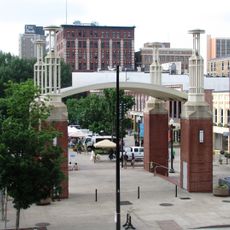
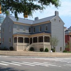
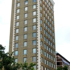
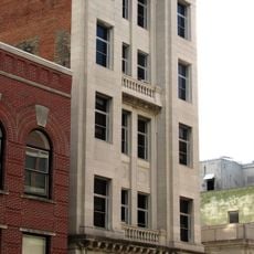
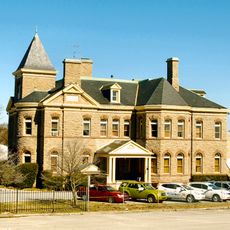
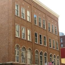
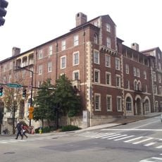
Emory Place Historic District is a neighborhood in northern downtown Knoxville comprising commercial buildings, churches, and residential structures across approximately 10 acres. The area extends between Broadway and King streets, incorporating North Central, Emory, Fifth, and East Fourth avenues.

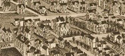
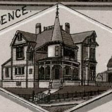
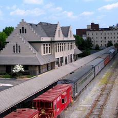
The district emerged in the 1890s around a train station and transformed from an industrial center into a residential area following the arrival of the electric trolley in 1905. These transportation shifts led to architectural changes that shaped the neighborhood's appearance over several decades.

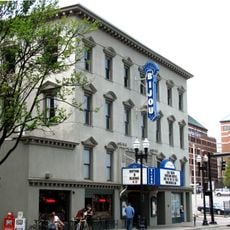
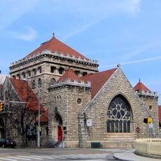
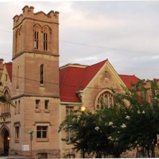
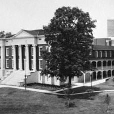
The neighborhood showcases notable buildings like the Beaux-Arts Knoxville High School from 1910 and First Christian Church with Neoclassical marble details from 1913. These structures reflect how the community expressed its importance during the early 20th century growth period.

The district is easy to explore on foot by walking through the streets between Broadway and King Street, where the main buildings are distributed. The flat topography and orderly block layout make it simple to discover the various corners and architectural details throughout the area.

The original Dummy Line railroad that served the district in its early days was one of the first mechanized rail lines in the region. This early transportation pioneer was crucial in helping the area develop into an important center in the first place.

Location: Tennessee

GPS coordinates: 35.97407,-83.92248

Latest update: December 13, 2025 17:01

Photos
Around this place
Sunsphere
United States of America

Sunsphere

1.4 km
Market Square
United States of America

Market Square

1 km
World's Fair Park
United States of America

World's Fair Park

1.4 km
Tennessee Theatre
United States of America

Tennessee Theatre

1.3 km
Bijou Theatre
United States of America

Bijou Theatre

1.4 km
White's Fort
United States of America

White's Fort

1.2 km
Old Customs House
United States of America

Old Customs House

1.2 km
St. John's Cathedral
United States of America

St. John's Cathedral

1.4 km
James Park House
United States of America

James Park House

1.4 km
United States Post Office and Courthouse
United States of America

United States Post Office and Courthouse

1.5 km
General Building
United States of America

General Building

1.3 km
Mechanics' Bank and Trust Company Building
United States of America

Mechanics' Bank and Trust Company Building

1.1 km
Greystone
United States of America

Greystone

1.2 km
The Burwell
United States of America

The Burwell

1.2 km
Medical Arts Building
United States of America

Medical Arts Building

1.5 km
Fidelity Building
United States of America

Fidelity Building

1.1 km
Isaac Ziegler House
United States of America

Isaac Ziegler House

658 m
Knoxville YMCA Building
United States of America

Knoxville YMCA Building

1.2 km
Trinity Methodist Episcopal Church
United States of America

Trinity Methodist Episcopal Church

450 m
Caswell–Taylor House
United States of America

Caswell–Taylor House

672 m
Knoxville Museum of Art
United States of America

Knoxville Museum of Art

1.3 km
Knoxville Civic Coliseum
United States of America

Knoxville Civic Coliseum

1.4 km
Knoxville National Cemetery
United States of America

Knoxville National Cemetery

415 m
Old City Hall
United States of America

Old City Hall

982 m
Plaza Tower
United States of America

Plaza Tower

1.4 km
Lawson McGhee Library
United States of America

Lawson McGhee Library

1.3 km
Southern Terminal and Warehouse Historic District
United States of America

Southern Terminal and Warehouse Historic District

561 m
Gay Street Commercial Historic District
United States of America

Gay Street Commercial Historic District

1 km
Show the full map
Reviews

Visited this place? Tap the stars to rate it and share your experience / photos with the community! Try now! You can cancel it anytime.

« Emory Place Historic District - Historic district in Knoxville, Tennessee » is provided by Around Us (aroundus.com). Images and texts are derived from Wikimedia project under a Creative Commons license. You are allowed to copy, distribute, and modify copies of this page, under the conditions set by the license, as long as this note is clearly visible.

Discover hidden gems everywhere you go!

From secret cafés to breathtaking viewpoints, skip the crowded tourist spots and find places that match your style. Our app makes it easy with voice search, smart filtering, route optimization, and insider tips from travelers worldwide. Download now for the complete mobile experience.

Around Us App Screenshot

A unique approach to discovering new places

Le Figaro

All the places worth exploring

France Info

A tailor-made excursion in just a few clicks

20 Minutes