Chest opened
+${chestReward.xp} XP
Explorer
NOUVEAU ×${chestReward.collectible.quantity}
tapez pour fermer
Chest locked

Open chests in the app

Around Us is built for your phone — chests unlock when you walk, explore and capture nearby places.

Enable Location

We need your location to show you interesting places around you

Discover nearby places

Find interesting locations and hidden gems around you

Precise directions

Get accurate directions and distances to places

Your location is never shared with other users. It's only used when you tap the location button.

Log in to your account

Start exploring — it's free

Trusted by 72,878 travelers worldwide

Continue with Google
Continue with Apple
or

We will send you a code to connect

By continuing, you accept our Terms and Conditions and our Privacy Policy

Check your inbox

We've sent a pincode in your inbox. Please enter the code below.

Fairfax Line
Discussion Reviews Photo
3.7k Popularity

Fairfax Line, Colonial boundary line in West Virginia, United States

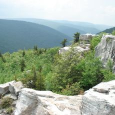
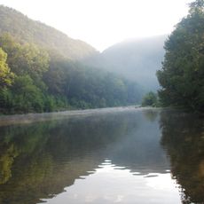
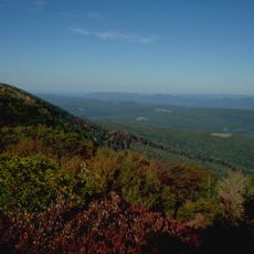
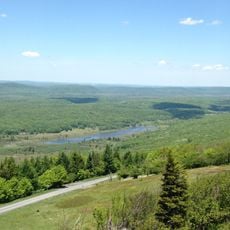
The Fairfax Line is a historic boundary that stretches about 77 miles (124 km) across mountainous terrain from the headwaters of the North Branch Potomac River to a point in the Rappahannock River watershed. It marks a land area that was formally surveyed and claimed during colonial times.

In 1746, a team of surveyors led by Colonel Peter Jefferson traced this boundary line across the landscape to define property rights for a large colonial land grant. The survey became a milestone in establishing formal territorial claims in the region.

The line shows how early settlers used rivers and mountain features as natural boundary markers to define land ownership. This method of marking territory became a foundation for property rights in the developing colonial region.

The northwestern endpoint at the Fairfax Stone marks the source of the North Branch Potomac River near the Maryland border and is the most accessible starting point for visitors. From there, the boundary line runs southeastward through rugged mountain country that requires good hiking equipment and physical preparation.

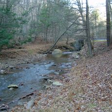
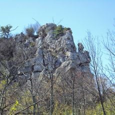
The line follows natural features like ridge lines and river sources with surprising accuracy for its time, using methods that required only basic tools and careful observation. Many of the original survey markers, including stone cairns and carved trees, remain visible along parts of the route today.

The community of curious travelers

AroundUs brings together thousands of curated places, local tips, and hidden gems, enriched daily by 60,000 contributors worldwide.

Start exploring
Location
GPS coordinates
39.00000,-79.00000
Latest update
December 11, 2025 18:11
Around this place
Dolly Sods Wilderness
United States of America

Dolly Sods Wilderness

31.8 km
Smoke Hole Canyon
United States of America

Smoke Hole Canyon

29.2 km
Smoke Hole Caverns
United States of America

Smoke Hole Caverns

23.1 km
Lost River State Park
United States of America

Lost River State Park

13.8 km
Bear Rocks Preserve
United States of America

Bear Rocks Preserve

27 km
Big Schloss
United States of America

Big Schloss

29.6 km
Canaan Valley National Wildlife Refuge
United States of America

Canaan Valley National Wildlife Refuge

33.9 km
Fort Pleasant
United States of America

Fort Pleasant

15.5 km
Lighthorse Harry Lee Cabin
United States of America

Lighthorse Harry Lee Cabin

13.5 km
Hermitage Motor Inn
United States of America

Hermitage Motor Inn

10.5 km
Willow Wall
United States of America

Willow Wall

14.5 km
Fort Van Meter
United States of America

Fort Van Meter

29.6 km
John Mathias House
United States of America

John Mathias House

17.8 km
Clifford Hollow Bridge
United States of America

Clifford Hollow Bridge

14.8 km
Kuykendall Polygonal Barn
United States of America

Kuykendall Polygonal Barn

29.5 km
Garrett VanMeter House
United States of America

Garrett VanMeter House

16.2 km
Old Judy Church
United States of America

Old Judy Church

24.1 km
Grant County Courthouse
United States of America

Grant County Courthouse

10.5 km
Buena Vista Farms
United States of America

Buena Vista Farms

15.1 km
Hickory Hill
United States of America

Hickory Hill

6.1 km
P.W. Inskeep House
United States of America

P.W. Inskeep House

8.7 km
Thomas Maslin House
United States of America

Thomas Maslin House

7.2 km
Old Stone Tavern
United States of America

Old Stone Tavern

7.3 km
Moorefield Historic District
United States of America

Moorefield Historic District

7.1 km
Old Hardy County Courthouse
United States of America

Old Hardy County Courthouse

7.4 km
Judge J. W. F. Allen House
United States of America

Judge J. W. F. Allen House

7.1 km
Wilson-Kuykendall Farm
United States of America

Wilson-Kuykendall Farm

4.5 km
Hardy County Public Library
United States of America

Hardy County Public Library

7.4 km
Show the full map
Reviews
Share your experience

No review yet

Discussions
Start a discussion...

No discussion yet

« Fairfax Line - Colonial boundary line in West Virginia, United States » is provided by Around Us (aroundus.com). Images and texts are derived from Wikimedia project under a Creative Commons license. You are allowed to copy, distribute, and modify copies of this page, under the conditions set by the license, as long as this note is clearly visible.

Discover hidden gems everywhere you go!

From secret cafés to breathtaking viewpoints, skip the crowded tourist spots and find places that match your style. Our app makes it easy with voice search, smart filtering, route optimization, and insider tips from travelers worldwide. Download now for the complete mobile experience.

Around Us App Screenshot

A unique approach to discovering new places

Le Figaro

All the places worth exploring

France Info

A tailor-made excursion in just a few clicks

20 Minutes

Around Us
Travel Guide & Maps
Download

Send to your phone

QR Code
1

Open the camera app on your mobile.

2

Point at the QR code with your camera. A notification will appear.

3

Tap the notification to open the link.