Log in to your account

AroundUs is a community-driven map of interesting places, built by curious explorers like you. It grows with every review, story, and photo you share.
Connect to save your favorite spots, contribute locations, and create personalized routes.
Continue with Google
Continue with Apple
Continue with X
Continue with Facebook
Continue with email
By continuing, you accept our Terms and Conditions and our Privacy Policy
Create an account

Fergus Falls Wetland Management District

Add to collection
Map
Suggest a change
Share

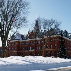
Fergus Falls Wetland Management District, Wetland Management District in western Minnesota, United States.

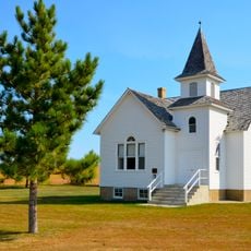
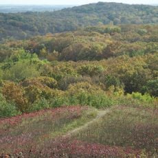
Fergus Falls Wetland Management District protects wetlands and prairie lands spread across several counties in western Minnesota as habitats for migratory birds and wildlife. The area contains marshes, open water, and grasslands that shift with the seasons and support diverse species throughout the year.

The district was established in 1962 to protect Minnesota's prairie wetlands and grasslands from development. Within a few years, a focused program began to acquire and preserve smaller wetland areas to secure additional natural habitats for wildlife.

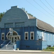
The learning center on site serves as a place where visitors connect with the natural history of prairie wetlands and their role in supporting wildlife. People come here to understand how this landscape shaped the region's identity and continues to matter for local life.

Trails and viewing areas are open for wildlife watching, hiking, and seasonal activities that vary throughout the year. Spring and fall are the best times to visit when migratory birds pass through in larger numbers and the landscape is most active.

The location sits within one of North America's most important bird migration corridors, where the wetlands produce a substantial portion of the continent's migratory waterfowl. This hidden significance explains why protecting these seemingly ordinary landscapes matters so much for wildlife across vast distances.

Website: https://fws.gov/refuge/fergus_falls_wmd

GPS coordinates: 46.23833,-96.04167

Latest update: December 14, 2025 16:47

Photos
Around this place
Inspiration Peak
United States of America

Inspiration Peak

37.8 km
Glendalough State Park
United States of America

Glendalough State Park

30.7 km
Maplewood State Park
United States of America

Maplewood State Park

33.6 km
Phelps Mill
United States of America

Phelps Mill

23.2 km
Pelican Pete
United States of America

Pelican Pete

37.1 km
Park Region Luther College
United States of America

Park Region Luther College

5.5 km
Prospect House
United States of America

Prospect House

25.7 km
Wilkin County Courthouse
United States of America

Wilkin County Courthouse

42.1 km
Richland County Courthouse
United States of America

Richland County Courthouse

43.6 km
Stiklestad United Lutheran Church
United States of America

Stiklestad United Lutheran Church

29.1 km
O.A.E. Blyberg House
United States of America

O.A.E. Blyberg House

36.4 km
Fergus Falls City Hall
United States of America

Fergus Falls City Hall

5.5 km
Otter Tail County Courthouse
United States of America

Otter Tail County Courthouse

5.3 km
Grant County Courthouse
United States of America

Grant County Courthouse

27.6 km
River Inn
United States of America

River Inn

5.5 km
C.C. Clement House
United States of America

C.C. Clement House

5.9 km
Trinity Lutheran Church
United States of America

Trinity Lutheran Church

46.6 km
C.J. Wright House
United States of America

C.J. Wright House

5.8 km
Hotel Kaddatz
United States of America

Hotel Kaddatz

5.6 km
Roosevelt Hall
United States of America

Roosevelt Hall

38.3 km
J. A. Johnson Blacksmith Shop
United States of America

J. A. Johnson Blacksmith Shop

32.2 km
People's Union Church
United States of America

People's Union Church

47.7 km
District No. 182 School
United States of America

District No. 182 School

20 km
Craigie Flour Mill Historical Marker
United States of America

Craigie Flour Mill Historical Marker

33.6 km
Wahpeton Post Office
United States of America

Wahpeton Post Office

43.7 km
John W. Mason House
United States of America

John W. Mason House

5.2 km
Leach Public Library
United States of America

Leach Public Library

43.5 km
Inspiration Peak State Wayside Park
United States of America

Inspiration Peak State Wayside Park

37.5 km
Show the full map
Reviews

Visited this place? Tap the stars to rate it and share your experience / photos with the community! Try now! You can cancel it anytime.

« Fergus Falls Wetland Management District - Wetland Management District in western Minnesota, United States » is provided by Around Us (aroundus.com). Images and texts are derived from Wikimedia project under a Creative Commons license. You are allowed to copy, distribute, and modify copies of this page, under the conditions set by the license, as long as this note is clearly visible.

Discover hidden gems everywhere you go!

From secret cafés to breathtaking viewpoints, skip the crowded tourist spots and find places that match your style. Our app makes it easy with voice search, smart filtering, route optimization, and insider tips from travelers worldwide. Download now for the complete mobile experience.

Around Us App Screenshot

A unique approach to discovering new places

Le Figaro

All the places worth exploring

France Info

A tailor-made excursion in just a few clicks

20 Minutes