Enable Location

We need your location to show you interesting places around you

Discover nearby places

Find interesting locations and hidden gems around you

Precise directions

Get accurate directions and distances to places

Your location is never shared with other users. It's only used when you tap the location button.

Glendalough State Park

Log in to your account

Start exploring — it's free

Trusted by 61,904 travelers worldwide

Continue with Google
Continue with Apple
or

We will send you a code to connect

By continuing, you accept our Terms and Conditions and our Privacy Policy

Check your inbox

We've sent a pincode in your inbox. Please enter the code below.

Glendalough State Park

Glendalough State Park, State park in Otter Tail County, United States.

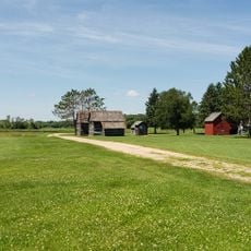
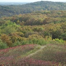
Glendalough State Park sits in a transition zone between prairie and hardwood forest, spreading across about 1,931 acres (780 hectares) of land and 1,000 acres (400 hectares) of water. The terrain blends grassland, woods, and multiple lakes that give the park its varied character.

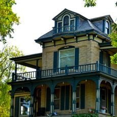
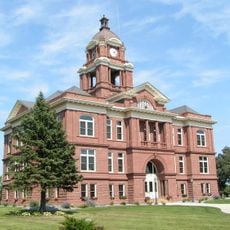
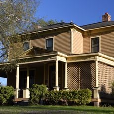
The land was first developed as Valentine's Camp in 1903 and was later bought by a newspaper publisher who renamed it after an Irish monastery. This transition from private resort to state park reflects how many Minnesota properties changed ownership over the decades.

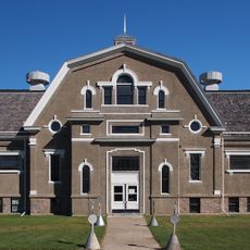
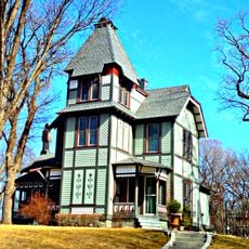
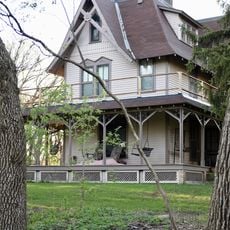
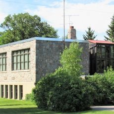
The historic lodge once served as a private retreat for prominent business figures who sought rest away from the city. Such gathering places reveal how wealthy visitors of that era valued their leisure time in natural settings.

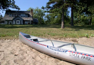
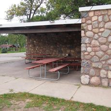
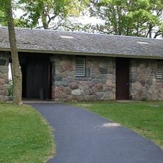
The park offers camping sites of different types, canoe launch points, and equipment rentals for water exploration. Visitors should plan ahead and check current conditions before arriving, as seasonal changes affect water access and facility availability.

Annie Battle Lake has a special Heritage Fishery status with rules designed to maintain healthy populations of sunfish, crappie, and walleye in an undeveloped setting. This lake offers good fishing opportunities for those seeking quieter waters.

The community of curious travelers

AroundUs brings together thousands of curated places, local tips, and hidden gems, enriched daily by 60,000 contributors worldwide.

Start exploring
Inception
1992
GPS coordinates
46.33330,-95.66670
Latest update
December 10, 2025 20:05
Around this place
Kensington Runestone
United States of America

Kensington Runestone

57.9 km
Inspiration Peak
United States of America

Inspiration Peak

23.1 km
Maplewood State Park
United States of America

Maplewood State Park

31.1 km
Lake Carlos State Park
United States of America

Lake Carlos State Park

45.2 km
Phelps Mill
United States of America

Phelps Mill

12.9 km
Pelican Pete
United States of America

Pelican Pete

41.3 km
Finn Creek Museum
United States of America

Finn Creek Museum

29 km
Hewitt Public School
United States of America

Hewitt Public School

44.8 km
Park Region Luther College
United States of America

Park Region Luther College

32.8 km
Prospect House
United States of America

Prospect House

6.5 km
O.A.E. Blyberg House
United States of America

O.A.E. Blyberg House

41.1 km
Fergus Falls City Hall
United States of America

Fergus Falls City Hall

31.9 km
Otter Tail County Courthouse
United States of America

Otter Tail County Courthouse

32 km
River Inn
United States of America

River Inn

31.8 km
Grant County Courthouse
United States of America

Grant County Courthouse

44.6 km
C.C. Clement House
United States of America

C.C. Clement House

30.9 km
Trinity Lutheran Church
United States of America

Trinity Lutheran Church

16.9 km
C.J. Wright House
United States of America

C.J. Wright House

30.8 km
Hotel Kaddatz
United States of America

Hotel Kaddatz

31.9 km
Roosevelt Hall
United States of America

Roosevelt Hall

50 km
J. A. Johnson Blacksmith Shop
United States of America

J. A. Johnson Blacksmith Shop

49.9 km
People's Union Church
United States of America

People's Union Church

48.1 km
District No. 182 School
United States of America

District No. 182 School

15.6 km
Craigie Flour Mill Historical Marker
United States of America

Craigie Flour Mill Historical Marker

4.7 km
John W. Mason House
United States of America

John W. Mason House

32.1 km
Inspiration Peak State Wayside Park
United States of America

Inspiration Peak State Wayside Park

22.9 km
Recreation Building
United States of America

Recreation Building

54.5 km
Lake Carlos State Park WPA/Rustic Style Historic District
United States of America

Lake Carlos State Park WPA/Rustic Style Historic District

45.1 km
Show the full map
« Glendalough State Park - State park in Otter Tail County, United States » is provided by Around Us (aroundus.com). Images and texts are derived from Wikimedia project under a Creative Commons license. You are allowed to copy, distribute, and modify copies of this page, under the conditions set by the license, as long as this note is clearly visible.

Discover hidden gems everywhere you go!

From secret cafés to breathtaking viewpoints, skip the crowded tourist spots and find places that match your style. Our app makes it easy with voice search, smart filtering, route optimization, and insider tips from travelers worldwide. Download now for the complete mobile experience.

Around Us App Screenshot

A unique approach to discovering new places

Le Figaro

All the places worth exploring

France Info

A tailor-made excursion in just a few clicks

20 Minutes

Around Us
Travel Guide & Maps
Download

Send to your phone

QR Code
1

Open the camera app on your mobile.

2

Point at the QR code with your camera. A notification will appear.

3

Tap the notification to open the link.