Enable Location

We need your location to show you interesting places around you

Discover nearby places

Find interesting locations and hidden gems around you

Precise directions

Get accurate directions and distances to places

Your location is never shared with other users. It's only used when you tap the location button.

Otter Tail County

Log in to your account

Start exploring — it's free

Trusted by 61,909 travelers worldwide

Continue with Google
Continue with Apple
or

We will send you a code to connect

By continuing, you accept our Terms and Conditions and our Privacy Policy

Check your inbox

We've sent a pincode in your inbox. Please enter the code below.

Otter Tail County, Administrative division in Minnesota, US.

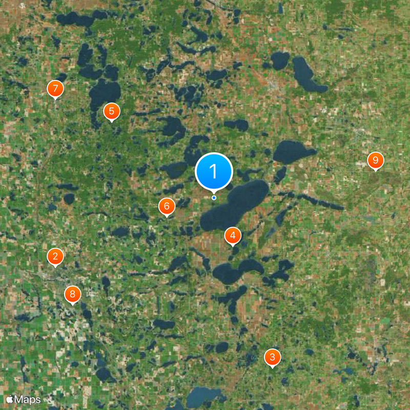
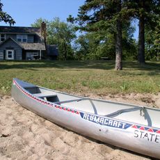
Otter Tail County is an administrative division in Minnesota that contains more than a thousand lakes scattered throughout its territory. Rolling hills, forests, and river systems shape the landscape across this expansive region.

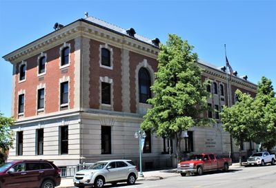
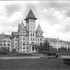
The county was established in 1858 from parts of Cass and Pembina Counties, with Fergus Falls becoming the seat of government. This formation reflected the pattern of European settlement moving through Minnesota.

Native American artifacts and burial mounds near Pelican Rapids indicate human presence dating back to approximately 11,000 BC in this region.

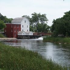
The two main rivers provide exploration and recreation opportunities, while the numerous lakes offer water-based activities throughout the county. Fergus Falls serves as the administrative center where visitors can access regional information and services.

The county takes its name from the river flowing through the region, a name referring to otter tails. This naming choice reflects the wildlife that characterizes the waterways here.

The community of curious travelers

AroundUs brings together thousands of curated places, local tips, and hidden gems, enriched daily by 60,000 contributors worldwide.

Start exploring
Location
Inception
March 18, 1858
Capital city
Fergus Falls
Shares border with
Becker County, Douglas County, Grant County, Wadena County, Todd County, Wilkin County, Clay County
GPS coordinates
46.41000,-95.71000
Latest update
December 20, 2025 14:24
Around this place
Fergus Falls Regional Treatment Center
United States of America

Fergus Falls Regional Treatment Center

31.1 km
Inspiration Peak
United States of America

Inspiration Peak

32.2 km
Glendalough State Park
United States of America

Glendalough State Park

9.2 km
Maplewood State Park
United States of America

Maplewood State Park

22.9 km
Phelps Mill
United States of America

Phelps Mill

9.1 km
Pelican Pete
United States of America

Pelican Pete

33.6 km
United States of America

Fergus Falls Wetland Management District

31.9 km
Finn Creek Museum
United States of America

Finn Creek Museum

29.4 km
Park Region Luther College
United States of America

Park Region Luther College

32.4 km
Prospect House
United States of America

Prospect House

13.8 km
O.A.E. Blyberg House
United States of America

O.A.E. Blyberg House

33.5 km
Fergus Falls City Hall
United States of America

Fergus Falls City Hall

31.5 km
Otter Tail County Courthouse
United States of America

Otter Tail County Courthouse

31.6 km
River Inn
United States of America

River Inn

31.3 km
C.C. Clement House
United States of America

C.C. Clement House

30.3 km
Trinity Lutheran Church
United States of America

Trinity Lutheran Church

22.3 km
C.J. Wright House
United States of America

C.J. Wright House

30.2 km
Hotel Kaddatz
United States of America

Hotel Kaddatz

31.4 km
People's Union Church
United States of America

People's Union Church

39.5 km
District No. 182 School
United States of America

District No. 182 School

12.6 km
Craigie Flour Mill Historical Marker
United States of America

Craigie Flour Mill Historical Marker

6 km
Elizabeth Village Hall and Jail
United States of America

Elizabeth Village Hall and Jail

32.5 km
John W. Mason House
United States of America

John W. Mason House

31.8 km
United States of America

Old Smokey Ski Hill Park

32.6 km
Inspiration Peak State Wayside Park
United States of America

Inspiration Peak State Wayside Park

32.1 km
United States of America

Pebble Lake Recreation Area Entrance Gate and Wall

31.5 km
United States of America

Block Lake

32.4 km
United States of America

West Leaf Lake

16.8 km
Show the full map
« Otter Tail County - Administrative division in Minnesota, US » is provided by Around Us (aroundus.com). Images and texts are derived from Wikimedia project under a Creative Commons license. You are allowed to copy, distribute, and modify copies of this page, under the conditions set by the license, as long as this note is clearly visible.

Discover hidden gems everywhere you go!

From secret cafés to breathtaking viewpoints, skip the crowded tourist spots and find places that match your style. Our app makes it easy with voice search, smart filtering, route optimization, and insider tips from travelers worldwide. Download now for the complete mobile experience.

Around Us App Screenshot

A unique approach to discovering new places

Le Figaro

All the places worth exploring

France Info

A tailor-made excursion in just a few clicks

20 Minutes

Around Us
Travel Guide & Maps
Download

Send to your phone

QR Code
1

Open the camera app on your mobile.

2

Point at the QR code with your camera. A notification will appear.

3

Tap the notification to open the link.