Enable Location

We need your location to show you interesting places around you

Discover nearby places

Find interesting locations and hidden gems around you

Precise directions

Get accurate directions and distances to places

Your location is never shared with other users. It's only used when you tap the location button.

Lake Carlos State Park

Log in to your account

Start exploring — it's free

Trusted by 61,904 travelers worldwide

Continue with Google
Continue with Apple
or

We will send you a code to connect

By continuing, you accept our Terms and Conditions and our Privacy Policy

Check your inbox

We've sent a pincode in your inbox. Please enter the code below.

Lake Carlos State Park

Lake Carlos State Park, State park in Douglas County, Minnesota.

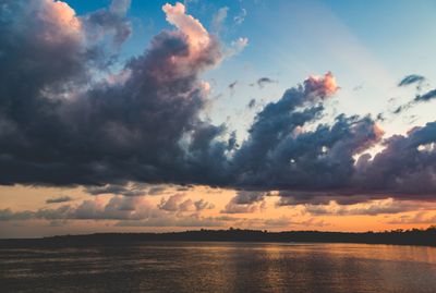
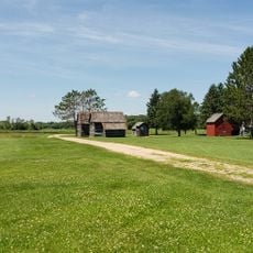
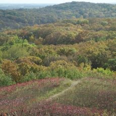
Lake Carlos State Park is a natural area in Douglas County covering approximately 1,305 acres with marshes, wetlands, and lakes surrounded by different types of forest. The lakes formed from ancient glacial movements and shape the overall landscape of the region.

The park was acquired by the state of Minnesota in 1937 during the Great Depression, following settlers who came to the area after the 1851 Traverse des Sioux treaty. This state purchase was part of efforts to preserve natural areas during difficult economic times.

The park offers a place where visitors can experience the different habitats that shape life in this part of Minnesota, from wetlands to forests and woodland ponds.

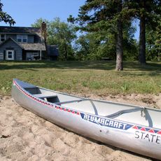
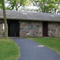
The park offers camping, hiking trails, swimming areas, and fishing spots for warmer months. Winter brings opportunities for cross-country skiing and snowshoeing, making it a year-round destination for outdoor activities.

The lakes in the park reach depths of around 150 feet (45 meters), making them unusually deep for this region. This depth is a direct result of the powerful glacial forces that carved the landscape during the Ice Age.

The community of curious travelers

AroundUs brings together thousands of curated places, local tips, and hidden gems, enriched daily by 60,000 contributors worldwide.

Start exploring
Location
Inception
1937
GPS coordinates
45.99750,-95.33639
Latest update
December 11, 2025 11:06
Around this place
Kensington Runestone
United States of America

Kensington Runestone

33.1 km
Inspiration Peak
United States of America

Inspiration Peak

24 km
Glendalough State Park
United States of America

Glendalough State Park

45.2 km
Sinclair Lewis Boyhood Home
United States of America

Sinclair Lewis Boyhood Home

41.3 km
Viking Altar Rock
United States of America

Viking Altar Rock

40.3 km
Church of St. Joseph-Catholic
United States of America

Church of St. Joseph-Catholic

37.5 km
Glenwood Public Library
United States of America

Glenwood Public Library

39 km
Minnesota Home School for Girls Historic District
United States of America

Minnesota Home School for Girls Historic District

40.8 km
Finn Creek Museum
United States of America

Finn Creek Museum

50.9 km
Hewitt Public School
United States of America

Hewitt Public School

41.6 km
Original Main Street Historic District
United States of America

Original Main Street Historic District

41.6 km
Todd County Courthouse, Sheriff's House, and Jail
United States of America

Todd County Courthouse, Sheriff's House, and Jail

36.9 km
Grey Eagle Village Hall
United States of America

Grey Eagle Village Hall

49.5 km
Prospect House
United States of America

Prospect House

43.4 km
Batcher Opera House Block
United States of America

Batcher Opera House Block

36.8 km
Grant County Courthouse
United States of America

Grant County Courthouse

49.5 km
Trinity Lutheran Church
United States of America

Trinity Lutheran Church

37.3 km
Roosevelt Hall
United States of America

Roosevelt Hall

43.8 km
Pope County Courthouse
United States of America

Pope County Courthouse

38.9 km
Hotel Reichert
United States of America

Hotel Reichert

36.9 km
Daniel Pennie House
United States of America

Daniel Pennie House

29.9 km
Dr. George R. Christie House
United States of America

Dr. George R. Christie House

36.6 km
Craigie Flour Mill Historical Marker
United States of America

Craigie Flour Mill Historical Marker

48.4 km
Fremad Association Building
United States of America

Fremad Association Building

39 km
Bridge L7075
United States of America

Bridge L7075

40.9 km
Bank of Long Prairie
United States of America

Bank of Long Prairie

36.9 km
Inspiration Peak State Wayside Park
United States of America

Inspiration Peak State Wayside Park

24.2 km
Lake Carlos State Park WPA/Rustic Style Historic District
United States of America

Lake Carlos State Park WPA/Rustic Style Historic District

637 m
Show the full map
« Lake Carlos State Park - State park in Douglas County, Minnesota » is provided by Around Us (aroundus.com). Images and texts are derived from Wikimedia project under a Creative Commons license. You are allowed to copy, distribute, and modify copies of this page, under the conditions set by the license, as long as this note is clearly visible.

Discover hidden gems everywhere you go!

From secret cafés to breathtaking viewpoints, skip the crowded tourist spots and find places that match your style. Our app makes it easy with voice search, smart filtering, route optimization, and insider tips from travelers worldwide. Download now for the complete mobile experience.

Around Us App Screenshot

A unique approach to discovering new places

Le Figaro

All the places worth exploring

France Info

A tailor-made excursion in just a few clicks

20 Minutes

Around Us
Travel Guide & Maps
Download

Send to your phone

QR Code
1

Open the camera app on your mobile.

2

Point at the QR code with your camera. A notification will appear.

3

Tap the notification to open the link.