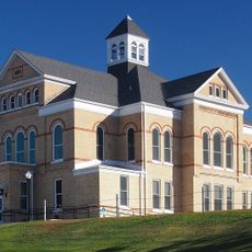
Hewitt Public School
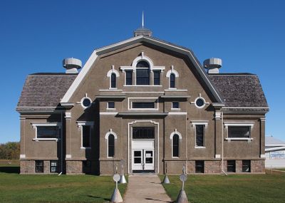
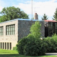
Hewitt Public School is a school building in Minnesota that operated from 1911 to 1979 and now houses a museum. The structure features a cross-shaped design with symmetrical windows, poured concrete walls covered in stucco, a granite foundation, and interior spaces including classrooms, an auditorium, offices, and a gymnasium added in 1952.
The building was constructed in 1911 to serve the growing town and farm families in the area following school district consolidation efforts. It closed in 1979 as enrollment declined, and was later converted into a museum by the Hewitt Historical Society.
The school was named after the town it serves and functioned as a community gathering place throughout its years of operation. Beyond classroom lessons, it hosted public health programs in the 1920s, farming education sessions, and wartime collection efforts that shaped local life.
The building sits in a quiet residential setting with older homes and trees nearby, making it easy to reach on foot. Multiple entrance points, a wide central staircase, and various accessible rooms allow visitors to explore the space and learn about local history at their own pace.
The structure was built with poured concrete and stucco in 1911, an unusual material choice that demonstrated fire-resistant construction at the time. This decision helped preserve the building in good condition for over a century.
The community of curious travelers
AroundUs brings together thousands of curated places, local tips, and hidden gems, enriched daily by 60,000 contributors worldwide.