Enable Location

We need your location to show you interesting places around you

Discover nearby places

Find interesting locations and hidden gems around you

Precise directions

Get accurate directions and distances to places

Your location is never shared with other users. It's only used when you tap the location button.

Mường Lay

Log in to your account

Start exploring — it's free

Trusted by 62,376 travelers worldwide

Continue with Google
Continue with Apple
or

We will send you a code to connect

By continuing, you accept our Terms and Conditions and our Privacy Policy

Check your inbox

We've sent a pincode in your inbox. Please enter the code below.

Mường Lay

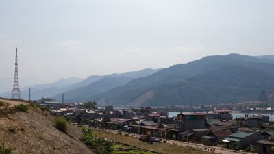
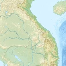
Mường Lay, District-level town in Điện Biên Province, Vietnam

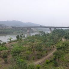
Mường Lay is a district-level town nestled in mountainous terrain where the Da River flows through its center. The settlement spreads across the valley with the river serving as the natural heart of the community.

The town was founded in 1971 as an administrative center for the surrounding region. The construction of a major reservoir afterward reshaped the landscape and settlement patterns significantly.

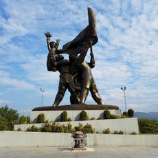
The Thai Trang people form the main community here, and their daily lives and traditions are visible throughout the town. You notice their homes, markets, and way of organizing community life woven into the local landscape.

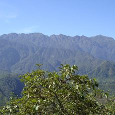
The best time to visit is during the dry season when mountain roads are more accessible and easier to navigate. Allow plenty of travel time since the routes wind through passes and the terrain demands careful driving.

The climate here swings between cold and hot extremes depending on the season, creating noticeably different conditions throughout the year. Visitors often find these temperature shifts more dramatic than expected for a mountain valley settlement.

The community of curious travelers

AroundUs brings together thousands of curated places, local tips, and hidden gems, enriched daily by 60,000 contributors worldwide.

Start exploring
Location
Inception
October 8, 1971
GPS coordinates
22.06778,103.15056
Latest update
December 8, 2025 13:44
« Mường Lay - District-level town in Điện Biên Province, Vietnam » is provided by Around Us (aroundus.com). Images and texts are derived from Wikimedia project under a Creative Commons license. You are allowed to copy, distribute, and modify copies of this page, under the conditions set by the license, as long as this note is clearly visible.

Discover hidden gems everywhere you go!

From secret cafés to breathtaking viewpoints, skip the crowded tourist spots and find places that match your style. Our app makes it easy with voice search, smart filtering, route optimization, and insider tips from travelers worldwide. Download now for the complete mobile experience.

Around Us App Screenshot

A unique approach to discovering new places

Le Figaro

All the places worth exploring

France Info

A tailor-made excursion in just a few clicks

20 Minutes

Around Us
Travel Guide & Maps
Download

Send to your phone

QR Code
1

Open the camera app on your mobile.

2

Point at the QR code with your camera. A notification will appear.

3

Tap the notification to open the link.