Kailali District, Administrative district in western Nepal
Kailali is an administrative district in western Nepal that covers an area of around 3,235 square kilometers across the Terai plain. The landscape spans from tropical lowlands to subtropical higher elevations, with Dhangadhi serving as the main administrative hub.
The area originally formed part of the Doti Kingdom before being contested during the Anglo-Nepalese war. It was returned to Nepal through the Sugauli Treaty in 1816.
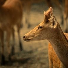
The Tharu people form a significant portion of the population and their language is commonly heard in everyday conversations across the district. Their traditions and ways of life shape what you see in local communities and how people gather together.
Dhangadhi, the main administrative hub, serves as the best starting point for exploring the district with good connections to other areas. The varying elevation zones mean different climates and landscapes depending on where you travel within the district.
The district has dramatic elevation changes ranging from tropical plains below 300 meters to subtropical regions above 1,000 meters. These sharp differences create distinctly different landscapes and living conditions across relatively short distances.
The community of curious travelers
AroundUs brings together thousands of curated places, local tips, and hidden gems, enriched daily by 60,000 contributors worldwide.