Pantabangan Dam

Log in to your account

AroundUs is a community-driven map of interesting places, built by curious explorers like you. It grows with every review, story, and photo you share.
Connect to save your favorite spots, contribute locations, and create personalized routes.
By continuing, you accept our Terms and Conditions and our Privacy Policy

Pantabangan Dam

Add to collection
Map
Suggest a change
Share

Pantabangan Dam, Embankment dam in Pantabangan, Nueva Ecija, Philippines.

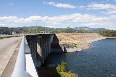
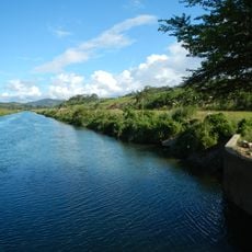
Pantabangan Dam is an earth-fill dam that extends across the Pampanga River for approximately 1,615 meters and rises about 107 meters in height. The reservoir stores water for irrigation systems and hydroelectric power generation.

Construction of Pantabangan Dam began in 1971 and was completed in 1976, resulting in the relocation of around 1,300 residents from the original settlement. The project represented a major infrastructure undertaking for the region.

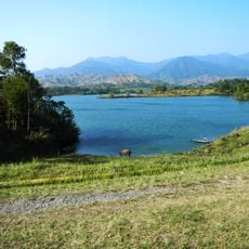
The submerged town of Pantabangan becomes visible at low water levels, revealing the cross of the Saint Andrew Church from 1825. This landmark shows how the area looked before the water covered it.

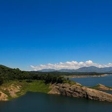
The dam can be visited from the shoreline, where you can see the full expanse of water and the structure itself. It is best to visit during clear weather and wear comfortable shoes, as walking paths surround the site.

The structure was built with special features designed to withstand earthquakes up to magnitude 8. This was an important consideration during construction in this seismically active region.

Inception: 1977

Elevation above the sea: 237 m

Length: 1,615 m

GPS coordinates: 15.81444,121.10806

Latest update: December 7, 2025 19:31

Photos
Around this place
Show the full map
Cabanatuan American Memorial
Philippines

Cabanatuan American Memorial

34.6 km
Aurora Memorial National Park
Philippines

Aurora Memorial National Park

29.2 km
Cabanatuan Cathedral
Philippines

Cabanatuan Cathedral

39.4 km
Pantabangan–Carranglan Watershed Forest Reserve
Philippines

Pantabangan–Carranglan Watershed Forest Reserve

7 km
Mount Guiwan
Philippines

Mount Guiwan

24 km
Casecnan Protected Landscape
Philippines

Casecnan Protected Landscape

43.9 km
Cuyapo, Nueva Ecija historical marker
Philippines

Cuyapo, Nueva Ecija historical marker

47.5 km
Baler Church
Philippines

Baler Church

49 km
Death Place of General Antonio Luna historical marker
Philippines

Death Place of General Antonio Luna historical marker

39.4 km
Doña Aurora Aragon-Quezon House
Philippines

Doña Aurora Aragon-Quezon House

49.1 km
Church of Baler historical marker
Philippines

Church of Baler historical marker

49 km
Nueva Ecija High School historical marker
Philippines

Nueva Ecija High School historical marker

39 km
Dikaloyungan historical marker
Philippines

Dikaloyungan historical marker

50.3 km
Lt. Gilmore Rescue Party historical marker
Philippines

Lt. Gilmore Rescue Party historical marker

49.1 km
Siege of the Church of Baler historical marker
Philippines

Siege of the Church of Baler historical marker

49.1 km
Aurora Aragon Quezon historical marker
Philippines

Aurora Aragon Quezon historical marker

49.1 km
Birthplace of Manuel Luis Quezon historical marker
Philippines

Birthplace of Manuel Luis Quezon historical marker

49 km
Cathedral of Saint Joseph the Worker
Philippines

Cathedral of Saint Joseph the Worker

12.9 km
Battle of Balete Pass historical marker
Philippines

Battle of Balete Pass historical marker

40.3 km
Town of Baler historical marker
Philippines

Town of Baler historical marker

49.1 km
Central Luzon State University historical marker
Philippines

Central Luzon State University historical marker

21.2 km
Baler Municipal Hall
Philippines

Baler Municipal Hall

49.1 km
Memorare historical marker (Raid at Cabanatuan)
Philippines

Memorare historical marker (Raid at Cabanatuan)

34.5 km
Rancho Caridad historical marker
Philippines

Rancho Caridad historical marker

51 km
Lazaro Francisco historical marker
Philippines

Lazaro Francisco historical marker

39.8 km
General Manuel Tinio historical marker
Philippines

General Manuel Tinio historical marker

41.1 km
Quezon Park
Philippines

Quezon Park

49 km
MGL Hotel & Resort
Philippines

MGL Hotel & Resort

37.4 km
Show the full map
Reviews

Visited this place? Tap the stars to rate it and share your experience / photos with the community! Try now! You can cancel it anytime.

« Pantabangan Dam - Embankment dam in Pantabangan, Nueva Ecija, Philippines » is provided by Around Us (aroundus.com). Images and texts are derived from Wikimedia project under a Creative Commons license. You are allowed to copy, distribute, and modify copies of this page, under the conditions set by the license, as long as this note is clearly visible.

Discover hidden gems everywhere you go!

From secret cafés to breathtaking viewpoints, skip the crowded tourist spots and find places that match your style. Our app makes it easy with voice search, smart filtering, route optimization, and insider tips from travelers worldwide. Download now for the complete mobile experience.

Around Us App Screenshot

A unique approach to discovering new places

Le Figaro

All the places worth exploring

France Info

A tailor-made excursion in just a few clicks

20 Minutes