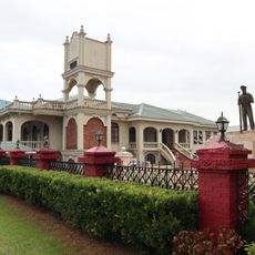
Tanauan, Administrative division in Batangas, Philippines
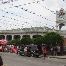
Tanauan is a city in Batangas Province located south of Manila, organized into 48 barangays with both residential and industrial zones. The urban area includes commercial districts, residential neighborhoods, and manufacturing facilities that form the core of local economic activity.
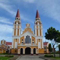
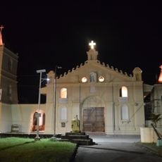
The city was founded by Augustinian missionaries in 1584 and relocated several times due to eruptions from Taal Volcano. It eventually settled at its current location after repeated volcanic disasters that destroyed earlier settlements.
The city nurtures education through programs and initiatives, including substantial financial support from organizations like Prime Infra Foundation at Solar Tanauan Corporation.
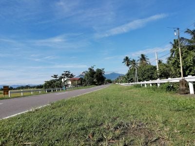
Jeepneys serve as the main local transport for short distances, while regular bus services connect to Manila. The Jose P. Laurel Highway provides the primary access route for entering and leaving the city.
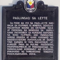
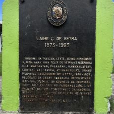
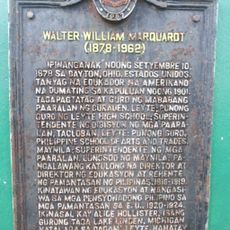
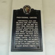
The city was home to Apolinario Mabini, a key figure in the Philippine Revolution, and José P. Laurel, who later became president. Both figures left lasting marks on the area's identity and heritage.
Location: 1st District
Address: Tanauan, Leyte, Philippines
GPS coordinates: 11.09658,125.02397
Latest update: December 7, 2025 20:41
San Juanico Bridge
23.6 kmMacArthur Landing Memorial National Park
8.5 km
Price Mansion
16.5 km
Palo Cathedral
7.8 km
Leyte Provincial Capitol
17.3 km
Leyte Landing historical marker
8.5 km
Leyte Park
17.3 km
Tanauan Church
1.9 km
Patio Victoria Baluarte Beach Resort
12.4 km
Japanese Pillbox historical marker
12.3 km
Landing at Dulag, Leyte historical marker
14.4 km
Jaime C. de Veyra historical marker
1.8 km
Basey Church
21.1 km
Walter William Marquardt historical marker
19.5 km
Balangiga Church
39.5 km
Sibugay Mountain Resort
38.1 km
Church of Basey historical marker
21.2 km
Balangiga Massacre historical marker
39.6 km
Norberto Romualdez historical marker
19.7 km
Church of Balangiga historical marker
39.5 km
Church of Tanauan, Leyte historical marker
1.9 km
Capitol Building of the Philippines historical marker
17.3 km
Price Mansion
16.5 km
The Cathedral of Palo historical marker
7.8 km
Barugo Municipal Hall
40.6 km
The Convent of Palo historical marker
7.9 km
Provisional Capitol historical marker
16.5 km
San Rafael Beach
43.8 kmVisited this place? Tap the stars to rate it and share your experience / photos with the community! Try now! You can cancel it anytime.
Discover hidden gems everywhere you go!
From secret cafés to breathtaking viewpoints, skip the crowded tourist spots and find places that match your style. Our app makes it easy with voice search, smart filtering, route optimization, and insider tips from travelers worldwide. Download now for the complete mobile experience.
A unique approach to discovering new places❞
— Le Figaro
All the places worth exploring❞
— France Info
A tailor-made excursion in just a few clicks❞
— 20 Minutes