Coffre ${chestReward.rarityLabel}
+${chestReward.xp} XP
Explorer
NOUVEAU ×${chestReward.collectible.quantity}
tapez pour fermer

Enable Location

We need your location to show you interesting places around you

Discover nearby places

Find interesting locations and hidden gems around you

Precise directions

Get accurate directions and distances to places

Your location is never shared with other users. It's only used when you tap the location button.

Stavropol Upland

Log in to your account

Start exploring — it's free

Trusted by 70,157 travelers worldwide

Continue with Google
Continue with Apple
or

We will send you a code to connect

By continuing, you accept our Terms and Conditions and our Privacy Policy

Check your inbox

We've sent a pincode in your inbox. Please enter the code below.

Stavropol Upland
Discussion Reviews 1 Photos
10.4k Popularity

Stavropol Upland, Elevated plateau in southwestern Russia.

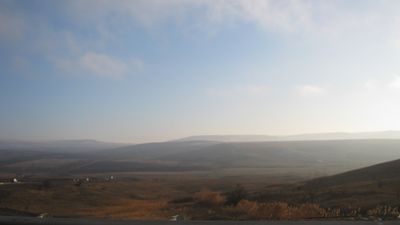
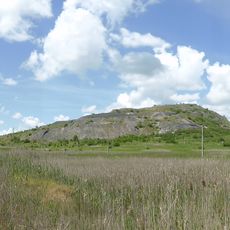
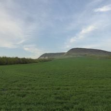
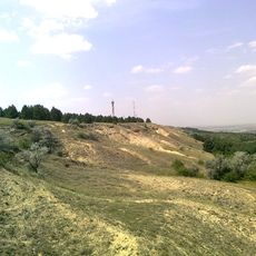
Stavropol Upland is an expansive plateau spread across southwestern Russia, characterized by limestone and sandstone tablelands. Elevations vary between 300 and 600 meters, creating a gently rolling landscape that defines the region's visual character.

This upland has served as a natural boundary between the Caucasus Mountains and the Russian plains for centuries, shaping movement and exchange in the region. Its position influenced how communities developed and how the landscape was eventually settled.

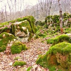
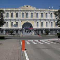
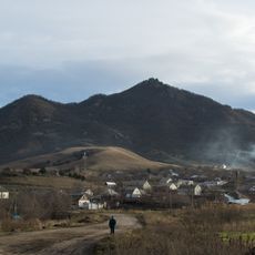
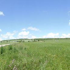
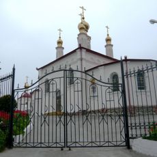
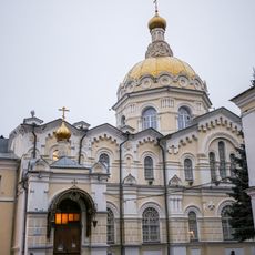
Several ethnic communities have shaped the region through traditional farming practices and ways of living that remain visible in the landscape today. Small villages and cultivated fields reflect how people have adapted their daily routines to the rolling terrain.

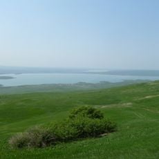
The southeastern area near Mineralnye Vody and Pyatigorsk contains natural mineral springs that attract visitors seeking out these natural water sources. Exploring this zone works best when you plan ahead to find the specific locations and facilities available in the area.

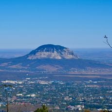
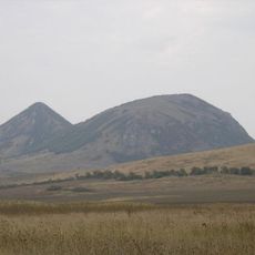
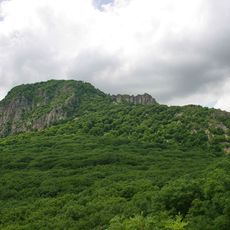
Mount Beshtau rises prominently from the surrounding terrain, reaching approximately 1,400 meters in height. This distinctive peak often goes unnoticed by visitors focused on the broader tablelands, yet it marks an important visual landmark in the Mineralnye Vody-Pyatigorsk area.

The community of curious travelers

AroundUs brings together thousands of curated places, local tips, and hidden gems, enriched daily by 60,000 contributors worldwide.

Start exploring
Part of
იმიერკავკასიის ვაკე
GPS coordinates
44.93333,42.66667
Latest update
December 10, 2025 15:54
Around this place
Strizhament
Russian Federation

Strizhament

51.8 km
Gora Zmeyka
Russian Federation

Gora Zmeyka

91.8 km
Sengiley reservour
Russian Federation

Sengiley reservour

73.8 km
Stavropol Local Museum
Russian Federation

Stavropol Local Museum

56.4 km
Verblyud
Russian Federation

Verblyud

83.7 km
Cathedral of the Kazan Icon of the Mother of God
Russian Federation

Cathedral of the Kazan Icon of the Mother of God

55.7 km
Kinzhal
Russian Federation

Kinzhal

78.8 km
Russian Federation

Kubansk Reservoir

83.9 km
Dynamo Stadium
Russian Federation

Dynamo Stadium

56.2 km
Gora Razvalka
Russian Federation

Gora Razvalka

91.6 km
Stavropol Drama Theatre
Russian Federation

Stavropol Drama Theatre

56.5 km
Byk
Russian Federation

Byk

86.6 km
Bryk
Russian Federation

Bryk

41.5 km
Stavropol Library
Russian Federation

Stavropol Library

56.2 km
Kutsay Mountain
Russian Federation

Kutsay Mountain

46.8 km
Mount Kokurtly
Russian Federation

Mount Kokurtly

78 km
Lycée classique de Stavropol
Russian Federation

Lycée classique de Stavropol

55.5 km
Church of the Annunciation
Russian Federation

Church of the Annunciation

88.4 km
Saint Gregory the Illuminator Church
Russian Federation

Saint Gregory the Illuminator Church

54.8 km
Церковь Святого Николая Чудотворца (Минеральные Воды)
Russian Federation

Церковь Святого Николая Чудотворца (Минеральные Воды)

88.4 km
Церковь равноапостольной княгини Ольги (Железноводск)
Russian Federation

Церковь равноапостольной княгини Ольги (Железноводск)

92 km
Храм Апостолов Петра и Павла (Светлоград)
Russian Federation

Храм Апостолов Петра и Павла (Светлоград)

46.8 km
Stavropol stud
Russian Federation

Stavropol stud

53.7 km
Дом Алиева (Черкесск)
Russian Federation

Дом Алиева (Черкесск)

92.3 km
Saint Andrew Orthodox church in Stavropol
Russian Federation

Saint Andrew Orthodox church in Stavropol

56.9 km
Monument to Soviet soldiers in Cherkessk
Russian Federation

Monument to Soviet soldiers in Cherkessk

92.1 km
Theater of the Mesnyankin Brothers
Russian Federation

Theater of the Mesnyankin Brothers

55.3 km
Yegorlykskoye Vodokhranilishche
Russian Federation

Yegorlykskoye Vodokhranilishche

81.9 km
Show the full map
Reviews
Share your experience

No review yet

Discussions
Start a discussion...

No discussion yet

« Stavropol Upland - Elevated plateau in southwestern Russia » is provided by Around Us (aroundus.com). Images and texts are derived from Wikimedia project under a Creative Commons license. You are allowed to copy, distribute, and modify copies of this page, under the conditions set by the license, as long as this note is clearly visible.

Discover hidden gems everywhere you go!

From secret cafés to breathtaking viewpoints, skip the crowded tourist spots and find places that match your style. Our app makes it easy with voice search, smart filtering, route optimization, and insider tips from travelers worldwide. Download now for the complete mobile experience.

Around Us App Screenshot

A unique approach to discovering new places

Le Figaro

All the places worth exploring

France Info

A tailor-made excursion in just a few clicks

20 Minutes

Around Us
Travel Guide & Maps
Download

Send to your phone

QR Code
1

Open the camera app on your mobile.

2

Point at the QR code with your camera. A notification will appear.

3

Tap the notification to open the link.