See the monuments around you in AROpen chests in the app
Around Us is built for your phone — point your camera at the streets and discover the monuments and places around you in augmented reality.Around Us is built for your phone — chests unlock when you walk, explore and capture nearby places.
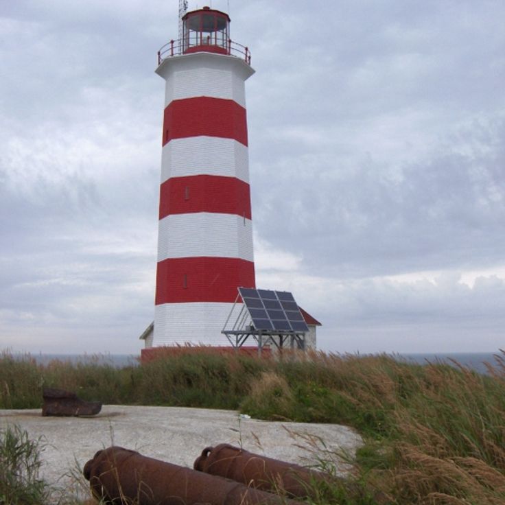
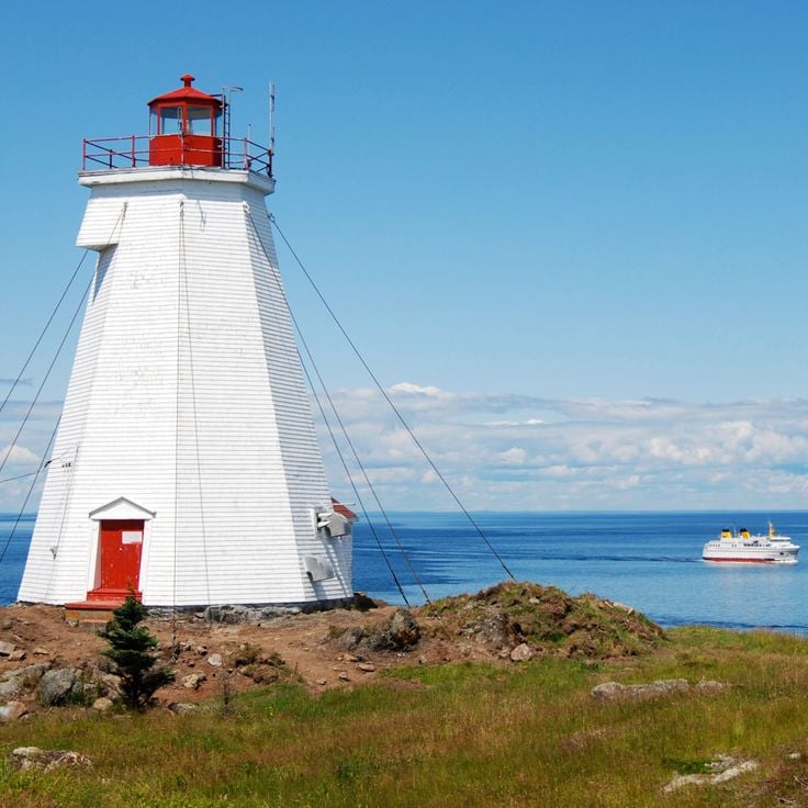
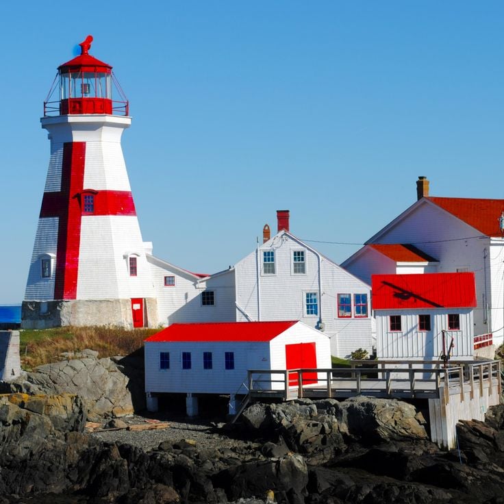
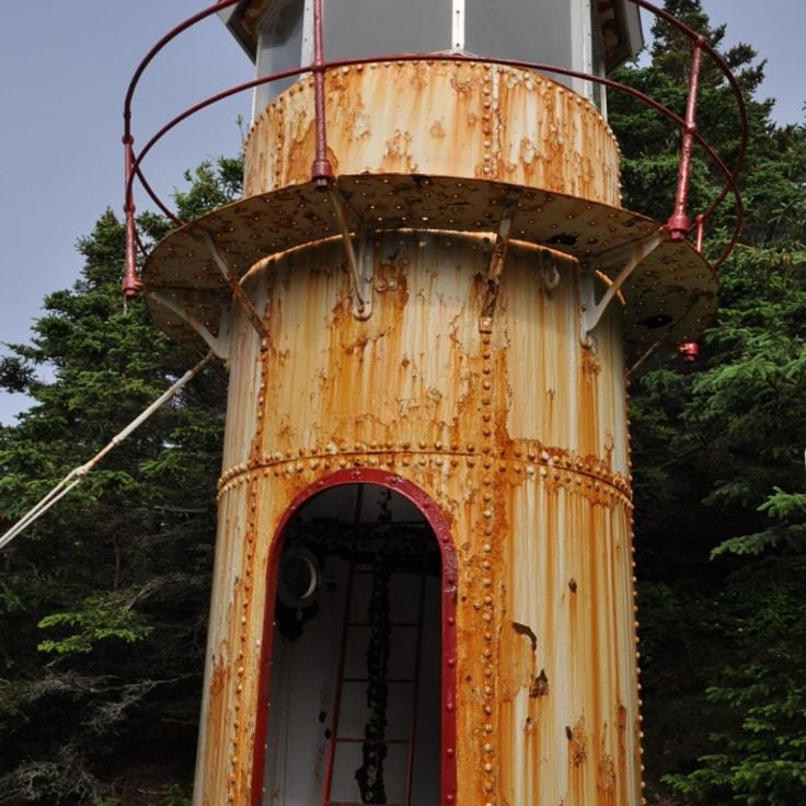
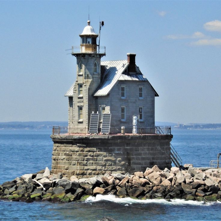
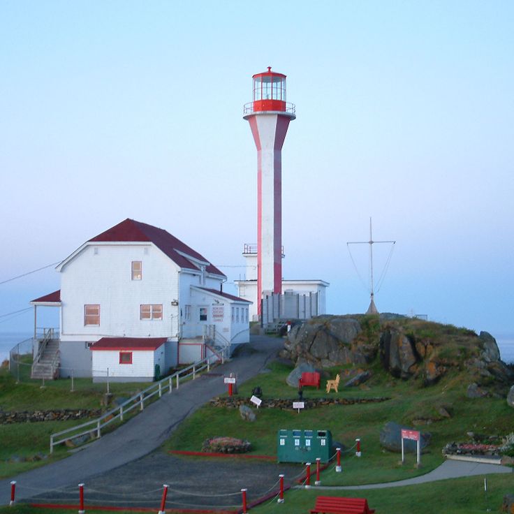
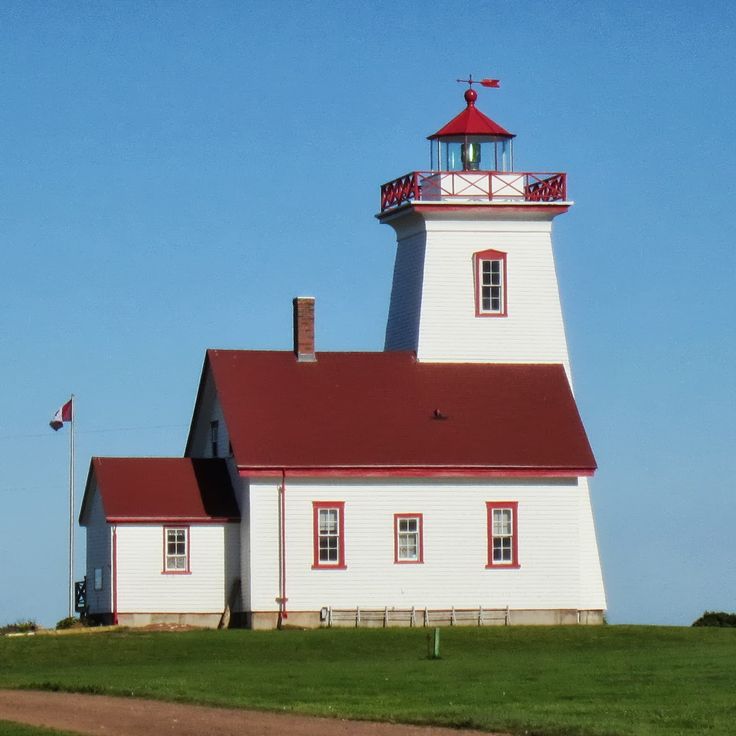
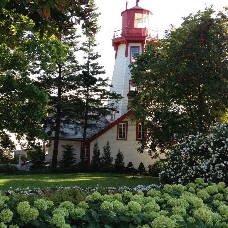
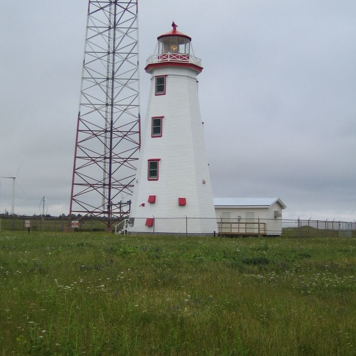
Lighthouses of Canada: maritime navigation and coastal history
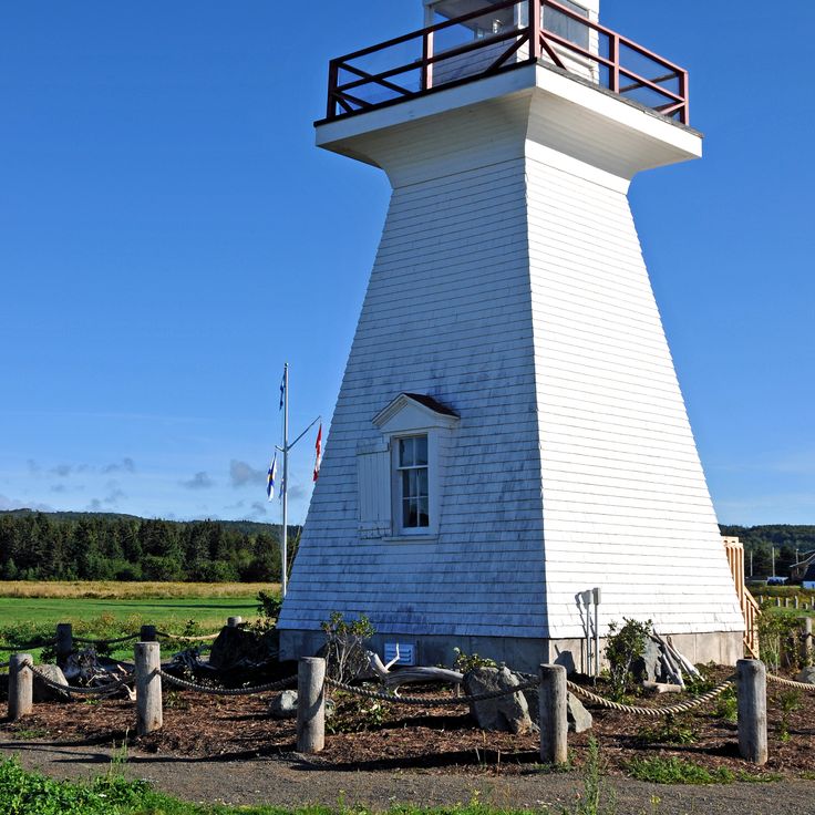
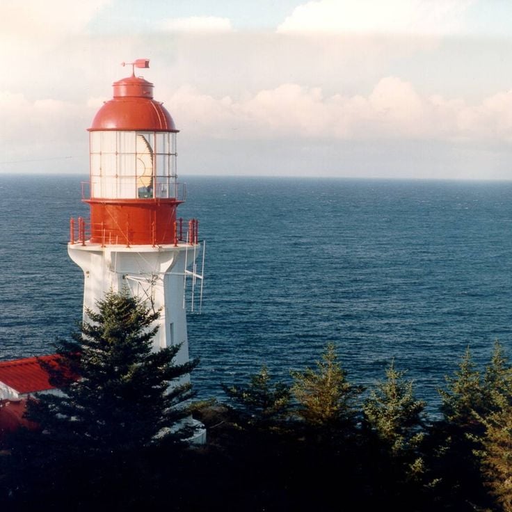
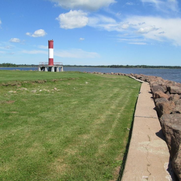
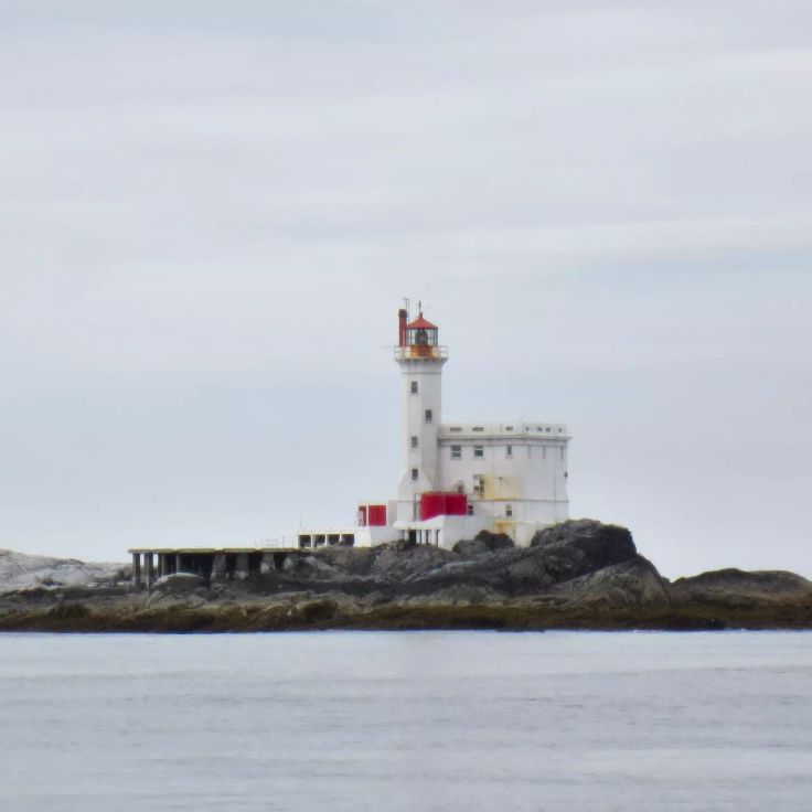
Canada's lighthouses stand as markers of maritime history, guiding ships through dangerous waters for generations. These towers line the country's coasts, from the foggy shores of Nova Scotia to the rocky cliffs of British Columbia. Peggy's Point Lighthouse, Cape Spear, and Cape Bonavista are among the most recognized, but every lighthouse tells a story of navigation, survival, and human determination. Their colors - red and white stripes, solid red, solid white - helped sailors identify them in storms and fog. Each light served as a lifeline for fishing boats, merchant vessels, and mariners making their way through treacherous seas.
These structures represent generations of lighthouse keepers who lived in remote locations, tending the beams night and day. They were often the only people for miles around, managing the lights and recording weather and ship movements. From Sambro Island off Halifax to Race Rocks near Victoria, each lighthouse tells of the people who made their homes there and the vessels they helped bring safely to shore. Today, many are automated, but they remain important landmarks that reveal how communities adapted to life by the sea and how human ingenuity solved the challenge of safe passage through difficult waters.
Lighthouses of Canada: maritime navigation and coastal history
Canada's lighthouses stand as markers of maritime history, guiding ships through dangerous waters for generations. These towers line the country's coasts, from the foggy shores of Nova Scotia to the rocky cliffs of British Columbia. Peggy's Point Lighthouse, Cape Spear, and Cape Bonavista are among the most recognized, but every lighthouse tells a story of navigation, survival, and human determination. Their colors - red and white stripes, solid red, solid white - helped sailors identify them in storms and fog. Each light served as a lifeline for fishing boats, merchant vessels, and mariners making their way through treacherous seas.
These structures represent generations of lighthouse keepers who lived in remote locations, tending the beams night and day. They were often the only people for miles around, managing the lights and recording weather and ship movements. From Sambro Island off Halifax to Race Rocks near Victoria, each lighthouse tells of the people who made their homes there and the vessels they helped bring safely to shore. Today, many are automated, but they remain important landmarks that reveal how communities adapted to life by the sea and how human ingenuity solved the challenge of safe passage through difficult waters.
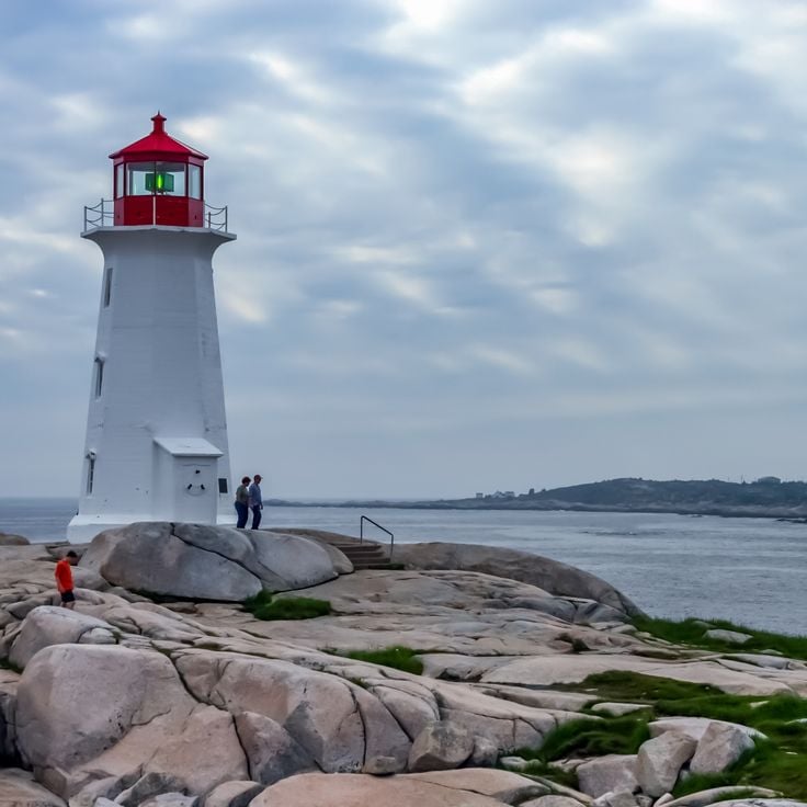
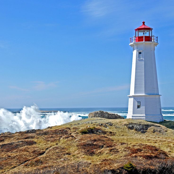
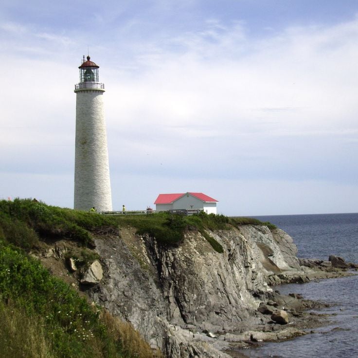
This lighthouse stands on smooth granite rocks that drop directly into the sea. The white tower was built to guide ships through the rocky coast. Waves break right at the foundation, and on windy days spray reaches up to the lantern. Visitors come here to see the light and walk on the rocks, watching where they step. The surrounding area is bare, with little vegetation between the stone formations. Fishermen know this coast well and use the beacon to find their way back. The building looks simple and functional, without ornament. From here the Atlantic stretches to the horizon, and you feel the vastness of the ocean.
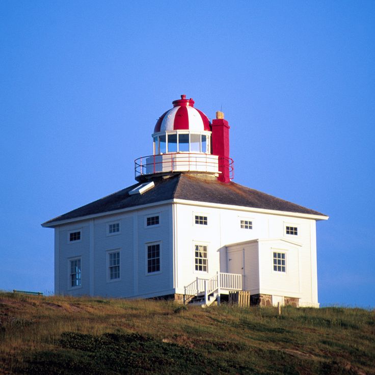
The lighthouse at Cape Spear stands on the easternmost point of North America, overlooking the shipping routes of the Atlantic. The stone structure was built in the eighteen thirties to guide vessels along this exposed stretch of coast, where fog and currents made navigation difficult. From the rocks where the tower sits, there is nothing but open water to the east, and the light turned here for decades to warn captains away from the cliffs. Waves break constantly against the rock formation, and wind blows straight off the ocean. The place gives the sense of standing at the edge of the continent, where land ends and sea begins. Walking paths circle the site, and on clear days you can sometimes see icebergs drift past. The building itself is plain and functional, constructed to withstand the harsh conditions that prevail here throughout the year.
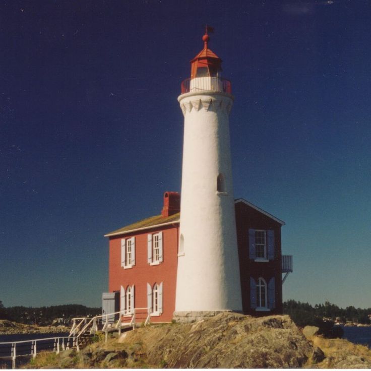
The Fisgard Lighthouse shows its red and white facade at the entrance to Esquimalt Harbour. This lighthouse was the first built on the west coast of the country, and since its completion in 1860 it has warned ships of the rocks and currents in the Strait of Juan de Fuca. The square brick tower stands on a rocky outcrop surrounded by the cold waters of the Pacific. The adjoining keeper's house sits right at the water's edge and forms a compact station with the tower. From the outside, the building looks sturdy and functional, built to withstand wind and waves. The lighthouse is now part of a historic site that also includes the remains of Fort Rodd Hill. Visitors can walk along the shoreline and watch the passing ships while the tower continues to watch over the channel.
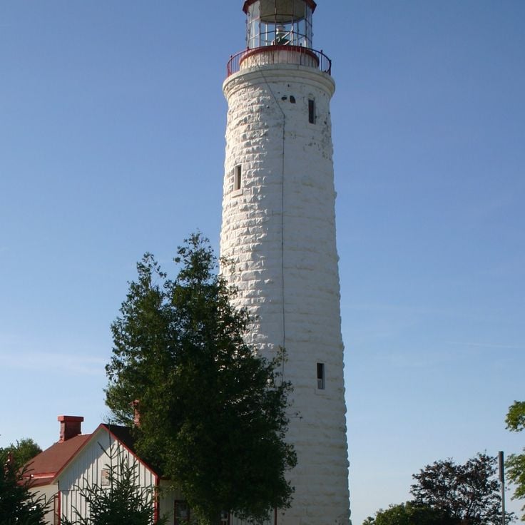
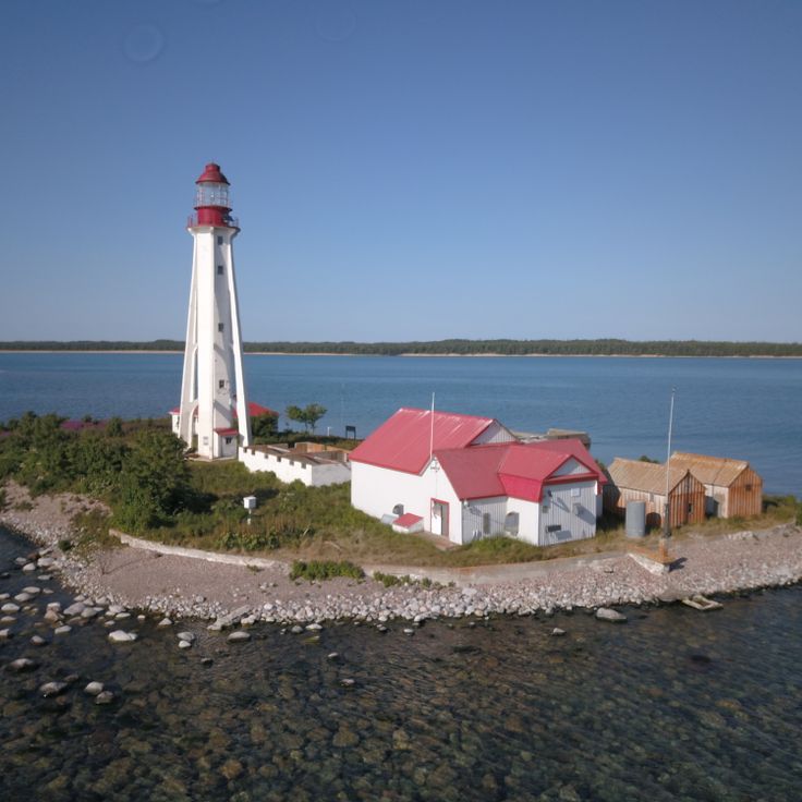
Point Clark Lighthouse stands on the eastern shore of Lake Huron, marking a stretch of coast that once challenged sailing ships and steamers. Its walls of pale limestone were raised in the middle of the nineteenth century to guide vessels through the shifting winds and currents of the Great Lakes. The design follows a pattern repeated along Canadian waters at the time: a solid tower with a beacon at the top, lighting the night. Seen from the shore, the tower rises like a quiet guardian over the flat water. The surroundings consist of pebble beaches and low trees that bend in the wind. Those who approach the lighthouse feel the expanse of the lake and the stillness broken only by the waves. It is among the few remaining structures of its kind on Huron, telling of a time when lake traffic shaped the life of the region.
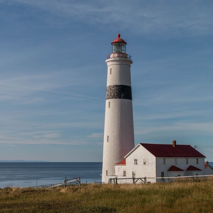
The lighthouse at Point Amour was built in the mid nineteenth century from pale limestone and stands on the coast of Labrador where it watches over the strait. The stone platform walls are simple and thick to resist wind and waves. A narrow staircase climbs inside the tower, which rises above the rocky landscape. From the top, the view over the water is wide, and the light has marked the route for vessels navigating between the gulf and the open Atlantic. The rough coast around it remains bare and exposed, with low growth between the stones. This lighthouse is among the tallest of its kind in the country and has served as a guide for maritime passage for more than a century and a half.
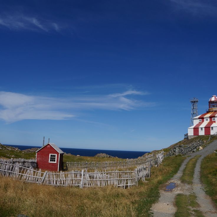
The Louisbourg lighthouse was built in 1734 and was the first of its kind in Canada. The structure marks the early importance of shipping in the North Atlantic and shows how French colonial authorities sought to secure access to the fortified town. The tower stood at the harbor entrance and guided vessels through the often foggy and treacherous waters off the island coast. Because of its position on the shores of Cape Breton, this lighthouse played a central role in protecting trade routes between Europe and North America.
The Cape Bonavista lighthouse was built in 1843 and sits on a rocky headland facing the Atlantic. The red and white striped exterior stands out against the gray stone and the water. Inside, the rooms display furnishings from the mid 19th century: wooden furniture, tools and everyday objects that the keepers once used. You get a sense of how life unfolded here, far from settlements, shaped by weather and tides. The spiral stairs lead up to the lantern that has guided sailors for more than a century and a half. From the top you see the jagged coastline, waves breaking on the rocks, and sometimes whales or icebergs passing offshore. The quiet is broken only by wind and the sound of water.
The lighthouse on Sambro Island has stood at the entrance to Halifax Harbor since 1758 and continues to guide ships to this day. It is the oldest working lighthouse in the country. The stone walls of the structure have endured Atlantic storms for many generations. The building sits on a rocky outcrop surrounded by the cold waters of the North Atlantic. This position was crucial for navigation along the Nova Scotia coast, where fog and rough seas made passage difficult. The tower marks the transition between the open ocean and the sheltered harbor. The setting consists of bare granite, seaweed and the constant rhythm of waves breaking against the shore. For ships, the light from this lighthouse meant the first safe bearing after long weeks at sea. The structure remains one of the few witnesses to early settlement along this coast and to the history of maritime connections between North America and Europe.
The Swallowtail lighthouse was built in 1860 on the coast of Grand Manan to guide ships entering North Head harbor. The white tower with a red roof stands on a rocky point that becomes nearly surrounded by water at high tide. The path to the lighthouse descends through a steep stairway along the cliff face. At low tide, visitors can explore the tidal pools around the base. Island fishermen have relied on this beacon for over a century. From here, you look out over the Bay of Fundy with its strong currents and dramatic tides. This lighthouse is one of the maritime landmarks along the Canadian Atlantic coast, where dozens of such towers mark the difficult passages.
The Head Harbour Lighthouse has stood on a rock in the tidal current off Campobello Island since 1829, and is only reachable over land at low tide. The white tower with its octagonal shape and red lantern rises above the cold water of the Bay of Fundy, where the strongest tides in the world raise and lower the sea several yards twice each day. At high tide the access disappears under the waves and the rocks around the lighthouse become almost completely submerged. The few hours of low water open a narrow passage over which visitors can make their way across seaweed and slippery stones to the base of the tower. The lighthouse has guided ships through the fog-draped waters along the border between New Brunswick and Maine for nearly two centuries. Its position on the isolated rock shows how far lighthouse keepers had to go to maintain maritime safety in this dangerous passage.
Great Northern Peninsula, Newfoundland and Labrador, Canada
The Cow Head lighthouse has stood on this exposed stretch of coast since 1909, guiding ships past a series of hidden reefs. The cylindrical wooden structure rises from a rocky point where wind rarely stops and waves crash against granite ledges. It was built to warn fishermen and cargo vessels about the shallow rocks that become especially dangerous during rough weather. The area remains remote, with few houses nearby and long stretches of open shoreline. From this spot, the view stretches far over the Atlantic without much shelter from the storms that regularly push in from the ocean. The lighthouse now operates automatically, but its presence recalls how essential these markers were for sailors navigating this rugged northern peninsula.
This lighthouse has stood on top of a cliff above the Minas Basin since 1914. Its position offers wide views over water known for strong tides. The surrounding area shows rough rock formations rising from the sea. The tower marks a point where ships have navigated for more than a century. The place connects the maritime history of the region with the power of the Nova Scotia coast.
The Langara Point lighthouse has stood at the northern entrance to the Inside Passage since 1913, guiding vessels that travel this route. The coastal waters off the northern tip of Haida Gwaii are often wrapped in fog and churned by rough seas. The beacon warns of rocks and helps ships find their way when visibility drops. The station sits on a remote headland surrounded by water and forest. Waves crash against the cliffs while seabirds wheel overhead. The isolation of this place gives a sense of remoteness common to many Pacific lighthouse stations. Visitors who reach here see the ocean stretching wide and experience the conditions under which lighthouse keepers once worked.
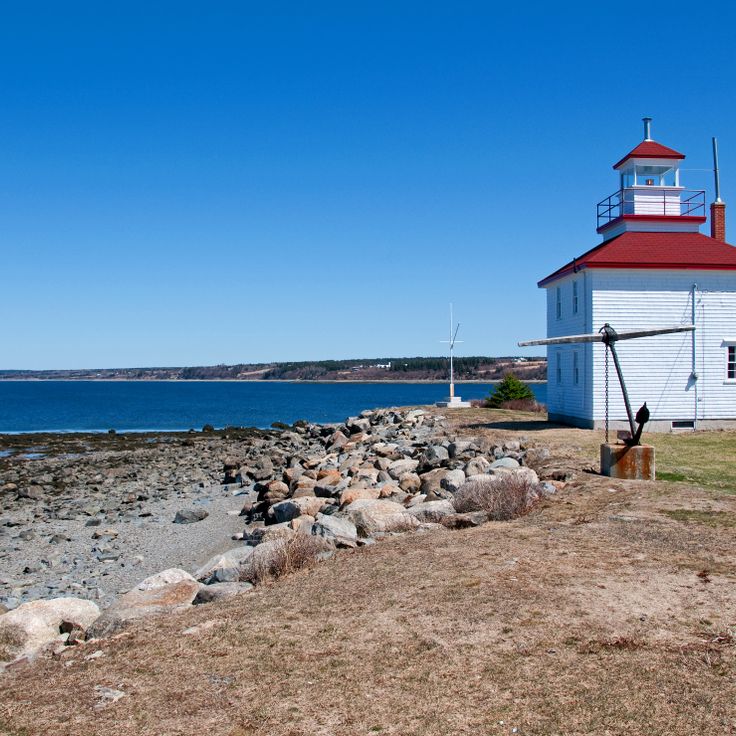
The Fort Point lighthouse stands at the mouth of the LaHave River and has guided ships since 1855. The white wooden structure rises above a rocky shore where the river meets the Atlantic. At this point, the calmer waters of the LaHave encounter the open sea, and the building long marked an important entry for fishing boats and trading vessels navigating the Nova Scotia coast. The tower belongs among the older beacons in the country and recalls a time when small coastal communities depended on maritime traffic. From here, you can look across the water and the forested shores that stretch along the river mouth.
This lighthouse stands on a rocky reef in the open sea, warning ships of difficult waters along this northern coast. Built on bare stone washed by waves, it marks the dangers of a passage many sailors fear. Fog and heavy swells arrive often, and the light cuts through these conditions to show the route. Access to the reef remains difficult, and the station feels like an outpost at the edge of the inhabited world. The surrounding landscape offers only rock and ocean, without any vegetation or shelter from the elements.
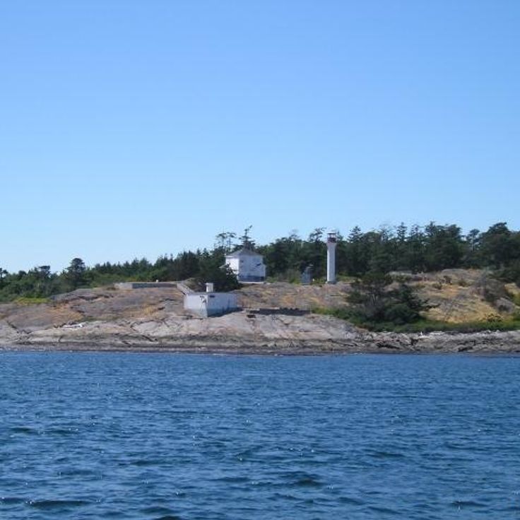
The Race Rocks lighthouse stands on a cluster of rocky islets off Vancouver Island, where the water narrows between the island and the mainland. The currents here run fast and unpredictable, making the spot treacherous for ships. The square granite tower was built in the 1860s and became one of the first beacons on Canada's Pacific coast. A protected marine area surrounds the station, where sea lions haul out on the rocks and seabirds nest in large numbers. The sound of waves mixes with the calls of animals. The site remains both a witness to maritime history and a refuge for Pacific wildlife.
The Cape Forchu lighthouse stands with a shape that sets it apart from the round towers common along other shores. The concrete structure rises like an inverted cone above the rocky coastline, marking the approach to Yarmouth harbour. Its light turns high above the water, guiding vessels through the currents off the southwestern tip of Nova Scotia. Flat granite slabs spread around the base, reaching down to the edge of the sea, and a few low white wooden buildings sit nearby. On clear days the view stretches far across the Bay of Fundy, where tides and currents run strong. The place feels like a working piece of the coast, built to serve a purpose rather than to charm, with wind sweeping across the open ground and gulls circling overhead.
The Wood Islands lighthouse stands on the southern shore of the island and watches over the approach to Northumberland Strait. The white building holds a collection of maritime objects and photographs documenting life along the coast. The display includes old tools, navigation instruments, and images of vessels that passed through these waters. From outside, you can see the red lantern room rising against the sky and the meadows stretching down to the water. The site sits near the ferry route to Nova Scotia and recalls the time when this lighthouse guided ships traveling between the provinces.
The Kincardine lighthouse was built in the late 19th century, when traffic on Lake Huron grew heavier and the harbor entrance required a clear signal. The lake shore here shows flat beaches and low bluffs, where the water looks calmer than the Atlantic yet fog and storms tested the skills of captains. The tower stands close to the shore and marks the approach to the harbor, which handled shipments of timber and grain. Today the building holds an exhibit on navigation across the Great Lakes, with charts, instruments and accounts from crews. Visitors can trace how ships found their way before radar and electronics became available. The area around the lighthouse is flat and green, with views over the open water that on some days resembles a sea.
This tall lighthouse was built in the middle of the nineteenth century to guide ships into the great waterway leading inland. The white stone facade stands out against the sky and the water. The tower rises at an exposed point where wind and waves meet the shore. From here you can look over open water and take in the breadth of the horizon. The lighthouse at Cap-des-Rosiers has been serving its purpose for more than a century and a half and remains a landmark for vessels entering the Saint Lawrence River.
The Gibraltar Point lighthouse was built in stone in 1808 and stands on the western side of the Toronto Islands. Lake Ontario waves lap against the shoreline just a few steps from the tower foundation. The location marks a passage used by sailing ships and steamers approaching the harbor. The gray walls carry traces of two centuries of wind and weather. From here you can see the lake stretching to the horizon and the city visible beyond the island trees. The lighthouse remains among the oldest surviving structures along the Toronto waterfront and recalls a time when the water route was the most important thoroughfare in the region.
The Port Bickerton lighthouse was built in 1901 to guide ships approaching the rocky coast of Nova Scotia. Today this structure houses a museum that tells the story of maritime life in the region. Inside, the rooms display photographs, tools and equipment that speak to the daily work of fishermen and crews who lived along this shore. The building is simple and painted white with a red lantern at the top, visible from the road. The surrounding landscape is shaped by wind, with the sea constantly breaking against the cliffs. This lighthouse is one of many sentinels that were raised along the Canadian Atlantic coast to mark dangerous passages and harbor entrances.
The white wooden tower was built in 1886 to mark the passage through the Juan de Fuca Strait. Discovery Island Lighthouse stands at the eastern tip of the island, where currents shift and ships need to stay alert. It became one of the early beacons along this western shore and guided vessels traveling between Vancouver Island and the mainland. The tower still rises above the rocky shore, and from there you can watch the sea move against the granite outcrops with the forested hills of Vancouver Island visible across the water.
The Caribou Island lighthouse stands on a small island in Lake Superior and was built in 1912 to guide ships through dangerous waters. The island lies far out in the lake, surrounded by cold, deep water and frequent fog. The white concrete tower rises above flat rocks washed by waves. There are no trees here, only low vegetation that withstands the wind. Isolation defines the place: water as far as the eye can see, the sound of surf, the calls of gulls. In summer, boats can land, but in winter ice makes the island unreachable. The lighthouse belongs to the maritime landmarks of the Great Lakes and reminds us that these inland waters hold their own hazards.
The Cape North lighthouse has marked the northernmost tip of the island since it was built, standing on a rocky headland that looks straight out over open water. Its position mattered for vessels rounding the coast, where currents and winds meet. The landscape here feels raw and exposed, with jagged cliffs and water pounding the shore. On clear days the view reaches far across the Atlantic, and you sense the force of the elements that have shaped this part of the coast. The tower belongs to the maritime sentinels built along Canada's shores to guide sailors through.
The Gilbert's Cove lighthouse has been standing at the entrance to Baie Sainte-Marie since 1904, serving as a marker for ships making their way along this stretch of coast. The white wooden structure carries a light above the shoreline and includes a fog horn that sounds when visibility drops. From the point, you can watch the sea breaking against the rocky edges and feel the rhythm of the tides shaping the landscape. This place shows the practical side of Canadian maritime history, where such towers once meant the difference between safe passage and danger along the rugged Atlantic shore.
This lighthouse stands on smooth granite rocks that drop directly into the sea. The white tower was built to guide ships through the rocky coast. Waves break right at the foundation, and on windy days spray reaches up to the lantern. Visitors come here to see the light and walk on the rocks, watching where they step. The surrounding area is bare, with little vegetation between the stone formations. Fishermen know this coast well and use the beacon to find their way back. The building looks simple and functional, without ornament. From here the Atlantic stretches to the horizon, and you feel the vastness of the ocean.
The lighthouse at Cape Spear stands on the easternmost point of North America, overlooking the shipping routes of the Atlantic. The stone structure was built in the eighteen thirties to guide vessels along this exposed stretch of coast, where fog and currents made navigation difficult. From the rocks where the tower sits, there is nothing but open water to the east, and the light turned here for decades to warn captains away from the cliffs. Waves break constantly against the rock formation, and wind blows straight off the ocean. The place gives the sense of standing at the edge of the continent, where land ends and sea begins. Walking paths circle the site, and on clear days you can sometimes see icebergs drift past. The building itself is plain and functional, constructed to withstand the harsh conditions that prevail here throughout the year.
The Fisgard Lighthouse shows its red and white facade at the entrance to Esquimalt Harbour. This lighthouse was the first built on the west coast of the country, and since its completion in 1860 it has warned ships of the rocks and currents in the Strait of Juan de Fuca. The square brick tower stands on a rocky outcrop surrounded by the cold waters of the Pacific. The adjoining keeper's house sits right at the water's edge and forms a compact station with the tower. From the outside, the building looks sturdy and functional, built to withstand wind and waves. The lighthouse is now part of a historic site that also includes the remains of Fort Rodd Hill. Visitors can walk along the shoreline and watch the passing ships while the tower continues to watch over the channel.
Point Clark Lighthouse stands on the eastern shore of Lake Huron, marking a stretch of coast that once challenged sailing ships and steamers. Its walls of pale limestone were raised in the middle of the nineteenth century to guide vessels through the shifting winds and currents of the Great Lakes. The design follows a pattern repeated along Canadian waters at the time: a solid tower with a beacon at the top, lighting the night. Seen from the shore, the tower rises like a quiet guardian over the flat water. The surroundings consist of pebble beaches and low trees that bend in the wind. Those who approach the lighthouse feel the expanse of the lake and the stillness broken only by the waves. It is among the few remaining structures of its kind on Huron, telling of a time when lake traffic shaped the life of the region.
The lighthouse at Point Amour was built in the mid nineteenth century from pale limestone and stands on the coast of Labrador where it watches over the strait. The stone platform walls are simple and thick to resist wind and waves. A narrow staircase climbs inside the tower, which rises above the rocky landscape. From the top, the view over the water is wide, and the light has marked the route for vessels navigating between the gulf and the open Atlantic. The rough coast around it remains bare and exposed, with low growth between the stones. This lighthouse is among the tallest of its kind in the country and has served as a guide for maritime passage for more than a century and a half.
The Louisbourg lighthouse was built in 1734 and was the first of its kind in Canada. The structure marks the early importance of shipping in the North Atlantic and shows how French colonial authorities sought to secure access to the fortified town. The tower stood at the harbor entrance and guided vessels through the often foggy and treacherous waters off the island coast. Because of its position on the shores of Cape Breton, this lighthouse played a central role in protecting trade routes between Europe and North America.
The Cape Bonavista lighthouse was built in 1843 and sits on a rocky headland facing the Atlantic. The red and white striped exterior stands out against the gray stone and the water. Inside, the rooms display furnishings from the mid 19th century: wooden furniture, tools and everyday objects that the keepers once used. You get a sense of how life unfolded here, far from settlements, shaped by weather and tides. The spiral stairs lead up to the lantern that has guided sailors for more than a century and a half. From the top you see the jagged coastline, waves breaking on the rocks, and sometimes whales or icebergs passing offshore. The quiet is broken only by wind and the sound of water.
The lighthouse on Sambro Island has stood at the entrance to Halifax Harbor since 1758 and continues to guide ships to this day. It is the oldest working lighthouse in the country. The stone walls of the structure have endured Atlantic storms for many generations. The building sits on a rocky outcrop surrounded by the cold waters of the North Atlantic. This position was crucial for navigation along the Nova Scotia coast, where fog and rough seas made passage difficult. The tower marks the transition between the open ocean and the sheltered harbor. The setting consists of bare granite, seaweed and the constant rhythm of waves breaking against the shore. For ships, the light from this lighthouse meant the first safe bearing after long weeks at sea. The structure remains one of the few witnesses to early settlement along this coast and to the history of maritime connections between North America and Europe.
The Swallowtail lighthouse was built in 1860 on the coast of Grand Manan to guide ships entering North Head harbor. The white tower with a red roof stands on a rocky point that becomes nearly surrounded by water at high tide. The path to the lighthouse descends through a steep stairway along the cliff face. At low tide, visitors can explore the tidal pools around the base. Island fishermen have relied on this beacon for over a century. From here, you look out over the Bay of Fundy with its strong currents and dramatic tides. This lighthouse is one of the maritime landmarks along the Canadian Atlantic coast, where dozens of such towers mark the difficult passages.
The Head Harbour Lighthouse has stood on a rock in the tidal current off Campobello Island since 1829, and is only reachable over land at low tide. The white tower with its octagonal shape and red lantern rises above the cold water of the Bay of Fundy, where the strongest tides in the world raise and lower the sea several yards twice each day. At high tide the access disappears under the waves and the rocks around the lighthouse become almost completely submerged. The few hours of low water open a narrow passage over which visitors can make their way across seaweed and slippery stones to the base of the tower. The lighthouse has guided ships through the fog-draped waters along the border between New Brunswick and Maine for nearly two centuries. Its position on the isolated rock shows how far lighthouse keepers had to go to maintain maritime safety in this dangerous passage.
Great Northern Peninsula, Newfoundland and Labrador, Canada
The Cow Head lighthouse has stood on this exposed stretch of coast since 1909, guiding ships past a series of hidden reefs. The cylindrical wooden structure rises from a rocky point where wind rarely stops and waves crash against granite ledges. It was built to warn fishermen and cargo vessels about the shallow rocks that become especially dangerous during rough weather. The area remains remote, with few houses nearby and long stretches of open shoreline. From this spot, the view stretches far over the Atlantic without much shelter from the storms that regularly push in from the ocean. The lighthouse now operates automatically, but its presence recalls how essential these markers were for sailors navigating this rugged northern peninsula.
This lighthouse has stood on top of a cliff above the Minas Basin since 1914. Its position offers wide views over water known for strong tides. The surrounding area shows rough rock formations rising from the sea. The tower marks a point where ships have navigated for more than a century. The place connects the maritime history of the region with the power of the Nova Scotia coast.
The Langara Point lighthouse has stood at the northern entrance to the Inside Passage since 1913, guiding vessels that travel this route. The coastal waters off the northern tip of Haida Gwaii are often wrapped in fog and churned by rough seas. The beacon warns of rocks and helps ships find their way when visibility drops. The station sits on a remote headland surrounded by water and forest. Waves crash against the cliffs while seabirds wheel overhead. The isolation of this place gives a sense of remoteness common to many Pacific lighthouse stations. Visitors who reach here see the ocean stretching wide and experience the conditions under which lighthouse keepers once worked.
The Fort Point lighthouse stands at the mouth of the LaHave River and has guided ships since 1855. The white wooden structure rises above a rocky shore where the river meets the Atlantic. At this point, the calmer waters of the LaHave encounter the open sea, and the building long marked an important entry for fishing boats and trading vessels navigating the Nova Scotia coast. The tower belongs among the older beacons in the country and recalls a time when small coastal communities depended on maritime traffic. From here, you can look across the water and the forested shores that stretch along the river mouth.
This lighthouse stands on a rocky reef in the open sea, warning ships of difficult waters along this northern coast. Built on bare stone washed by waves, it marks the dangers of a passage many sailors fear. Fog and heavy swells arrive often, and the light cuts through these conditions to show the route. Access to the reef remains difficult, and the station feels like an outpost at the edge of the inhabited world. The surrounding landscape offers only rock and ocean, without any vegetation or shelter from the elements.
The Race Rocks lighthouse stands on a cluster of rocky islets off Vancouver Island, where the water narrows between the island and the mainland. The currents here run fast and unpredictable, making the spot treacherous for ships. The square granite tower was built in the 1860s and became one of the first beacons on Canada's Pacific coast. A protected marine area surrounds the station, where sea lions haul out on the rocks and seabirds nest in large numbers. The sound of waves mixes with the calls of animals. The site remains both a witness to maritime history and a refuge for Pacific wildlife.
The Cape Forchu lighthouse stands with a shape that sets it apart from the round towers common along other shores. The concrete structure rises like an inverted cone above the rocky coastline, marking the approach to Yarmouth harbour. Its light turns high above the water, guiding vessels through the currents off the southwestern tip of Nova Scotia. Flat granite slabs spread around the base, reaching down to the edge of the sea, and a few low white wooden buildings sit nearby. On clear days the view stretches far across the Bay of Fundy, where tides and currents run strong. The place feels like a working piece of the coast, built to serve a purpose rather than to charm, with wind sweeping across the open ground and gulls circling overhead.
The Wood Islands lighthouse stands on the southern shore of the island and watches over the approach to Northumberland Strait. The white building holds a collection of maritime objects and photographs documenting life along the coast. The display includes old tools, navigation instruments, and images of vessels that passed through these waters. From outside, you can see the red lantern room rising against the sky and the meadows stretching down to the water. The site sits near the ferry route to Nova Scotia and recalls the time when this lighthouse guided ships traveling between the provinces.
The Kincardine lighthouse was built in the late 19th century, when traffic on Lake Huron grew heavier and the harbor entrance required a clear signal. The lake shore here shows flat beaches and low bluffs, where the water looks calmer than the Atlantic yet fog and storms tested the skills of captains. The tower stands close to the shore and marks the approach to the harbor, which handled shipments of timber and grain. Today the building holds an exhibit on navigation across the Great Lakes, with charts, instruments and accounts from crews. Visitors can trace how ships found their way before radar and electronics became available. The area around the lighthouse is flat and green, with views over the open water that on some days resembles a sea.
This tall lighthouse was built in the middle of the nineteenth century to guide ships into the great waterway leading inland. The white stone facade stands out against the sky and the water. The tower rises at an exposed point where wind and waves meet the shore. From here you can look over open water and take in the breadth of the horizon. The lighthouse at Cap-des-Rosiers has been serving its purpose for more than a century and a half and remains a landmark for vessels entering the Saint Lawrence River.
The Gibraltar Point lighthouse was built in stone in 1808 and stands on the western side of the Toronto Islands. Lake Ontario waves lap against the shoreline just a few steps from the tower foundation. The location marks a passage used by sailing ships and steamers approaching the harbor. The gray walls carry traces of two centuries of wind and weather. From here you can see the lake stretching to the horizon and the city visible beyond the island trees. The lighthouse remains among the oldest surviving structures along the Toronto waterfront and recalls a time when the water route was the most important thoroughfare in the region.
The Port Bickerton lighthouse was built in 1901 to guide ships approaching the rocky coast of Nova Scotia. Today this structure houses a museum that tells the story of maritime life in the region. Inside, the rooms display photographs, tools and equipment that speak to the daily work of fishermen and crews who lived along this shore. The building is simple and painted white with a red lantern at the top, visible from the road. The surrounding landscape is shaped by wind, with the sea constantly breaking against the cliffs. This lighthouse is one of many sentinels that were raised along the Canadian Atlantic coast to mark dangerous passages and harbor entrances.
The white wooden tower was built in 1886 to mark the passage through the Juan de Fuca Strait. Discovery Island Lighthouse stands at the eastern tip of the island, where currents shift and ships need to stay alert. It became one of the early beacons along this western shore and guided vessels traveling between Vancouver Island and the mainland. The tower still rises above the rocky shore, and from there you can watch the sea move against the granite outcrops with the forested hills of Vancouver Island visible across the water.
The Caribou Island lighthouse stands on a small island in Lake Superior and was built in 1912 to guide ships through dangerous waters. The island lies far out in the lake, surrounded by cold, deep water and frequent fog. The white concrete tower rises above flat rocks washed by waves. There are no trees here, only low vegetation that withstands the wind. Isolation defines the place: water as far as the eye can see, the sound of surf, the calls of gulls. In summer, boats can land, but in winter ice makes the island unreachable. The lighthouse belongs to the maritime landmarks of the Great Lakes and reminds us that these inland waters hold their own hazards.
The Cape North lighthouse has marked the northernmost tip of the island since it was built, standing on a rocky headland that looks straight out over open water. Its position mattered for vessels rounding the coast, where currents and winds meet. The landscape here feels raw and exposed, with jagged cliffs and water pounding the shore. On clear days the view reaches far across the Atlantic, and you sense the force of the elements that have shaped this part of the coast. The tower belongs to the maritime sentinels built along Canada's shores to guide sailors through.
The Gilbert's Cove lighthouse has been standing at the entrance to Baie Sainte-Marie since 1904, serving as a marker for ships making their way along this stretch of coast. The white wooden structure carries a light above the shoreline and includes a fog horn that sounds when visibility drops. From the point, you can watch the sea breaking against the rocky edges and feel the rhythm of the tides shaping the landscape. This place shows the practical side of Canadian maritime history, where such towers once meant the difference between safe passage and danger along the rugged Atlantic shore.