Enable Location

We need your location to show you interesting places around you

Discover nearby places

Find interesting locations and hidden gems around you

Precise directions

Get accurate directions and distances to places

Your location is never shared with other users. It's only used when you tap the location button.

Log in to your account

Start exploring — it's free

Trusted by 62,917 travelers worldwide

Continue with Google
Continue with Apple
or

We will send you a code to connect

By continuing, you accept our Terms and Conditions and our Privacy Policy

Check your inbox

We've sent a pincode in your inbox. Please enter the code below.

Hang Dong
Discussion Reviews Photo
16.1k Popularity

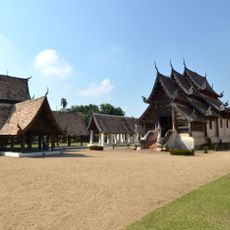
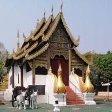
Hang Dong, Administrative district in Chiang Mai, Thailand

Hang Dong is an administrative district in Chiang Mai comprising 11 sub-districts and 109 villages spread across a large area. The territory sits at an elevation of 351 meters and is organized under ten municipal subdivisions that manage local services.

Prior to 1917, this district operated under a different name before being renamed to its current designation. It experienced a brief period as a minor district between 1938 and 1947 before returning to its established administrative structure.

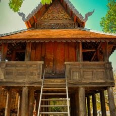
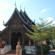
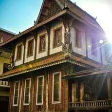
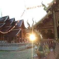
The Ban Tawai village maintains a wood carving tradition that started in the 1960s and remains active today. You can watch craftspeople at work in their studios, creating detailed wooden pieces that reflect local skill and heritage.

The district has several administrative centers serving as main hubs for visitors and residents. It helps to identify these primary locations to access local services and information efficiently.

Chinese immigrants introduced longan fruit cultivation to this region, making it one of Thailand's earliest growing areas for this crop. This early agricultural specialization continues to shape the local farming landscape today.

The community of curious travelers

AroundUs brings together thousands of curated places, local tips, and hidden gems, enriched daily by 60,000 contributors worldwide.

Start exploring
Location
Elevation above the sea
351 m
Shares border with
Samoeng, Mae Rim, Mueang Chiang Mai, Saraphi, Mueang Lamphun, San Pa Tong, Mae Wang
GPS coordinates
18.68694,98.91889
Latest update
December 7, 2025 19:28
Reviews
Share your experience

No review yet

Discussions
Start a discussion...

No discussion yet

« Hang Dong - Administrative district in Chiang Mai, Thailand » is provided by Around Us (aroundus.com). Images and texts are derived from Wikimedia project under a Creative Commons license. You are allowed to copy, distribute, and modify copies of this page, under the conditions set by the license, as long as this note is clearly visible.

Discover hidden gems everywhere you go!

From secret cafés to breathtaking viewpoints, skip the crowded tourist spots and find places that match your style. Our app makes it easy with voice search, smart filtering, route optimization, and insider tips from travelers worldwide. Download now for the complete mobile experience.

Around Us App Screenshot

A unique approach to discovering new places

Le Figaro

All the places worth exploring

France Info

A tailor-made excursion in just a few clicks

20 Minutes

Around Us
Travel Guide & Maps
Download

Send to your phone

QR Code
1

Open the camera app on your mobile.

2

Point at the QR code with your camera. A notification will appear.

3

Tap the notification to open the link.