Enable Location

We need your location to show you interesting places around you

Discover nearby places

Find interesting locations and hidden gems around you

Precise directions

Get accurate directions and distances to places

Your location is never shared with other users. It's only used when you tap the location button.

Henry County

Log in to your account

Start exploring — it's free

Trusted by 61,864 travelers worldwide

Continue with Google
Continue with Apple
or

We will send you a code to connect

By continuing, you accept our Terms and Conditions and our Privacy Policy

Check your inbox

We've sent a pincode in your inbox. Please enter the code below.

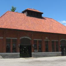
Henry County, Administrative county in northwestern Ohio, US.

Description

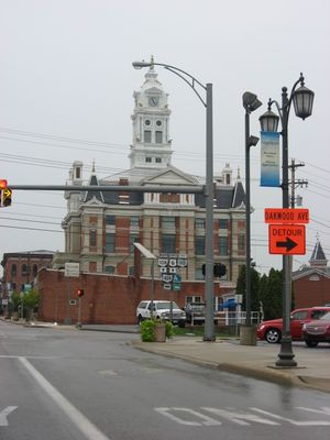
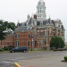
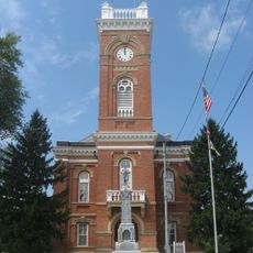
Henry County is an administrative county in northwestern Ohio that covers multiple municipalities and rural communities. Napoleon serves as the county seat and its main urban center.

History

The county was established in 1820 as part of Ohio's territorial expansion and administrative organization. Its development followed the settlement patterns and agricultural development of the northern region.

Culture

The Henry County Agricultural Society organizes annual fairs that bring together local farmers, exhibitors, and residents to celebrate agricultural traditions.

Practical

The county government office in Napoleon provides various services to residents including document registration and license issuance. It's helpful to check office hours in advance and bring required documents when visiting.

Did you know?

The Henry County Transportation Network maintains public transit services across the region, connecting residents to essential destinations throughout northwestern Ohio.

Location
Inception
February 12, 1820
Capital city
Napoleon
Shares border with
Fulton County, Lucas County, Wood County, Hancock County, Putnam County, Defiance County, Williams County
GPS coordinates
41.33000,-84.07000
Latest update
December 7, 2025 20:25

AroundUs brings together thousands of curated places, local tips, and hidden gems, enriched daily by 60,000 contributors worldwide. Discover all places nearby (Ohio).

Around this place
Fort Defiance
United States of America

Fort Defiance

24.5 km
Oak Openings Preserve Metropark
United States of America

Oak Openings Preserve Metropark

30.8 km
Mary Jane Thurston State Park
United States of America

Mary Jane Thurston State Park

18.4 km
Farnsworth Metropark
United States of America

Farnsworth Metropark

33.2 km
Goll Woods State Nature Preserve
United States of America

Goll Woods State Nature Preserve

34.7 km
Independence Dam State Park
United States of America

Independence Dam State Park

18.2 km
Interurban Bridge
United States of America

Interurban Bridge

33.4 km
Henry County Sheriff's Residence and Jail
United States of America

Henry County Sheriff's Residence and Jail

8.2 km
Dodge Site
United States of America

Dodge Site

33.2 km
Henry County Courthouse
United States of America

Henry County Courthouse

8.2 km
Putnam County Courthouse
United States of America

Putnam County Courthouse

34.6 km
John Edwards House
United States of America

John Edwards House

26.3 km
Defiance County Courthouse
United States of America

Defiance County Courthouse

24.8 km
Fulton County Courthouse
United States of America

Fulton County Courthouse

24.5 km
U.S. Post Office
United States of America

U.S. Post Office

35.3 km
Leipsic Village Hall
United States of America

Leipsic Village Hall

26.8 km
Defiance Public Library
United States of America

Defiance Public Library

24.6 km
Goll Homestead
United States of America

Goll Homestead

35.2 km
Dey Road Bridge
United States of America

Dey Road Bridge

26.8 km
Ottawa Waterworks Building
United States of America

Ottawa Waterworks Building

34.5 km
Brooke Site
United States of America

Brooke Site

29.1 km
George S. Clement House
United States of America

George S. Clement House

25.2 km
Jones-Read-Touvelle House
United States of America

Jones-Read-Touvelle House

24.4 km
St. John the Baptist Catholic Church
United States of America

St. John the Baptist Catholic Church

33.3 km
Wintergarden Park
United States of America

Wintergarden Park

33.5 km
Riverside Chapel
United States of America

Riverside Chapel

26.5 km
Lockport Covered Bridge
United States of America

Lockport Covered Bridge

36 km
Spemica Lawba-Johnny Logan
United States of America

Spemica Lawba-Johnny Logan

24.4 km
Show the full map
Administrative divisions
« Henry County - Administrative county in northwestern Ohio, US » is provided by Around Us (aroundus.com). Images and texts are derived from Wikimedia project under a Creative Commons license. You are allowed to copy, distribute, and modify copies of this page, under the conditions set by the license, as long as this note is clearly visible.

Discover hidden gems everywhere you go!

From secret cafés to breathtaking viewpoints, skip the crowded tourist spots and find places that match your style. Our app makes it easy with voice search, smart filtering, route optimization, and insider tips from travelers worldwide. Download now for the complete mobile experience.

Around Us App Screenshot

A unique approach to discovering new places

Le Figaro

All the places worth exploring

France Info

A tailor-made excursion in just a few clicks

20 Minutes

Around Us
Travel Guide & Maps
Download

Send to your phone

QR Code
1

Open the camera app on your mobile.

2

Point at the QR code with your camera. A notification will appear.

3

Tap the notification to open the link.