Mississippi County

Log in to your account

AroundUs is a community-driven map of interesting places, built by curious explorers like you. It grows with every review, story, and photo you share.
Connect to save your favorite spots, contribute locations, and create personalized routes.
By continuing, you accept our Terms and Conditions and our Privacy Policy
Add to collection
Map
Suggest a change
Share

Mississippi County, Administrative division in northeastern Arkansas, United States

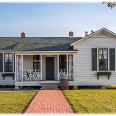
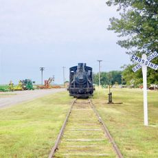
Mississippi County is an administrative division in northeastern Arkansas that stretches along the Mississippi River, encompassing farmland, manufacturing facilities, and several towns. The area is crossed by Interstate 55 and connected by rail lines and river ports for goods movement.

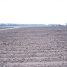
The area was founded in 1833 and initially developed as an agricultural region focused on cotton and livestock. During the 20th century, it transformed into a major steel production center through significant industrial investment.

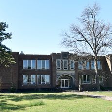
Arkansas Northeastern College provides educational programs for county residents while maintaining strong connections to local manufacturing and agricultural sectors.

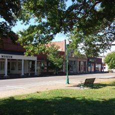
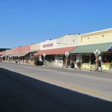
The area is easily accessible by car via Interstate 55, and there are several airports with facilities for visitors and business travelers. Hotels and restaurants are mainly concentrated in larger towns like Blytheville and Osceola.

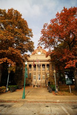
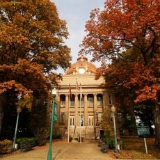
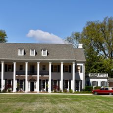
The administrative system is unusual with two separate courthouses and county seats serving different districts, which is rare in modern county governance. One seat is located in Blytheville to the north and the other in Osceola to the south.

Location: Arkansas

Inception: November 1, 1833

Capital city: Blytheville

Shares border with: Pemiscot County, Crittenden County, Dunklin County, Dyer County, Lauderdale County, Tipton County, Poinsett County, Craighead County, Shelby County

Website: https://mississippicountyar.org

GPS coordinates: 35.77667,-90.05444

Latest update: December 7, 2025 10:08

Photos
Around this place
Show the full map
Farm No. 266—Johnny Cash Boyhood Home
United States of America

Farm No. 266—Johnny Cash Boyhood Home

26.4 km
Fort Pillow State Park
United States of America

Fort Pillow State Park

24.8 km
Nodena Site
United States of America

Nodena Site

26.4 km
Alex Haley House and Museum
United States of America

Alex Haley House and Museum

44.7 km
Big Lake National Wildlife Refuge
United States of America

Big Lake National Wildlife Refuge

16.6 km
Eaker Site
United States of America

Eaker Site

23.4 km
Hampson Archeological Museum State Park
United States of America

Hampson Archeological Museum State Park

23 km
United States Highway 61 Arch
United States of America

United States Highway 61 Arch

28.5 km
Herman Davis State Park
United States of America

Herman Davis State Park

14.7 km
Mississippi County Courthouse
United States of America

Mississippi County Courthouse

11.2 km
Mississippi County Courthouse
United States of America

Mississippi County Courthouse

21.7 km
Kress Building
United States of America

Kress Building

22.2 km
Bank of Osceola
United States of America

Bank of Osceola

11.4 km
City Hall
United States of America

City Hall

11.2 km
Osceola Times Building
United States of America

Osceola Times Building

11.3 km
Keiser Water Tower
United States of America

Keiser Water Tower

11.7 km
Keiser School
United States of America

Keiser School

12 km
Hale Avenue Historic District
United States of America

Hale Avenue Historic District

11.3 km
West Main Street Residential Historic District
United States of America

West Main Street Residential Historic District

21.1 km
Lepanto Commercial Historic District
United States of America

Lepanto Commercial Historic District

31 km
Wilson Residential Historic District
United States of America

Wilson Residential Historic District

21.5 km
Florida Brothers Building
United States of America

Florida Brothers Building

11.2 km
Wilson Community House
United States of America

Wilson Community House

23 km
Chris Tompkins House
United States of America

Chris Tompkins House

11.3 km
Johnny Cash Boyhood Home
United States of America

Johnny Cash Boyhood Home

26.4 km
Fort Pillow State Historic Park
United States of America

Fort Pillow State Historic Park

24.3 km
Wilson Commercial Historic District
United States of America

Wilson Commercial Historic District

23.2 km
Jonesboro, Lake City & Eastern Railroad Steam Locomotive #34 and Associated Rolling Stock
United States of America

Jonesboro, Lake City & Eastern Railroad Steam Locomotive #34 and Associated Rolling Stock

2.3 km
Show the full map
Reviews

Visited this place? Tap the stars to rate it and share your experience / photos with the community! Try now! You can cancel it anytime.

« Mississippi County - Administrative division in northeastern Arkansas, United States » is provided by Around Us (aroundus.com). Images and texts are derived from Wikimedia project under a Creative Commons license. You are allowed to copy, distribute, and modify copies of this page, under the conditions set by the license, as long as this note is clearly visible.

Discover hidden gems everywhere you go!

From secret cafés to breathtaking viewpoints, skip the crowded tourist spots and find places that match your style. Our app makes it easy with voice search, smart filtering, route optimization, and insider tips from travelers worldwide. Download now for the complete mobile experience.

Around Us App Screenshot

A unique approach to discovering new places

Le Figaro

All the places worth exploring

France Info

A tailor-made excursion in just a few clicks

20 Minutes