Chest opened
+${chestReward.xp} XP
Explorer
NOUVEAU ×${chestReward.collectible.quantity}
tapez pour fermer
Chest locked

Open chests in the app

Around Us is built for your phone — chests unlock when you walk, explore and capture nearby places.

Enable Location

We need your location to show you interesting places around you

Discover nearby places

Find interesting locations and hidden gems around you

Precise directions

Get accurate directions and distances to places

Your location is never shared with other users. It's only used when you tap the location button.

Bath County Pumped Storage Station

Log in to your account

Start exploring — it's free

Trusted by 72,960 travelers worldwide

Continue with Google
Continue with Apple
or

We will send you a code to connect

By continuing, you accept our Terms and Conditions and our Privacy Policy

Check your inbox

We've sent a pincode in your inbox. Please enter the code below.

Bath County Pumped Storage Station
Discussion Reviews 1 Photos
34.4k Popularity

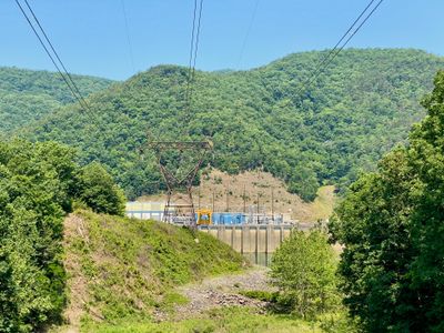
Bath County Pumped Storage Station, Hydroelectric power station in Bath County, Virginia, US

Bath County Pumped Storage Station is a hydroelectric facility that connects two reservoirs through underground tunnels and channels water across six turbines to produce power. The system operates by moving water between different elevations to generate electricity as needed.

Construction began in 1977 and was completed in 1985, creating a major power source for the eastern region. The project represented an important advance in pumped storage technology for supplying electricity across multiple states.

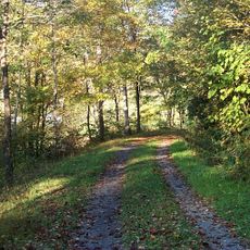
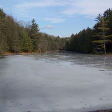
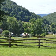
The station features two recreational ponds where locals and visitors fish, boat, and swim throughout the year. Hiking and camping opportunities draw people seeking outdoor activity in the area.

The site offers parking and access to trails leading to the lakes and hiking paths for visitors. Plan your visit during warmer months when water activities and camping facilities are fully operational.

The facility pumps water uphill between the two reservoirs to store energy, then releases it downward to generate electricity when needed. This pump-and-release method lets the plant act as a giant energy battery for the power grid.

The community of curious travelers

AroundUs brings together thousands of curated places, local tips, and hidden gems, enriched daily by 60,000 contributors worldwide.

Start exploring
Location
Inception
1977
Official opening
December 1985
GPS coordinates
38.20890,-79.80000
Latest update
December 19, 2025 22:48
Around this place
Green Bank Telescope
United States of America

Green Bank Telescope

25.2 km
The Omni Homestead Resort
United States of America

The Omni Homestead Resort

23.9 km
Cass Scenic Railroad State Park
United States of America

Cass Scenic Railroad State Park

23.2 km
Greenbrier River Trail
United States of America

Greenbrier River Trail

25.8 km
Green Bank Interferometer
United States of America

Green Bank Interferometer

25.2 km
Lazy River
United States of America

Lazy River

23.6 km
Reber Radio Telescope
United States of America

Reber Radio Telescope

24.7 km
40-foot telescope
United States of America

40-foot telescope

25.6 km
Seneca State Forest
United States of America

Seneca State Forest

17.7 km
Garth Newel
United States of America

Garth Newel

20.3 km
Barton Lodge
United States of America

Barton Lodge

23.8 km
Homestead Dairy Barns
United States of America

Homestead Dairy Barns

17.7 km
Hidden Valley
United States of America

Hidden Valley

11.5 km
Three Hills
United States of America

Three Hills

18.2 km
Pocahontas County Opera House
United States of America

Pocahontas County Opera House

25.8 km
McClung Farm Historic District
United States of America

McClung Farm Historic District

23.6 km
Switchback School
United States of America

Switchback School

22.3 km
Warm Springs Mill
United States of America

Warm Springs Mill

18 km
Frank and Anna Hunter House
United States of America

Frank and Anna Hunter House

26.3 km
Oakley Farm
United States of America

Oakley Farm

18.5 km
Pocahontas County Courthouse and Jail
United States of America

Pocahontas County Courthouse and Jail

25.2 km
Cass Historic District
United States of America

Cass Historic District

22.8 km
IOOF Lodge Building
United States of America

IOOF Lodge Building

25.8 km
Green Bank Observatory
United States of America

Green Bank Observatory

25.7 km
Green Bank Observatory Science Center
United States of America

Green Bank Observatory Science Center

24.7 km
300 foot Radio Telescope
United States of America

300 foot Radio Telescope

25.2 km
Green Bank Jansky Antenna
United States of America

Green Bank Jansky Antenna

24.8 km
Howard E. Tatel Radio Telescope
United States of America

Howard E. Tatel Radio Telescope

25.4 km
Show the full map
Reviews
Share your experience

No review yet

Discussions
Start a discussion...

No discussion yet

« Bath County Pumped Storage Station - Hydroelectric power station in Bath County, Virginia, US » is provided by Around Us (aroundus.com). Images and texts are derived from Wikimedia project under a Creative Commons license. You are allowed to copy, distribute, and modify copies of this page, under the conditions set by the license, as long as this note is clearly visible.

Discover hidden gems everywhere you go!

From secret cafés to breathtaking viewpoints, skip the crowded tourist spots and find places that match your style. Our app makes it easy with voice search, smart filtering, route optimization, and insider tips from travelers worldwide. Download now for the complete mobile experience.

Around Us App Screenshot

A unique approach to discovering new places

Le Figaro

All the places worth exploring

France Info

A tailor-made excursion in just a few clicks

20 Minutes

Around Us
Travel Guide & Maps
Download

Send to your phone

QR Code
1

Open the camera app on your mobile.

2

Point at the QR code with your camera. A notification will appear.

3

Tap the notification to open the link.