Enable Location

We need your location to show you interesting places around you

Discover nearby places

Find interesting locations and hidden gems around you

Precise directions

Get accurate directions and distances to places

Your location is never shared with other users. It's only used when you tap the location button.

Second Avenue

Log in to your account

Start exploring — it's free

Trusted by 68,201 travelers worldwide

Continue with Google
Continue with Apple
or

We will send you a code to connect

By continuing, you accept our Terms and Conditions and our Privacy Policy

Check your inbox

We've sent a pincode in your inbox. Please enter the code below.

Second Avenue
Discussion Reviews 2 Photos
18.6k Popularity

Second Avenue, avenue in Manhattan

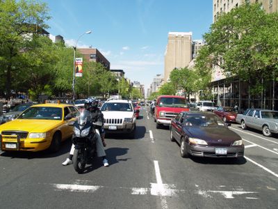
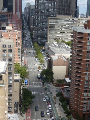
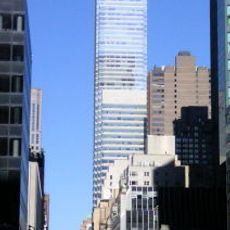
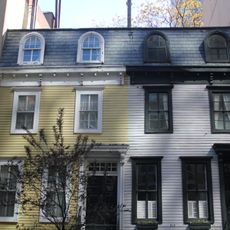
Second Avenue is a north-south thoroughfare in Manhattan that runs from Houston Street in the East Village to Harlem River Drive, spanning roughly 6 miles. It passes through diverse neighborhoods and mixes modern office buildings with older residential structures, small shops, tree-lined sidewalks, and transit infrastructure.

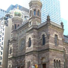
Second Avenue followed a grid plan from 1811 designed to organize the growing city. In the early 20th century, the Lower East Side section became the center of Yiddish theater, while an elevated train running from 1880 connected neighborhoods and shaped the street's character.

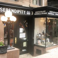
Second Avenue was the heart of Yiddish theater and Jewish culture in the Lower East Side during the early 20th century. Today, old bakeries and delis still line the street, reminding visitors of the immigrant communities who shaped this neighborhood.

The avenue is served by bus routes and a new subway line that partially opened in 2017, improving access to northern areas. A bike lane runs along the street, and you can explore different neighborhoods on foot by simply walking the avenue's length.

The elevated train was torn down between 1942 and 1955, which damaged many local businesses but later allowed the street to transform into an arts center. In the 1960s and 70s, old theaters became punk clubs and art spaces, breathing new life into the area.

The community of curious travelers

AroundUs brings together thousands of curated places, local tips, and hidden gems, enriched daily by 60,000 contributors worldwide.

Start exploring
Location
Location
GPS coordinates
40.75961,-73.96509
Latest update
February 16, 2026 23:42
Around this place
Citigroup Center
United States of America

Citigroup Center

451 m
Serendipity 3
United States of America

Serendipity 3

244 m
731 Lexington Avenue
United States of America

731 Lexington Avenue

346 m
Lipstick Building
United States of America

Lipstick Building

380 m
Central Synagogue
United States of America

Central Synagogue

456 m
425 Park Avenue
United States of America

425 Park Avenue

522 m
Rockefeller Guest House
United States of America

Rockefeller Guest House

471 m
Dangerfield's
United States of America

Dangerfield's

409 m
Trump Plaza
United States of America

Trump Plaza

414 m
Ritz Tower
United States of America

Ritz Tower

494 m
303 East 51st Street
United States of America

303 East 51st Street

504 m
250 East 57th Street
United States of America

250 East 57th Street

116 m
599 Lexington Avenue
United States of America

599 Lexington Avenue

515 m
919 Third Avenue
United States of America

919 Third Avenue

255 m
312 and 314 East 53rd Street
United States of America

312 and 314 East 53rd Street

383 m
St. John the Evangelist's Church
United States of America

St. John the Evangelist's Church

284 m
The Sovereign
United States of America

The Sovereign

335 m
Sutton Place Synagogue
United States of America

Sutton Place Synagogue

523 m
Treadwell Farm Historic District
United States of America

Treadwell Farm Historic District

447 m
William and Helen Martin Murphy Ziegler, Jr. House
United States of America

William and Helen Martin Murphy Ziegler, Jr. House

492 m
Trygve Lie Gallery
United States of America

Trygve Lie Gallery

445 m
French Church of Saint Esprit
United States of America

French Church of Saint Esprit

532 m
Casas del 311 y 313 de la Calle 58
United States of America

Casas del 311 y 313 de la Calle 58

33 m
Mount Vernon Hotel Museum
United States of America

Mount Vernon Hotel Museum

465 m
Barbara Rutherford Hatch House
United States of America

Barbara Rutherford Hatch House

536 m
Norwegian Seamen's Church, New York
United States of America

Norwegian Seamen's Church, New York

445 m
471 Park Avenue
United States of America

471 Park Avenue

492 m
Sutton Place
United States of America

Sutton Place

213 m
Show the full map
Reviews
Share your experience

No review yet

Discussions
Start a discussion...

No discussion yet

« Second Avenue - avenue in Manhattan » is provided by Around Us (aroundus.com). Images and texts are derived from Wikimedia project under a Creative Commons license. You are allowed to copy, distribute, and modify copies of this page, under the conditions set by the license, as long as this note is clearly visible.

Discover hidden gems everywhere you go!

From secret cafés to breathtaking viewpoints, skip the crowded tourist spots and find places that match your style. Our app makes it easy with voice search, smart filtering, route optimization, and insider tips from travelers worldwide. Download now for the complete mobile experience.

Around Us App Screenshot

A unique approach to discovering new places

Le Figaro

All the places worth exploring

France Info

A tailor-made excursion in just a few clicks

20 Minutes

Around Us
Travel Guide & Maps
Download

Send to your phone

QR Code
1

Open the camera app on your mobile.

2

Point at the QR code with your camera. A notification will appear.

3

Tap the notification to open the link.