·

Enable Location

We need your location to show you interesting places around you

Discover nearby places

Find interesting locations and hidden gems around you

Precise directions

Get accurate directions and distances to places

Your location is never shared with other users. It's only used when you tap the location button.

Pruitt–Igoe

Log in to your account

Start exploring — it's free

Trusted by 62,657 travelers worldwide

Continue with Google
Continue with Apple
or

We will send you a code to connect

By continuing, you accept our Terms and Conditions and our Privacy Policy

Check your inbox

We've sent a pincode in your inbox. Please enter the code below.

Pruitt–Igoe

Pruitt–Igoe, Public housing project in St. Louis, US

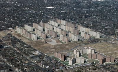
Pruitt–Igoe was a residential complex of 33 identical buildings in northern St. Louis, each standing eleven stories tall with elevators that served only selected floors. The development covered multiple city blocks in an area that today features partly woodland and partly public school grounds.

The federal government funded the project under the Housing Act of 1949 and opened the first buildings in 1954. Structural problems led to rapid decay, so the city began demolition in 1972 and removed the final structure by 1976.

The project's name combined William Pruitt, an African American fighter pilot, with John Igoe, a US congressman. Public perception turned the site into a symbol for the breakdown of socially engineered neighborhoods, though residents often reported strong community ties among themselves.

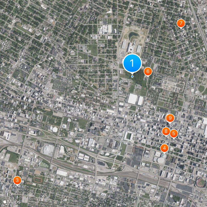
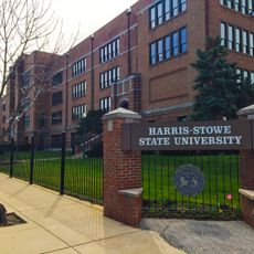
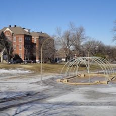
The northern portion of the former site now houses two city public schools. The southern section remains undeveloped and shows naturally returning greenery with shrubs and young trees, creating a contrast to the surrounding residential areas.

The televised demolition footage in 1972 reached news broadcasts worldwide and became a widely used archival image in debates about urban planning. Some architects called the end of this project the symbolic death date of modern architecture.

The community of curious travelers

AroundUs brings together thousands of curated places, local tips, and hidden gems, enriched daily by 60,000 contributors worldwide.

Start exploring
Location
Inception
1955
Architects
Minoru Yamasaki
GPS coordinates
38.64229,-90.20943
Latest update
December 12, 2025 20:58
Around this place
City Museum
United States of America

City Museum

1.2 km
Harris–Stowe State University
United States of America

Harris–Stowe State University

3.3 km
Kiel Auditorium
United States of America

Kiel Auditorium

1.7 km
St. Louis Public Library
United States of America

St. Louis Public Library

1.6 km
St. Stanislaus Kostka Church
United States of America

St. Stanislaus Kostka Church

324 m
Crown Candy Kitchen
United States of America

Crown Candy Kitchen

1.4 km
Campbell House Museum
United States of America

Campbell House Museum

1.4 km
World Aquarium
United States of America

World Aquarium

1.2 km
Scott Joplin House State Historic Site
United States of America

Scott Joplin House State Historic Site

728 m
Washington Avenue Historic District
United States of America

Washington Avenue Historic District

1.2 km
Soldiers' Memorial
United States of America

Soldiers' Memorial

1.7 km
St. Liborius Church and Buildings
United States of America

St. Liborius Church and Buildings

978 m
United States of America

St. Louis Exposition and Music Hall

1.7 km
Hotel Jefferson
United States of America

Hotel Jefferson

1.5 km
The Griot Museum of Black History
United States of America

The Griot Museum of Black History

1.2 km
Globe Building
United States of America

Globe Building

1.6 km
St. Louis Place Park
United States of America

St. Louis Place Park

999 m
Unitarian Church of the Messiah
United States of America

Unitarian Church of the Messiah

1.3 km
Shell Building
United States of America

Shell Building

1.8 km
Aloe Plaza
United States of America

Aloe Plaza

1.4 km
ABC Auto Sales and Investment Company Building
United States of America

ABC Auto Sales and Investment Company Building

1.5 km
St. Louis Union Station
United States of America

St. Louis Union Station

1.6 km
Phyllis Wheatley Heritage Center
United States of America

Phyllis Wheatley Heritage Center

1.1 km
Plaza Square Apartments Historic District
United States of America

Plaza Square Apartments Historic District

1.4 km
Locust Street Automotive District
United States of America

Locust Street Automotive District

1.3 km
Royal Tire Service Inc. Building
United States of America

Royal Tire Service Inc. Building

1.5 km
Autocar Sales and Service Building
United States of America

Autocar Sales and Service Building

1.1 km
Cadillac Automobile Company Building
United States of America

Cadillac Automobile Company Building

1.6 km
Show the full map
« Pruitt–Igoe - Public housing project in St. Louis, US » is provided by Around Us (aroundus.com). Images and texts are derived from Wikimedia project under a Creative Commons license. You are allowed to copy, distribute, and modify copies of this page, under the conditions set by the license, as long as this note is clearly visible.

Discover hidden gems everywhere you go!

From secret cafés to breathtaking viewpoints, skip the crowded tourist spots and find places that match your style. Our app makes it easy with voice search, smart filtering, route optimization, and insider tips from travelers worldwide. Download now for the complete mobile experience.

Around Us App Screenshot

A unique approach to discovering new places

Le Figaro

All the places worth exploring

France Info

A tailor-made excursion in just a few clicks

20 Minutes

Around Us
Travel Guide & Maps
Download

Send to your phone

QR Code
1

Open the camera app on your mobile.

2

Point at the QR code with your camera. A notification will appear.

3

Tap the notification to open the link.